
-
1:26

Amidst several rounds of storms, some could be severe today
-
0:34

South Bend Community Review Board hosts open discussion on youth...
-
2:19

INDOT walks through a proposed diverging diamond intersection...
-
1:08

Notre Dame’s Leonard Moore highlights student success and raises...
-
1:05

Mayflower Bridge set to close beginning April 6
-
0:21

Colfax Avenue eastbound lane closed for water and sewer work
-
0:46

Madison Street closed for lifestyle district project
-
4:11

Non-profit organization provides deep dive into Blackstone, a...
-
1:52

Storms possible overnight, strong storms by Tuesday evening
-
3:48

New partnership aims to help fight food insecurity across Elkhart...
-
2:00

A sunny Monday ahead, rainy almost every other day this week
-
2:59

Dusty May leads Michigan back to Final Four with dominant win...

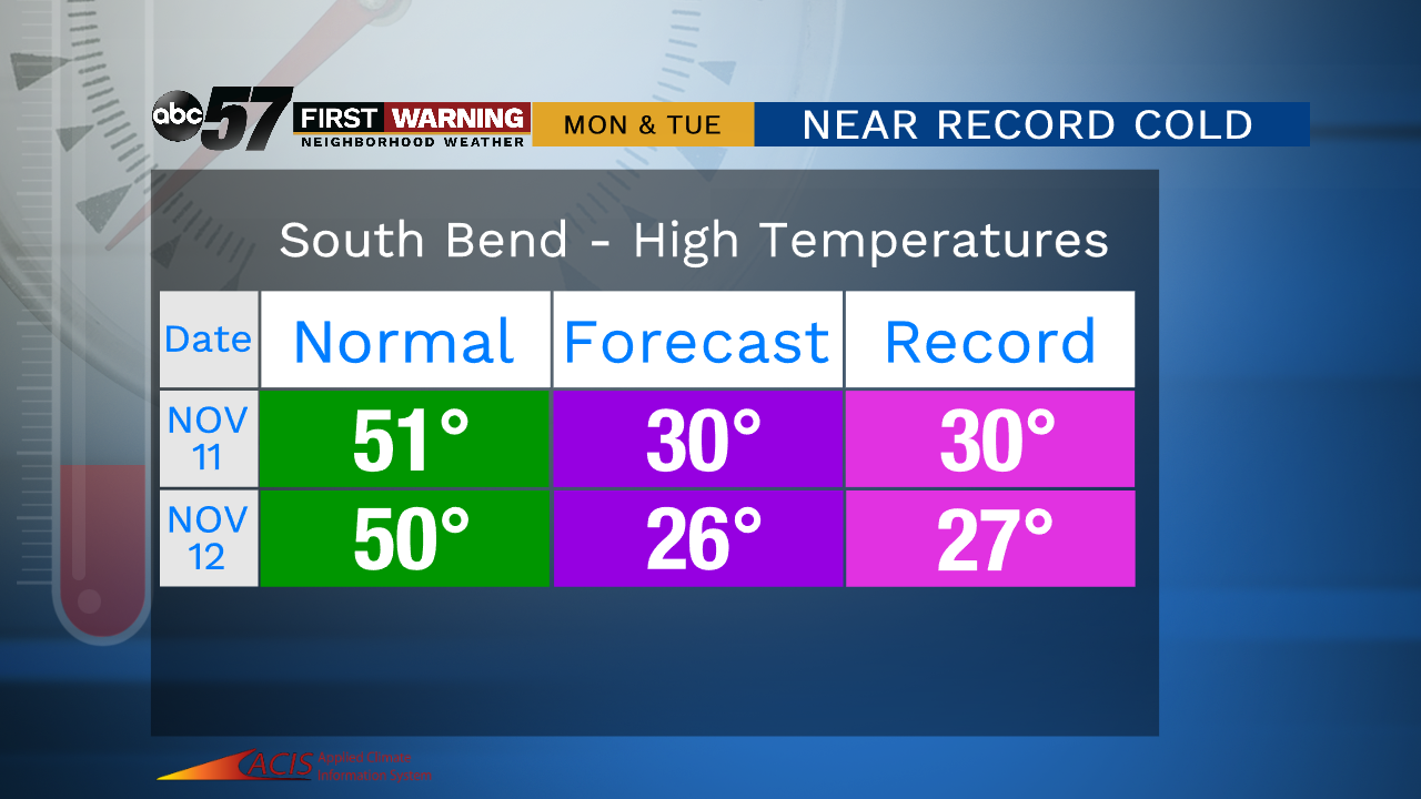
Cold weather lasts through Friday as temperatures struggle to break the freezing mark. A few flurries are possible off the lake in the morning with clouds breaking through the afternoon. The weekend is fair and a little warmer, with highs in the 40s. Temperatures crash again next week with record cold for mid-November. Snow also looks likely Monday through Wednesday morning with a lake effect set-up peaking Tuesday.

Tonight: Mostly cloudy, a few flurries / light snow near the lake. Low of 25.
Friday: Mostly cloudy to mostly sunny. High of 34.
Saturday: Partly cloudy. High of 42.
Sunday: Mostly cloudy. High of 44.
Monday: Snow showers. High of 30.
Sign up for the ABC 57 Newsletter