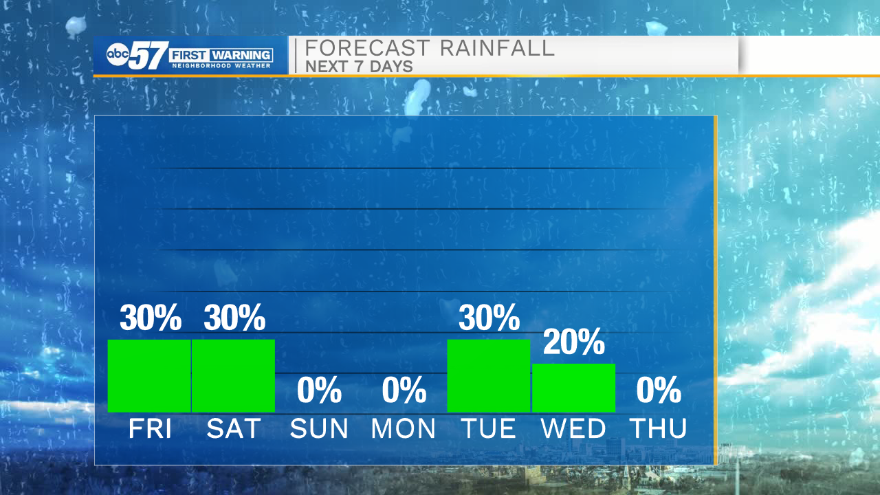
Isolated showers today turn scattered into the start of the weekend


It will be another chilly start to the day with temperatures dropping into the mid 50s this morning. This afternoon cloud cover will increase, and a few isolated showers will move in out of the west. Isolated showers will stick around through the overnight and most of the day tomorrow. It won’t be a wash out, but off and on light rain is expected. Make sure to have the umbrella packed with you if you head out to the Marshall County Blueberry Festival. High temperatures this weekend will hold in the upper 70s. Labor Day looks mostly dry with highs in the upper 70s. More rain chances return for the middle part of next week. High temperatures look to stay around average throughout the rest of the 10-day forecast.
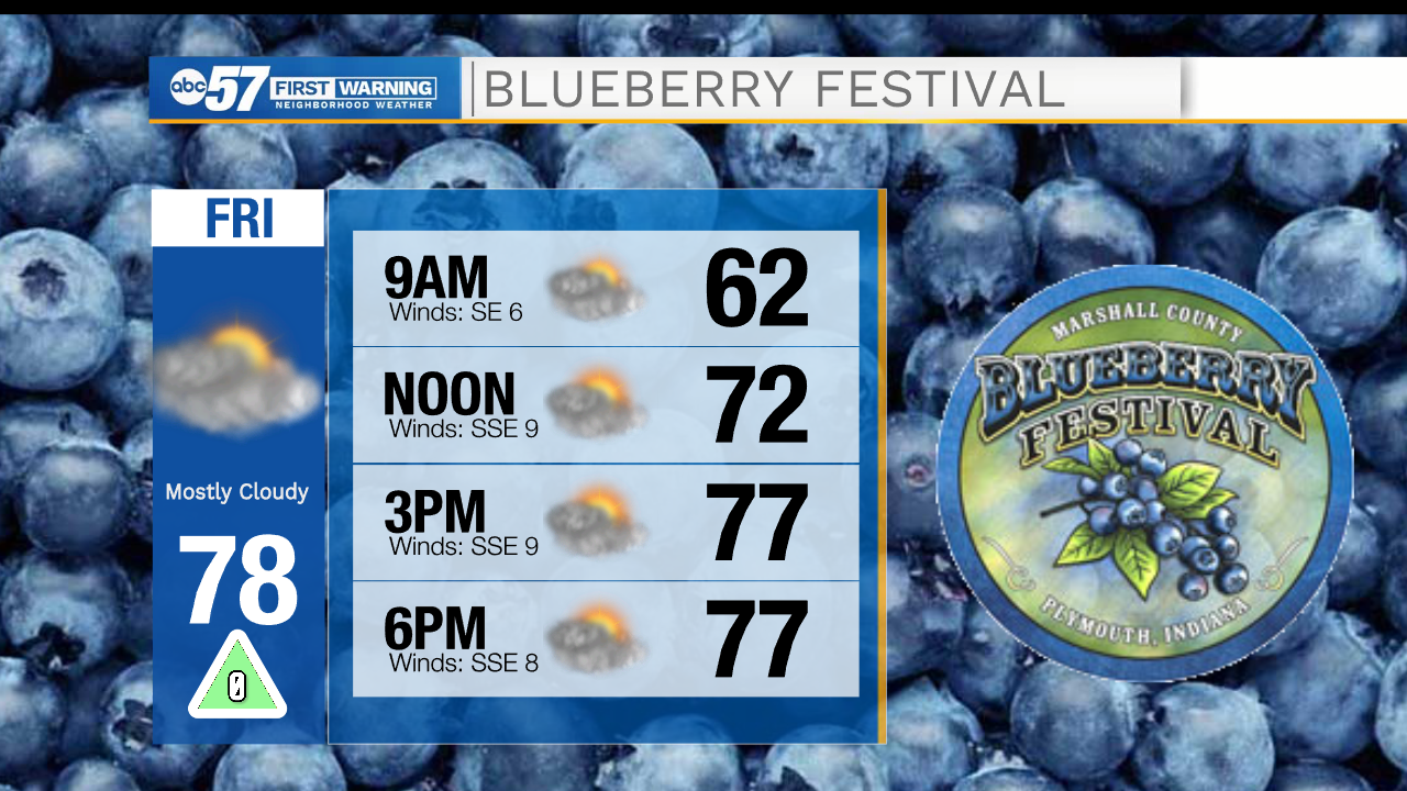
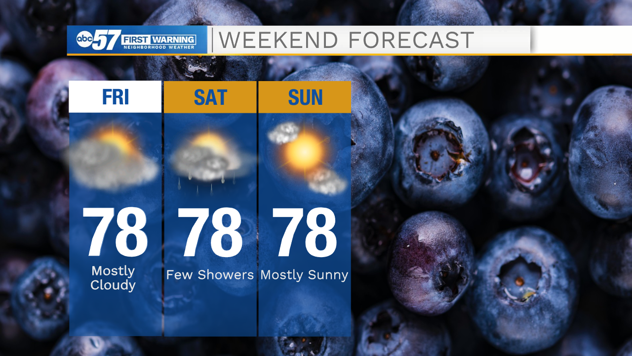
Today: Partly cloudy/isolated showers. High 78.
Tonight: Mostly cloudy/isolated showers. Low 62.
Tomorrow: Scattered showers. High 78.
Sunday: Mostly sunny. High 78.