Lake effect snow Monday morning; tapering off by afternoon


As you wake this morning, you may find some falling snow. Light lake effect snow showers this morning will taper off as we head into the afternoon. Areas around Lake Michigan could see +1” of snow today.
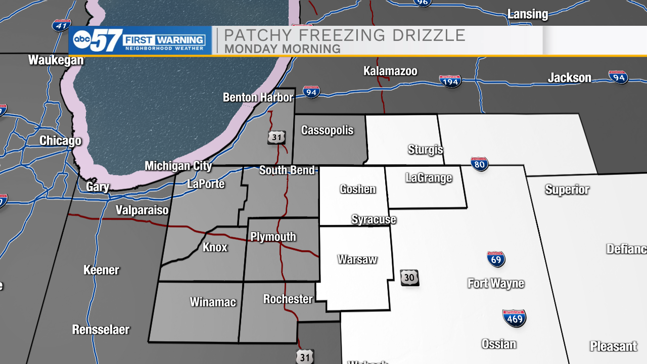
Other areas are dealing with slick spots from freezing drizzle, especially in Kosciusko, Elkhart, and LaGrange Counties. Get out the door a few minutes early if you need to drive anywhere. Drive slow and safe.
Temperatures climb near 30 this afternoon.
It’s slightly warmer on Tuesday, with highs in the upper 30s.
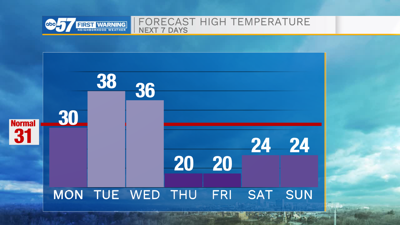
Wednesday morning temperatures start in the 30s, but it gets cooler through the day with another round of lake effect snow showers possible.
Snow showers linger into Thursday morning.
Thursday and Friday will be cold days, with highs around 20 degrees. Another round of snow is possible Saturday and Sunday.
Today: Lake effect snow showers. Cloudy and breezy. High 30.
Tonight: Cloudy. Low 22.
Tuesday: Mostly cloudy and breezy. High 38.
Wednesday: Few snow showers possible. Temperatures fall from 36.