Messy roads from freezing rain then rain turns snow


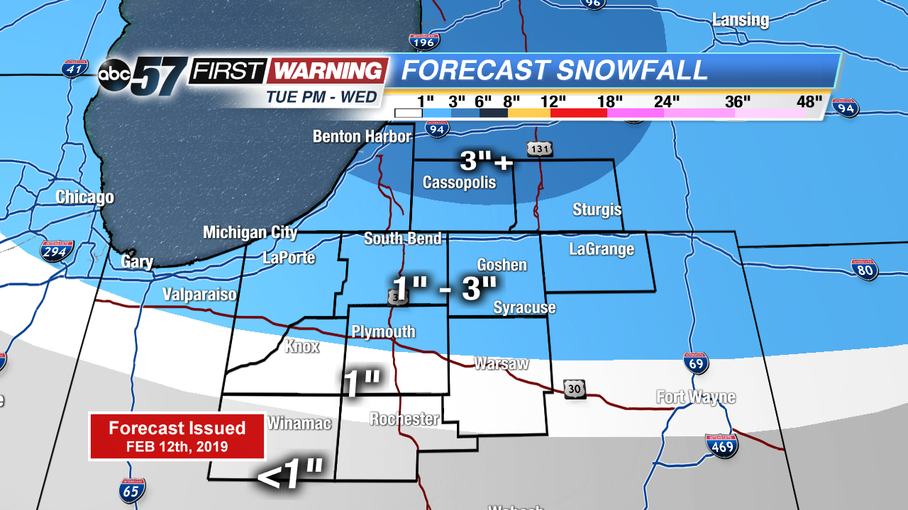
Roads are VERY slick early on this morning. If you can hold off driving on the roads until after 7am, it’s highly recommended. Freezing rain will transition over to rain from south to north starting at 4am as temperatures slowly warm. Scattered rain showers then last into the afternoon but then changes BACK to snow late afternoon. Scattered snow showers then last through the night but beginning tapering down Wednesday morning. 1-3” of snow is likely with locally higher amounts in our Michigan counties.
Winds pick up today becoming very gusty for Wednesday. Wind gusts will be around 35-45 mph so isolated power outages will be possible. We are briefly quiet for the start of Thursday before the next messy system moves in during the evening turning to snow Friday morning.
Today: Light showers and drizzle changing to PM snow, turning breezy, high of 38.
Tonight: Scattered snow, low of 23.
Wednesday: AM lake effect snow, mostly cloudy and windy, high of 32.
Thursday: Mostly cloudy with a chance of evening showers, high of 44.