
-
0:45

Still chilly most of the week
-
0:50

Freeze Warning active this morning
-
1:21

Three injured in shooting near downtown Elkhart
-
0:38

A Celebration of Life for Kaylon Woods
-
1:57

ABC57 reporter Annie Kate discusses ongoing fuel price hikes...
-
0:53

Michiana drivers share their thoughts about the current gas prices
-
1:12

Decision Day becomes new tradition at John Adams High School
-
6:13

Bethel University baseball player battles a brain tumor to retake...
-
1:22

EPD Chief Dan Milanese steps down from role, interim chief announced
-
1:16

Chilly today, cold tonight
-
3:16

Importance of water safety with warm weather around the corner
-
5:38

Celebrate with the Ivy Tech Impact Gala

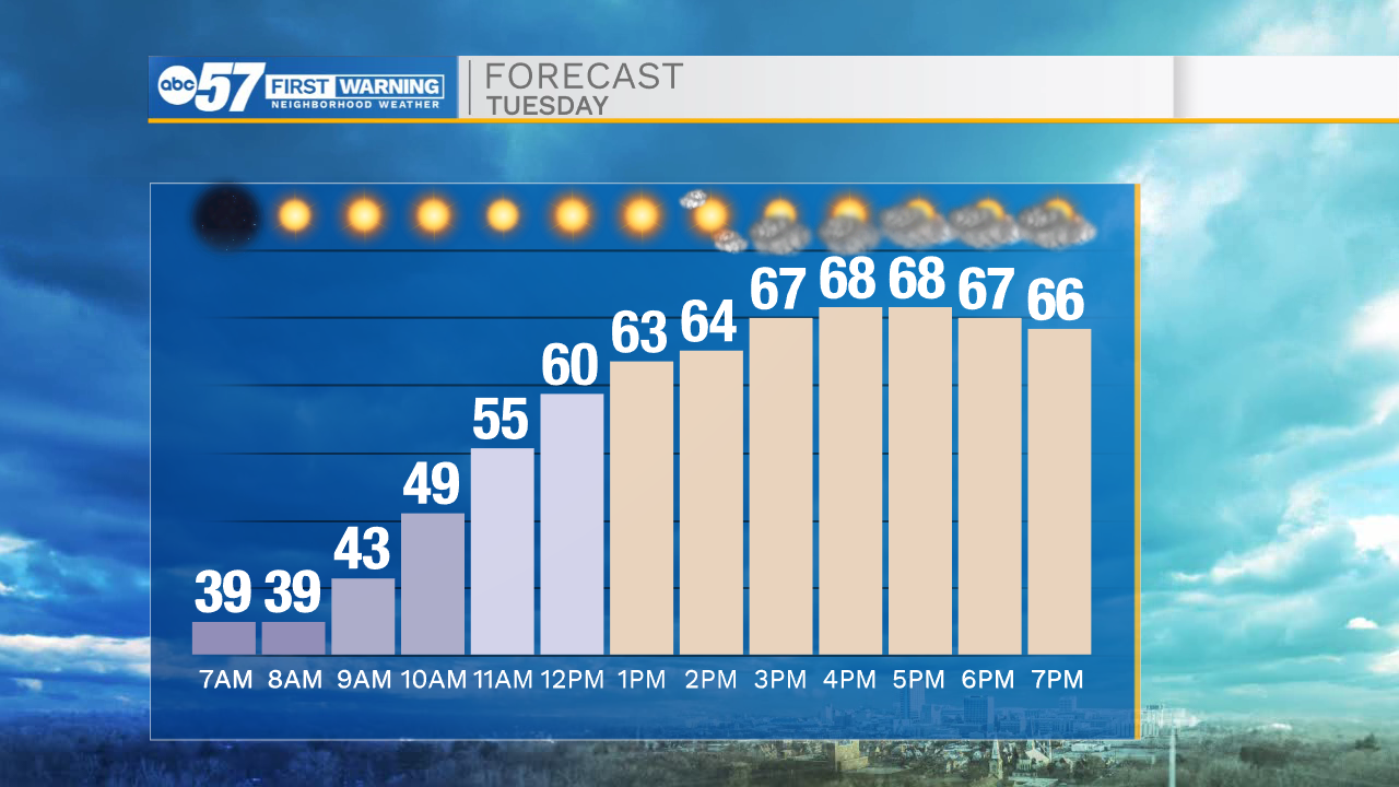
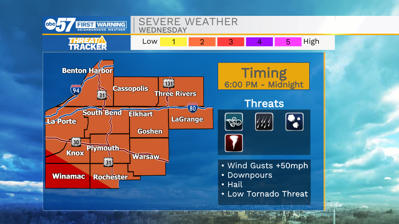
A mild and mostly sunny day is instore for Tuesday, enjoy the warmth because it is again temporary. Wednesday looks wet with a possibility of severe weather. There are still many factors that could increase or decrease and evening storm threat, especially rain during the day. Wednesday evening a line of thunderstorms arrives with the cold front. The end of the week is cool and breezy.
Tonight: Clouds breaking. Low 38
Tuesday: Mostly sunny to partly cloudy. High 70.
Wednesday: Scattered showers., evening thunderstorms. High 70.
Thursday: Breezy. High 55.
Sign up for the ABC 57 Newsletter