
-
0:50

Freeze Warning active this morning
-
0:38

A Celebration of Life for Kaylon Woods
-
1:57

ABC57 reporter Annie Kate discusses ongoing fuel price hikes...
-
0:53

Michiana drivers share their thoughts about the current gas prices
-
1:12

Decision Day becomes new tradition at John Adams High School
-
6:13

Bethel University baseball player battles a brain tumor to retake...
-
1:22

EPD Chief Dan Milanese steps down from role, interim chief announced
-
1:16

Chilly today, cold tonight
-
3:16

Importance of water safety with warm weather around the corner
-
5:38

Celebrate with the Ivy Tech Impact Gala
-
5:27

Magician Andy Gross comes to Goshen Theater
-
0:53

Cold and soaking rain through this morning

The weekend begins mild but will end cold and feeling more like January. Temperatures stay in the 40s Saturday, before dropping into the 30s Sunday. The chance of snow returns by Sunday afternoon with flurries, lake effect snow showers could bring accumulation by Monday. Next week is up-and-down with more significant cold by Groundhog Day.
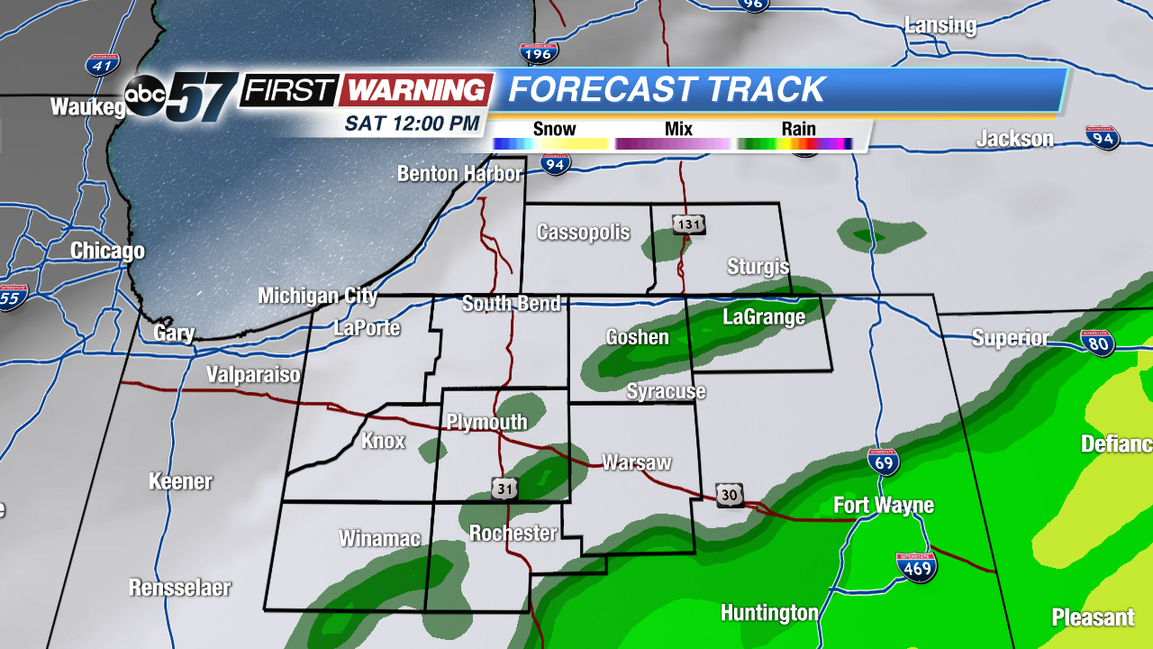 Any showers clear by midday Saturday
Tonight: Mostly cloudy, isolated showers, low of 42.
Saturday: Morning showers with early afternoon clearing, high of 48.
Sunday: Mostly cloudy, afternoon flurries, high of 36.
Monday: Lake effect snow showers, highs in the upper 20s.
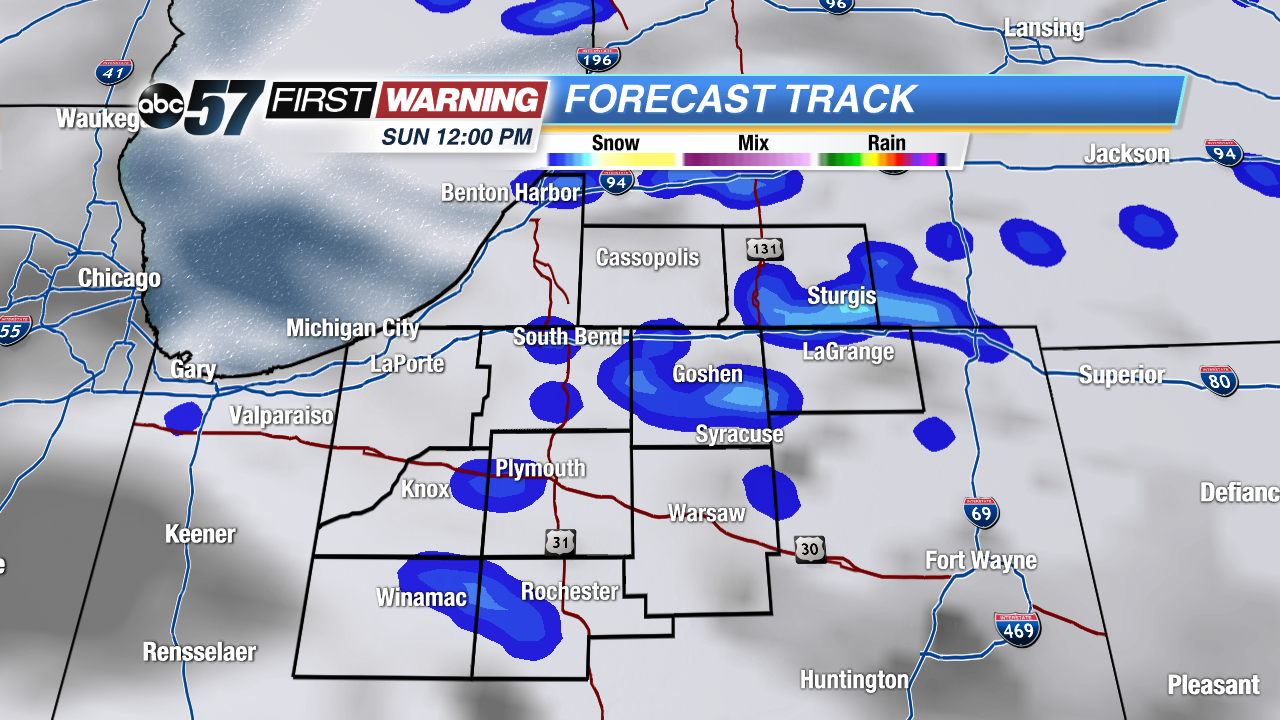 Chance of snow by Sunday afternoon.
Sign up for the ABC 57 Newsletter