
-
1:48

Longer days for the first day of Spring
-
1:30

Country music star Jake Owen to play at Blue Gate Performing...
-
1:51

Warm and sunny stretch with a few showers possible this weekend
-
0:30

Prayer vigil held for domestic violence victim in South Bend
-
1:10

Bristol Town Council votes in favor of annexation of 500 acres...
-
0:52

Official ribbon cutting for The Delta neighborhood in Elkhart
-
1:08

Traveling or booking a trip soon? Here’s what to know
-
0:27

Elkhart Police Department investigating a hit and run on Cassopolis...
-
2:40

Recovery efforts continue after EF-1 tornado devastated Edwardsburg
-
1:22

The March rollercoaster continues
-
0:55

Mishawaka High School Theatre presents ’Chicago! Teen’
-
2:25

Local chef showcasing her food at Pacers game

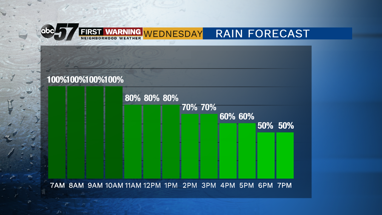
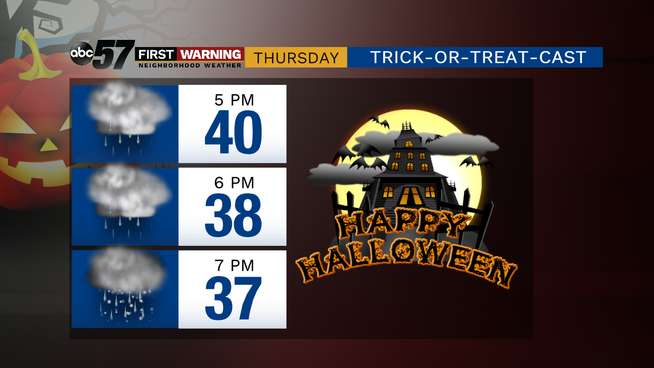
Ugly weather midweek. Rain starts early Wednesday morning and has few breaks through Thursday afternoon. Temperatures range between the mid to lower 40s, this is a cold wet rain that could mix with snow by Thursday evening. Trick-or-treating will be unpleasant to say the least. Lasting snow accumulation is unlikely due to the warm ground.
Tonight: Cloudy with rain arriving late. Low of 36.
Wednesday: Rainy. High of 42.
Thursday: Rainy and becoming breezy with wintry mix late. High of 46.
Friday: Partly cloudy. Breezy. High of 42.
Saturday: Mostly cloudy. High of 40.
Sign up for the ABC 57 Newsletter