


Tonight: Snow showers, the heaviest after midnight, with temperatures near 30 most the night. Plan to shovel and a slower drive Tuesday morning.
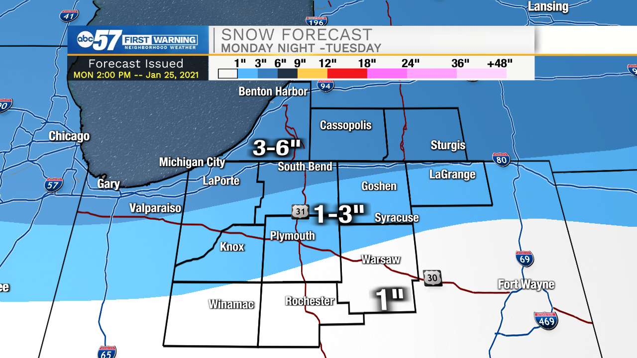
North of US-30: Snow showers pick up after 6pm with the heaviest snow expected around midnight, most will be 3-5” of snow but up to 6” of snow is possible.
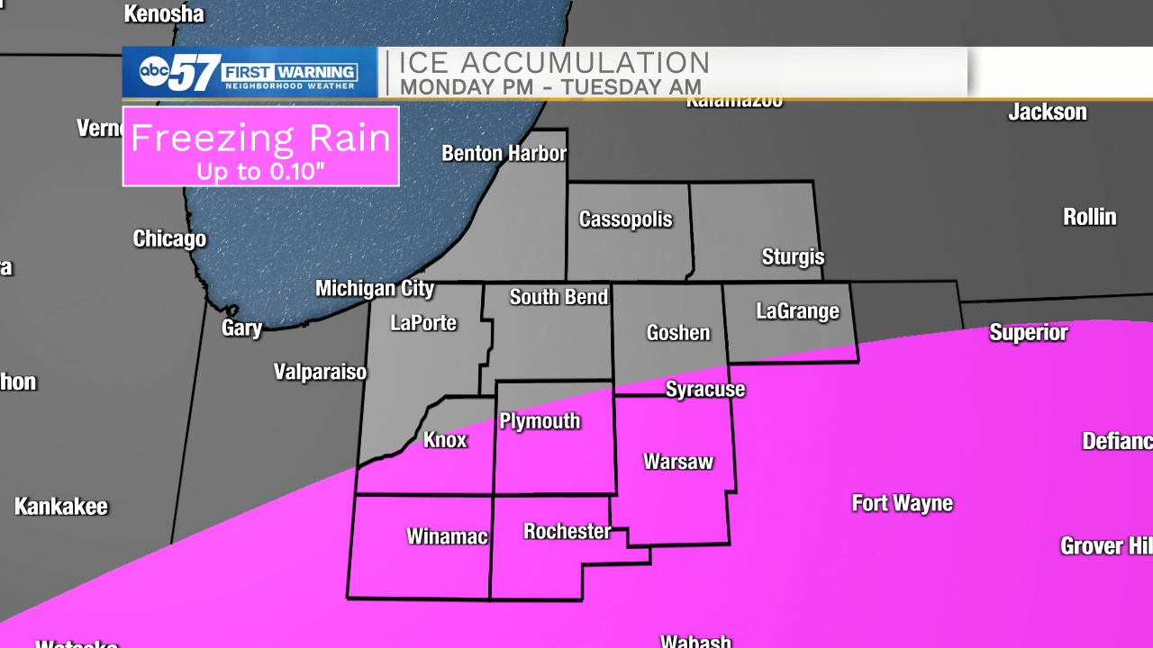
South of US-30: The system starts out as a wintry mix with light freezing rain possible. Any untreated roads will likely be slick. The wintry mix turns to snow overnight. 1-3” of snow is possible through Tuesday.
Snow showers persist through Tuesday morning but there's little additional accumulation, flurries are possible into the afternoon and evening. The midweek is clearing and colder before another round of messy weather this weekend. Saturday and Sunday look to be another round of snow / wintry mix.
Tuesday: Scattered snow showers. High 33.
Wednesday: Mostly cloudy High 26.
Thursday: Partly cloudy. High 24.