


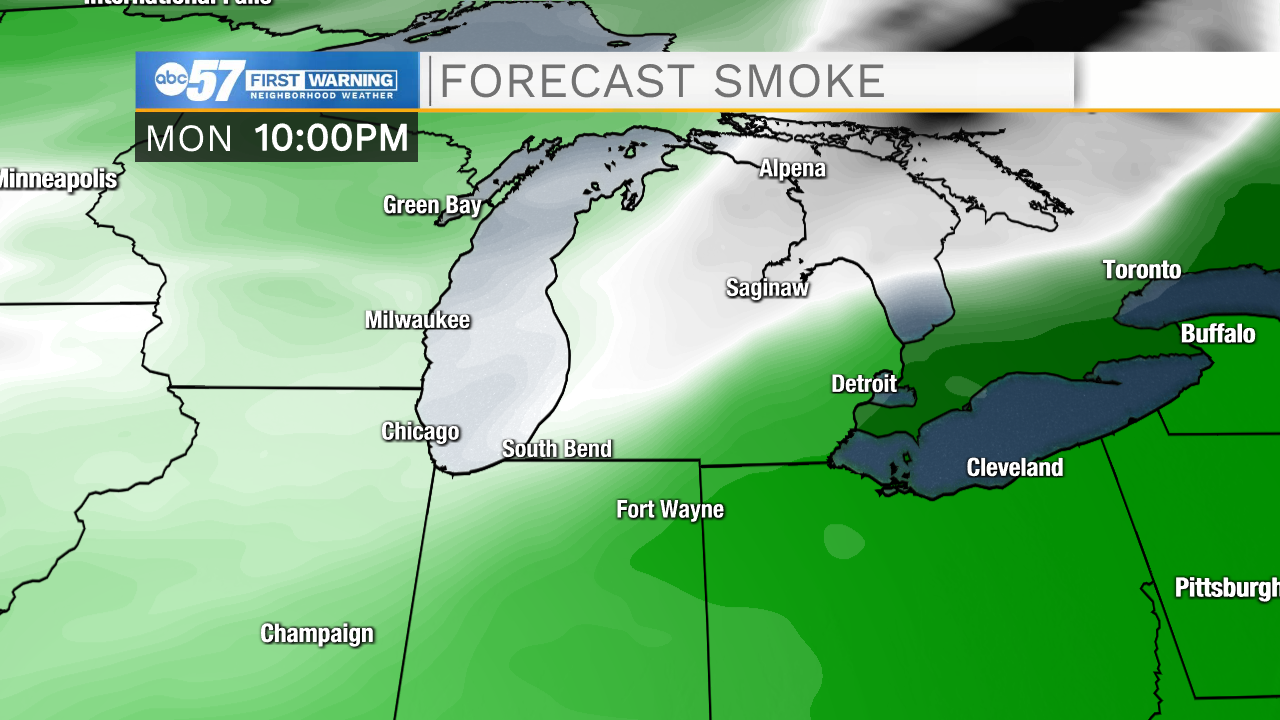
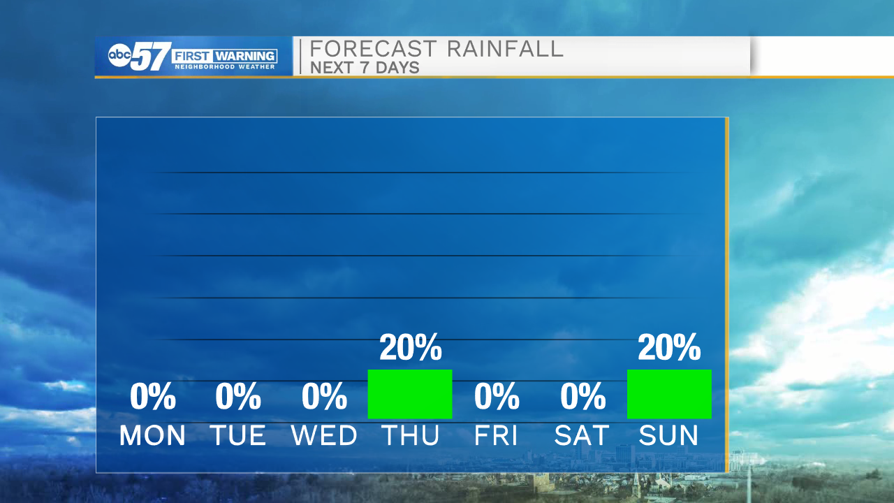
Clear skies stick around tonight which will help temperatures drop into the mid 40s tomorrow morning. Tomorrow afternoon smoke will push into Michiana causing hazy conditions. Temperatures tomorrow afternoon will top out in the mid 70s. The warming trend will continue into Wednesday where high temperatures look to hit the 80 degree mark. Cloud cover and a few low end rain chances remain in the forecast for Thursday. Those will clear, and mostly sunny skies will stick around for Friday and Saturday.
Another cold front will move into Michiana next Sunday, bringing better rain chances and cooler temperatures along with it. A few of those showers could linger into that Monday morning.
Tonight: Clear. Low 45.
Tomorrow: Sunny/Hazy. High 74.
Tuesday: Sunny. High 78.
Wednesday: Mostly sunny. High 80.