More extreme cold and snow showers for the rest of the week


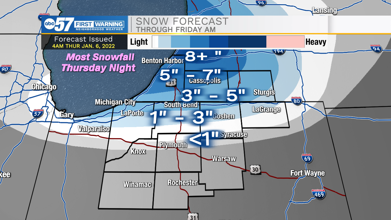
This morning is bitter cold with a few snow showers impacting portions of northern Michiana. Snow remains mostly light, but a slight uptick is expected throughout the day. Most of the moderate to heavy snow showers will develop later into the afternoon, evening, and overnight. Additional snow accumulations for Berrien and Cass counties could range from 5-7 inches. This will cause hazardous road conditions for your Friday morning commute. An additional 3-5 inches is possible for northern St. Joseph and LaPorte counties. Overall, further south towards highway 30 snow accumulations look slim to none. Winds today will increase back into the teens with gusts at 20-25mph. This will keep feel like temperatures near 0 or below throughout the day. Tonight feel like temperatures will drop below 0 for almost all of Michiana. Finally, tomorrow afternoon lake effect snow will clear out, but then another round of mixed wintry precip will develop Saturday and linger into Sunday. Early next week we will see more bitter cold temperatures with additional lake effect chances.
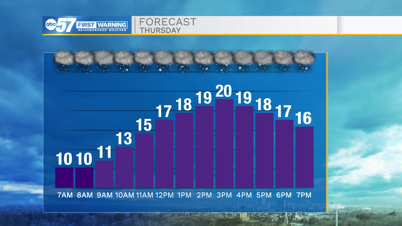

Today: Snow showers north/bitter cold. High 20.
Tonight: Moderate to heavy lake effect north. Low 10.
Tomorrow: Snow showers north/bitter cold. High 18.
Saturday: Mixed wintry precip. High 35.