
-
2:07

Locals have big visions for new skatepark in St. Joseph
-
2:29

Elkhart County residents still waiting for repair help a month...
-
1:13

Sinkhole develops on the Southwest side of South Bend
-
3:13

Local restaurants taking extra precautions to try and keep Cyclosporiasis...
-
3:39

World Series of Baton Twirling returns to Notre Dame, bringing...
-
2:37

Historic State Theater project awarded millions of dollars towards...
-
2:05

Building Nicholas Stanley’s defense in the final weeks before...
-
2:03

Fatal June officer-involved shooting of Jujuan Bates deemed justified,...
-
1:15

IDEM forecasts Air Quality Action Day for Northern Indiana due...
-
1:43

Unhealthy smoke headed our way
-
1:23

Kamm Island Pavilion dedicated to former mayor
-
2:29

Kevin Ward Meyers was a man with a lengthy criminal record,...

The humidity will surge again this week, bringing another round of showers and storms by the end of the week, along with the potential for heavy rain and flooding. Tuesday will be a typical July day but the mugginess rises significantly into Wednesday and stays steamy into the weekend. The best chance for rain looks to be Friday and Saturday.
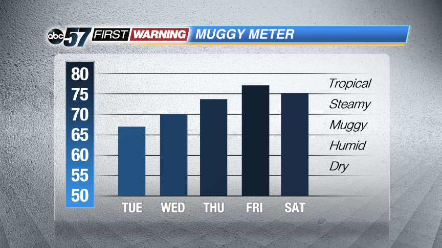 The humidity will surge through the end of the week. Could be the muggiest week yet.
Tonight: Mostly clear, low around 60.
Tuesday: Mostly sunny, highs in the mid-80s.
Wednesday: Mostly sunny, highs in the upper 80s, isolated showers / storms.
Thursday: Very humid, partly cloudy, chance of PM storms, highs in the upper 80s.
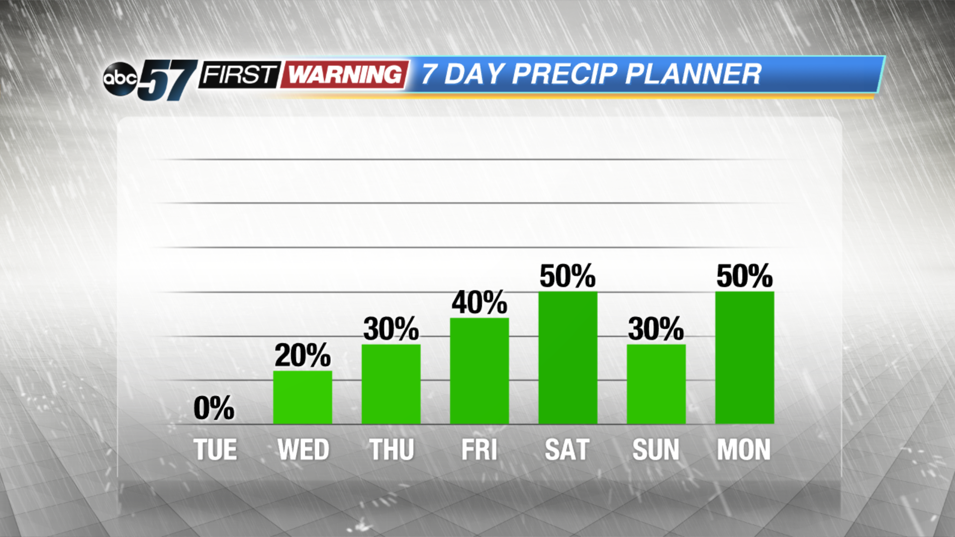 Along with the rise in the humidity, the chance for rain builds.
Sign up for the ABC 57 Newsletter