More rain tonight but the pattern is trying to dry out
By:
Tom Coomes
Posted: May 29, 2019 4:46 PM EDT

-
1:53

Local churches gearing up for the easter holiday amid a possible...
-
1:27

Wind Advisory in effect, Risk for severe weather still present
-
1:48

Preparations underway as Indiana University football trophies...
-
3:09

Indiana Utility Regulatory Commission collecting consumer data...
-
1:18

St. Joseph County officials host Election 101 Workshop on voting...
-
5:36

Hannah Hidalgo wins Naismith Defensive Player of the Year
-
2:50

New South Bend Cubs manager Daniel Wasinger ready for opening...
-
2:24

South Bend Cubs pitcher Kenten Egbert looks to build on strong...
-
1:52

Hoosiers face a gas tax increase as gas prices continue to rise
-
1:45

Iranian cybercrime group claims to have hacked St. Joseph County’s...
-
1:17

Cold and soaking rain today, another severe risk tomorrow
-
0:44

South Bend High School Music Festival highlights student talent

More rain/storms overnight that could bring heavy downpours and the threat of minor flooding and standing water for the morning drive.
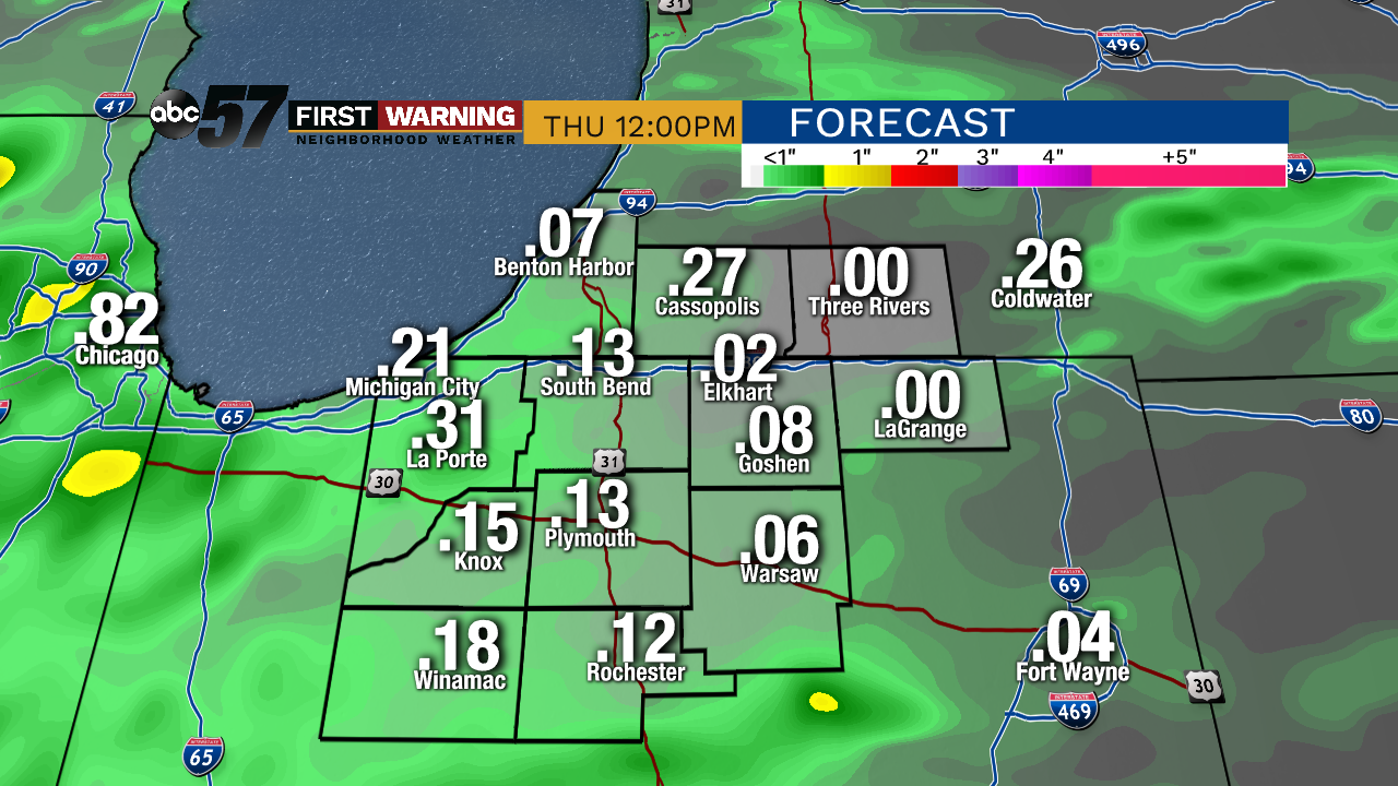
Rain early Thursday, then gradual clearing into Friday. The biggest change in the forecast is a warm-up on Friday as high look to spike near 80 with sunshine. The warm, dry weather doesn’t last as a front crashes through again Saturday with showers and storms. Sunshine returns to end the weekend but temps will be cool for early June with highs in the low 70s.
Tonight: Mostly cloudy with showers/storms overnight. Low of 58.
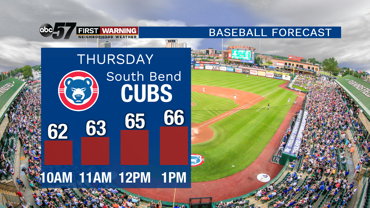
Thursday: Morning showers then clearing, high of 72
Friday: Mostly sunny. High of 70.
Saturday: Scattered showers and thunderstorms by the afternoon. High of 72.
Sign up for the ABC 57 Newsletter