
-
2:17

South Bend Cubs beat Beloit in home opener at Four Winds Field
-
2:25

Radio Sabor Latino returns home after 26 years
-
2:53

Local leaders call for transparency as Data Center conversations...
-
2:44

Pokagon Band, city of Dowagiac continue calls for data center...
-
3:32

South Bend Police Department share safety tips for short term...
-
1:11

Notre Dame professor Asher Kaufmann speaks on US blockades
-
0:25

Three rescued after Miner Street house fire; cat still missing
-
2:34

Hoosier state invests $200 million in affordable childcare, local...
-
1:58

Updated timings on storms, after midnight
-
1:50

St. Joseph County police urge caution on slick roads
-
1:32

Tracking storms after midnight
-
1:48

Severe weather is likely tonight for portions of Michiana

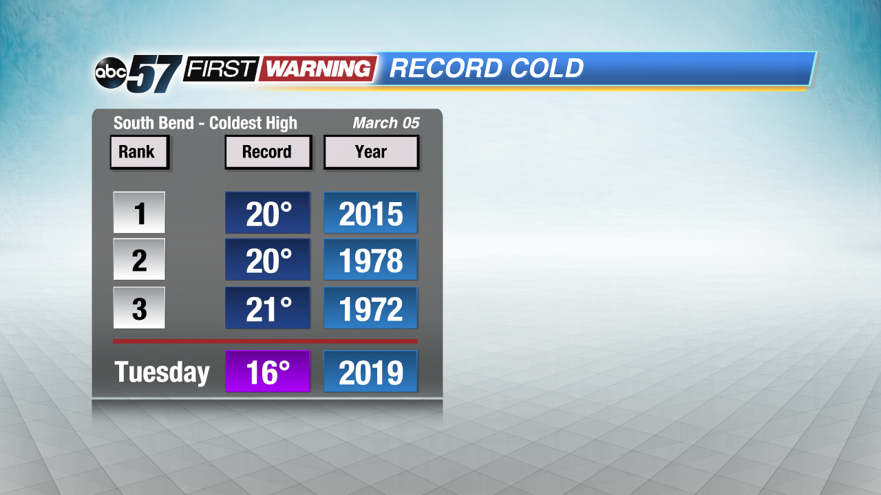
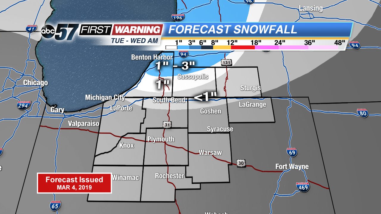
Record cold continues Tuesday along with lake effect snow showers. Highs in the teens would make for another coldest high for March 5th. Lake effect snow showers up to three inches possible north of the state line through Wednesday morning. Northern Indiana will see mostly flurries. There’s a slow warm-up the rest of the week. A very March-like weekend with highs in the 40s, rain and then snow Sunday into Monday.
Tonight: Partly cloudy, chance of snow, low 4.
Tuesday: Mostly cloudy, light snow showers, high of 16. Breezy.
Wednesday: Partly to mostly sunny, high of 24.
Thursday: Partly cloudy, high of 29.
Sign up for the ABC 57 Newsletter