


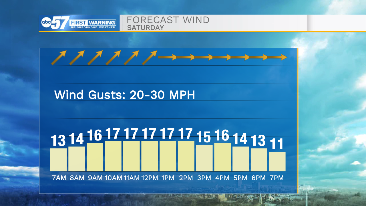
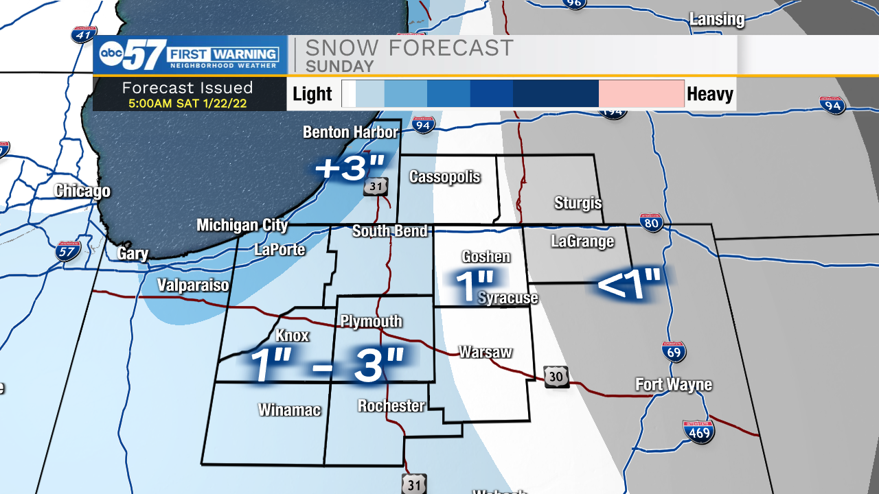
This morning a few flurries are possible throughout portions of Michiana. Along with the flurries, temperatures are bitter cold with lows in the teens and wind chills in the single digits. Winds will stay on the breezy side today with gusts ranging 20-30mph. High temperatures this afternoon will top out in the upper 20s. Our eye is on the next round of accumulating snow that arrives after midnight. A cold front will swing through the area bringing snow showers through tomorrow morning, and then lake effect that will linger into Sunday afternoon. We could see some minor accumulations throughout the area. Another round of snow will arrive Monday. This round could bring a few inches of snow accumulation to portions of Michiana. After that clears, lake effect will linger into the middle of next week. Along with the lake effect, temperatures will also fall putting lows in the single digits, and highs in the teens to lower 20s.
Today: Flurries. High 29.
Tonight: Scattered snow showers. Low 19.
Tomorrow: Snow showers. High 24.
Monday: Snow showers. High 32.