


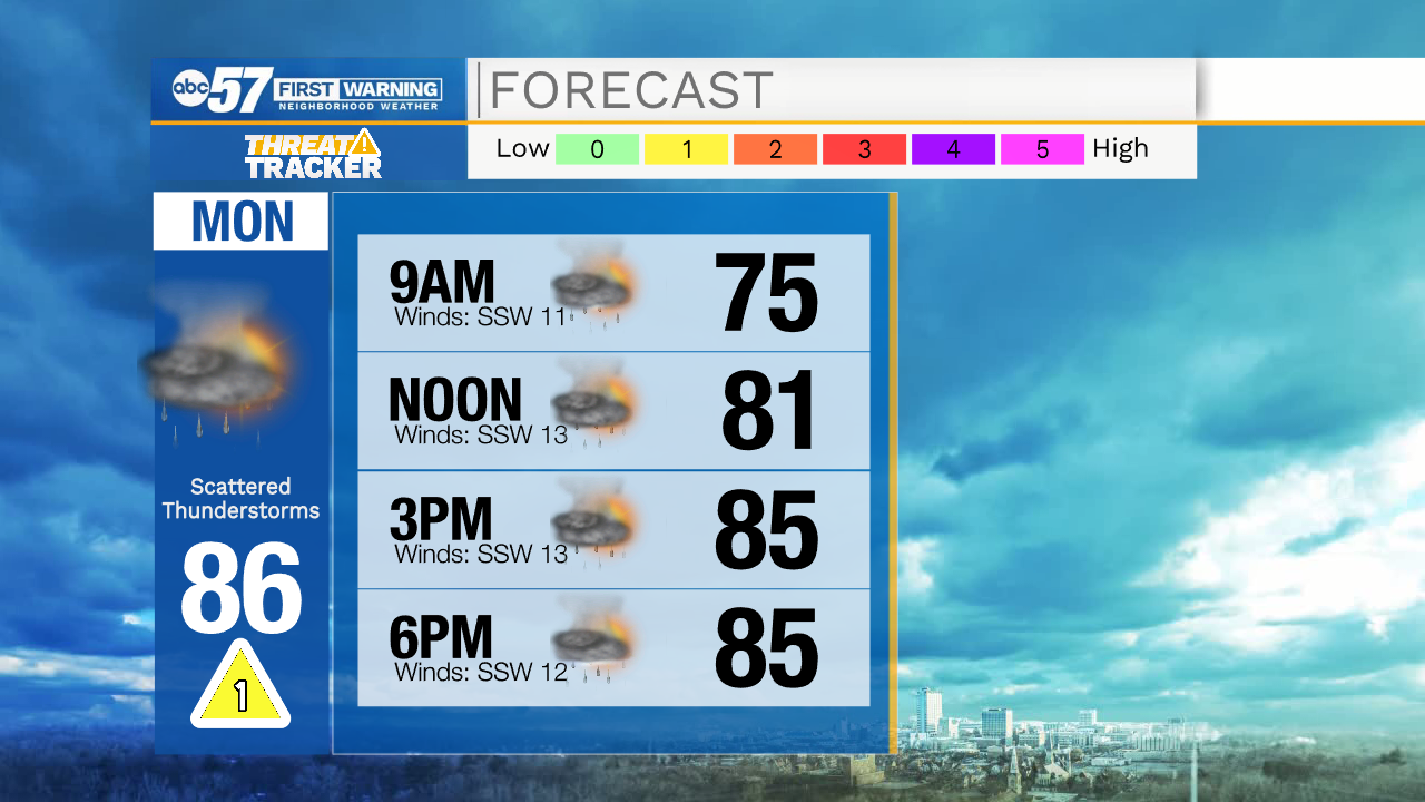
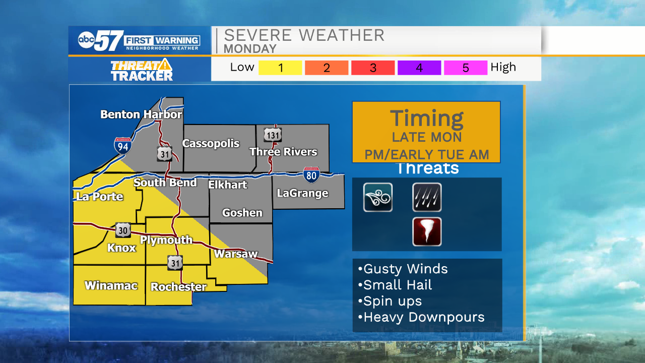
Our weather looks to stay mostly quiet this evening, until after midnight. Scattered showers and a few thunderstorms will push into Michiana during the early morning hours tomorrow. Isolated showers and storms will stick around into the afternoon. We will catch a brief break from the showers and storms during the late afternoon and evening, but then another round arrives late Monday evening into Tuesday morning. A few of those storms could be on the strong to severe side with the primary threat of gusty wind and small hail. There is a very low tornado potential that we will be watching closely. Isolated thunderstorms are possible again Tuesday, Wednesday, and Thursday as plenty of heat and humidity remain in the forecast. High temperatures will hold in the upper 80s through Thursday, but then a cold front arrives Friday, bringing more pleasant weather.
Tonight: Scattered showers/storms. Low 72.
Tomorrow: Scattered showers/storms. High 86.
Tuesday: Isolated showers/storms. High 90.
Wednesday: Isolated showers/storms. High 88.