


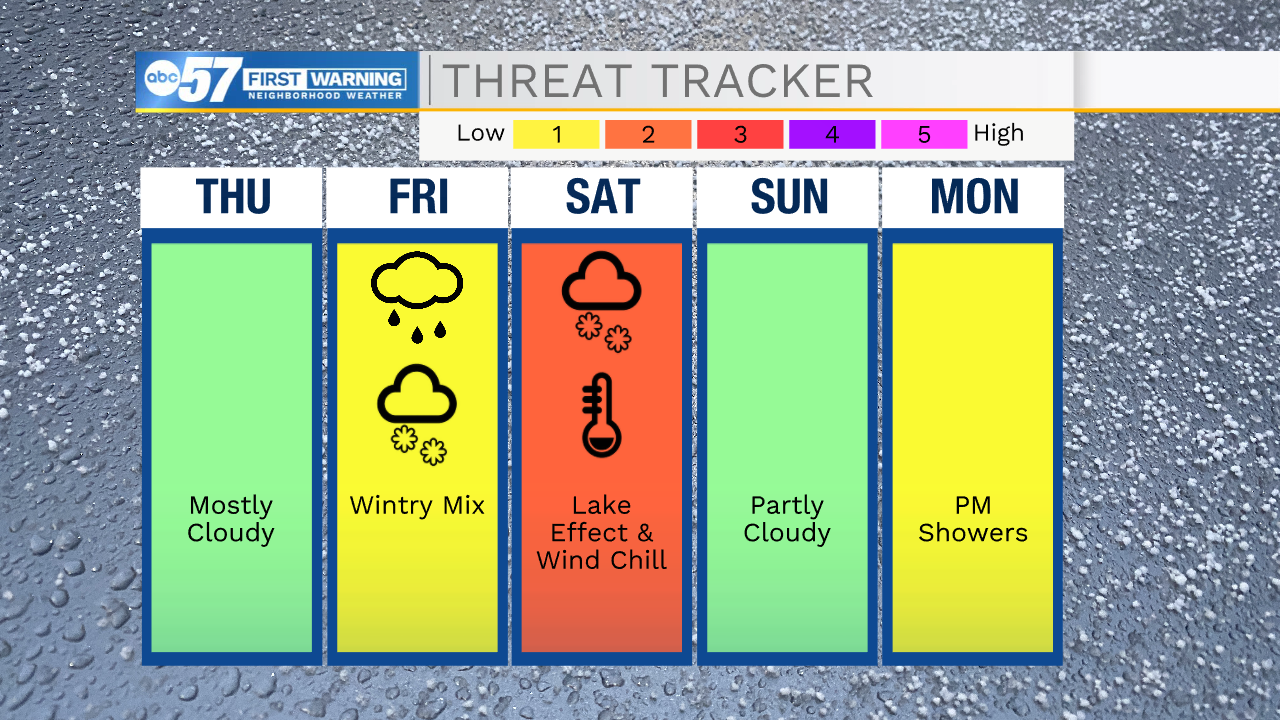
This morning is very cold with lows dropping well into the 20s, so make sure to bundle up before heading out the door. The cloud cover throughout Michiana this morning will start to clear giving way to mostly sunny to partly cloudy skies by the afternoon. This will help to warm highs again today into the mid 40s. Tomorrow will be another mild day with highs near 40, but once we hit the evening hours, colder temperatures will move in and snow chances will increase. Snow looks to arrive by late evening and will stick around into Friday morning. You will have to watch for a few isolated slick spots during your Friday morning commute. We will catch a little break from the snow Friday afternoon/evening, but then lake effect snow returns as we enter the first part of the weekend. Snow accumulations look to stay on the lower side, but a couple of inches can’t be ruled out. Wind chills Saturday morning will be well into the single digits. Highs Saturday afternoon will only top out in the mid 20s. Sunday afternoon we will already see highs making a run for the 40s, so any snow that does accumulate, it will melt quick. Next week highs will surge into the 50s, and potentially the lower 60s. Along with the warmer temperatures rain chances look possible as well, especially during the beginning part of the week.

Today: Partly cloudy/mostly sunny. High 44.
Tonight: Mostly cloudy. Low 26.
Tomorrow: Mostly cloudy. High 40.
Friday: Scattered snow showers. High 36.