-
2:01

Recap of Thursday night’s storms
-
2:14

Crossroads United Way shares and discusses new data regarding...
-
3:53

Language in environmental document regarding past contamination...
-
1:39

This week’s ABC57 Cub Reporter is Chip Bucher
-
1:53

Potawatomi Zoo and United Federal Credit Union host Children’s...
-
1:40

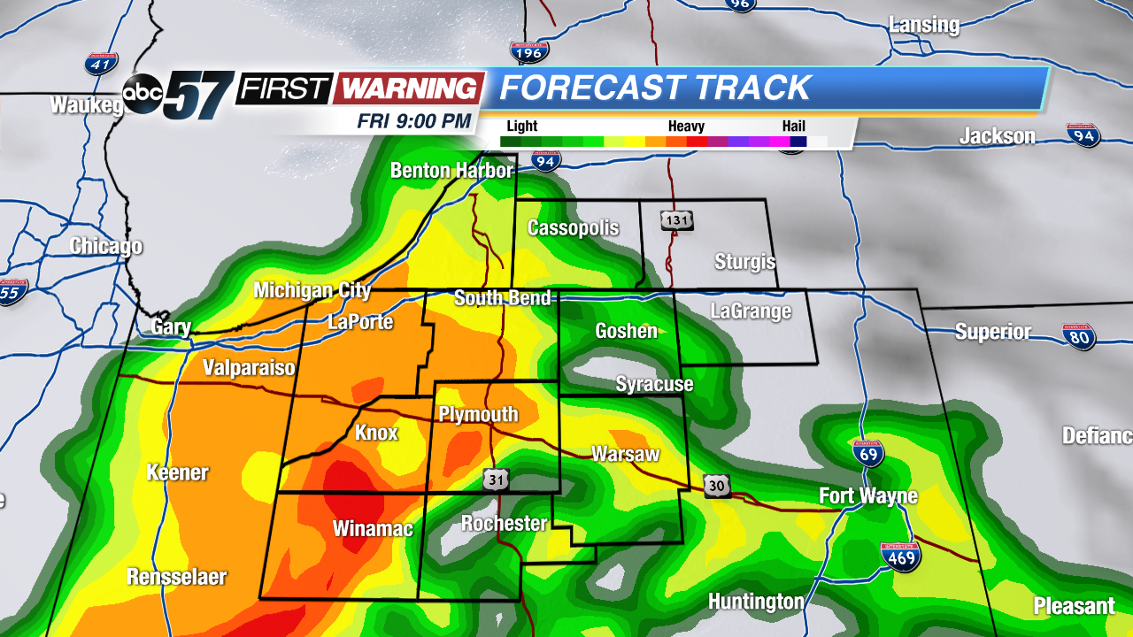
Storms still likely after 8:00 PM
-
4:54

Linden Avenue Farmers Market making fresh, healthy food more...
-
2:14

Update on Tonight’s Severe Weather Threat
-
2:32

Bikin’ Brothers cycling group promotes safety as E-Bike popularity...
-
1:30

Morning showers ending soon, Severe weather still expected tonight
-
1:39

Storms arriving early this morning
-
5:08

Hammond on the hunt

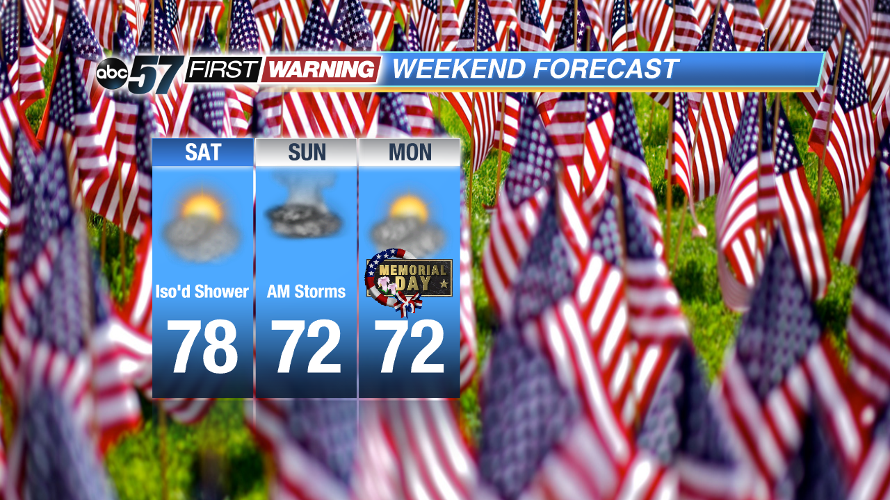
A milder and drier start to the Memorial Day Weekend. Even with the threat of rain, the holiday weekend is far from a washout. Friday will be fair and mild with highs in the mid-70s before a round for showers and storms Friday night into early Saturday. Saturday looks warm and dry before another round of showers and storms Sunday morning. The cycle continues, gradually drying into Monday before another round of showers and storms Monday night.
**Storms Friday evening could be strong to severe with heavy downpours, gusty wind and lightning.
Friday: Partly cloudy, high 74, showers and storms late.
Saturday: Partly cloudy, high 78
Sunday: AM Showers, then partly cloudy, highs in the low 70s.
Memorial Day: Partly cloudy highs in the low 70s, chance of rain late.