


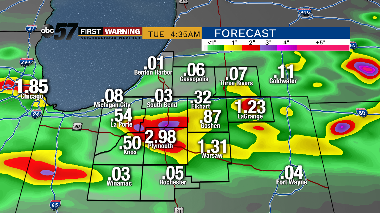
Showers and thunderstorms are likely Monday night through Tuesday morning. There is a low threat for severe weather with a higher likelihood of heavy, widespread rain. Much of Michiana could see over an inch by Tuesday morning. Minor flooding is also possible under localized downpours. The timeframe for the heaviest rain is around midnight.

Showers come to an end Tuesday morning as skies slowly clear and the humidity drops through the afternoon. An isolated storm could re-fire late in the day. The trend the rest of the week is dry with lower humidity, before another surge this weekend. Saturday could bring another round of storms ahead of a warm-up next week.
Tonight: Showers and storms likely, heavy rain possible, low of 68.
Tuesday: Mostly cloudy with leftover AM showers, then clearing skies. High of 78.
Wednesday: Partly cloudy, high of 78.
Thursday: Mostly sunny, high of 78.