New report highlights increasing flood risk locally and nationally


SOUTH BEND, Ind. -- A newly published report and online tool aims to help highlight past, present, and future flood risk of every home and property in the contiguous United States.The First Street Foundation is a non-profit research and technology group defining America’s flood risk.
The report’s focal point shows the need for improved flood risk information nationwide. Floodplain maps from FEMA, the Federal Emergency Management Agency set a national standard. The First Street Foundation’s report says that standard is dated and not good enough, highlighting the increasing flood risk using advanced modeling.
 Report Statistics for Indiana
Theonline tool allows you to search your town or zip code to see street level mapping.
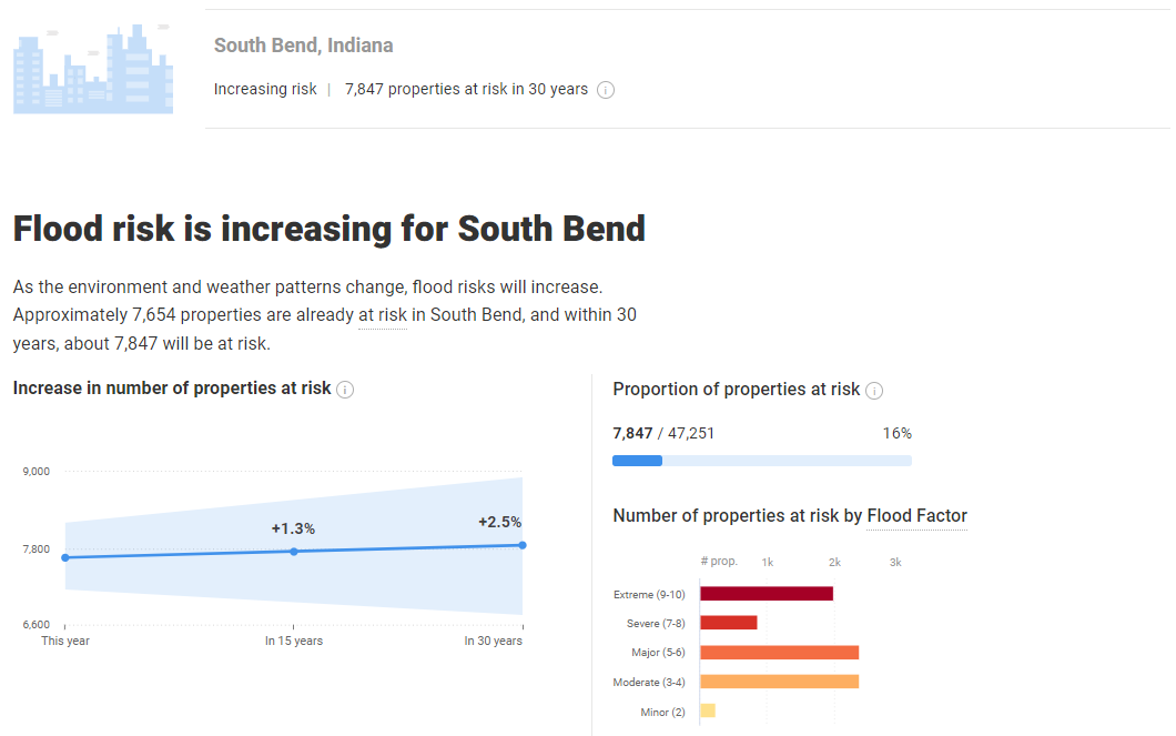 South Bend Statistics
For South Bend the tool shows a 2.5% increase, or about 200 more properties will be at risk over the next 30 years. Many of those homes are in the already flood prone North Shore Triangle neighborhood, where the flood is risk is greater and the frequency is higher. More flooding, more often.
 South Bend Mapping
Similar statistics reflect the growing flood risk in Goshen, a town that has already been hard hit by flooding. Where a 4.5% increase in flooding is likely over the next 30 years.
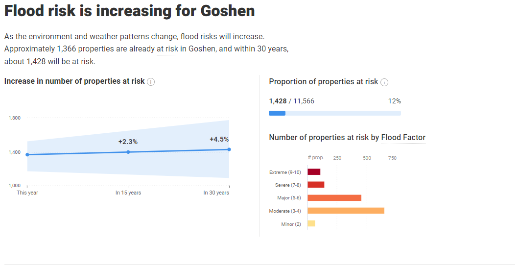 Goshen Statistics
This tool will help you evaluate the risk of flooding to your property, neighborhood and community.
 Goshen Mapping
Our Washed Away series has been taking you beyond the problems caused by extreme rainfall and flooding and showing you solutions and ways to prepare.