
-
2:01

Notre Dame professor talks A.I. development, responsible A.I....
-
0:20

Michiana communities clean up the mess from Thursday’s storms,...
-
1:18

Fair and mild end to the workweek
-
0:33

The Horan family is adding another member
-
2:01

Recap of Thursday night’s storms
-
2:14

Crossroads United Way shares and discusses new data regarding...
-
3:53

Language in environmental document regarding past contamination...
-
1:39

This week’s ABC57 Cub Reporter is Chip Bucher
-
1:53

Potawatomi Zoo and United Federal Credit Union host Children’s...
-
1:40

Storms still likely after 8:00 PM
-
4:54

Linden Avenue Farmers Market making fresh, healthy food more...
-
2:14

Update on Tonight’s Severe Weather Threat

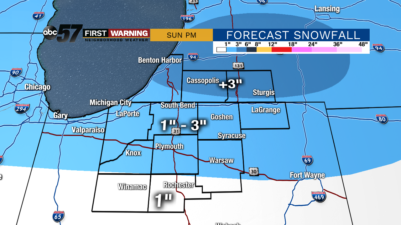
A few flurries are possible tonight under mostly cloudy skies. Saturday should be quiet and mostly cloudy before our next system arrives on Sunday. Precipitation will start out as snow before switching to a rain/snow mix in the afternoon and evening. Minor accumulations are possible, but travel impacts should be on the lower end of the spectrum. We’ll be cloudy to start the work week before another storm system moves in for Wednesday and Thursday. Temperatures will remain close to the seasonal norm for the next week or so.
Tonight: Mostly cloudy. A few flurries possible. Low of 21.
Saturday: Mostly cloudy. High 33.
Sunday: Mostly cloudy, snow changes to a wintry mix in the afternoon. High of 35.
Monday: Cloudy. High: 35
Sign up for the ABC 57 Newsletter