
-
1:10

Wintery weather starting in Michiana
-
3:11

Former players and coaches return to Notre Dame to honor Lou...
-
3:17

Notre Dame prepares for funeral of legendary coach Lou Holtz
-
0:56

Shipshewana on the Road takes over Elkhart
-
3:44

Large crowds expected at Notre Dame for Lou Holtz visitation
-
2:48

Storms arrive this evening, Snow Monday morning
-
4:33

Blustery and stormy today
-
0:39

Michiana Home Show continues to bring vendors to South Bend
-
0:58

Cookies and Canvas for the Heart raises awareness for children’s...
-
2:07

Most residents have power restored following high winds
-
0:44

26th annual St. Patrick’s Day Parade takes over Downtown South...
-
2:42

Active weather arrives Sunday

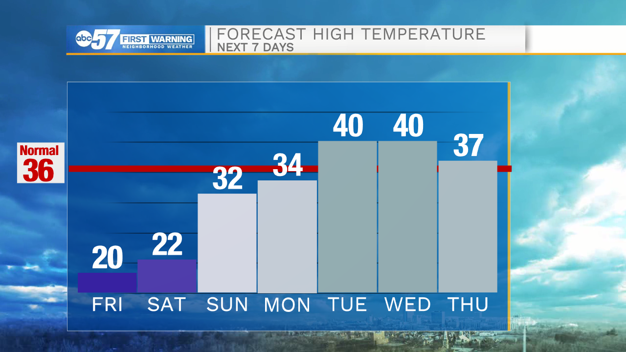
The cold continues to end the week, a few flurries and light snow showers are possible downwind of Lake Michigan, little accumulation is expected except due west of the lake what an inch or two is possible through Saturday morning. Temperatures drop again Friday night into the single digits, but the end of the deep freeze is nearing an end. Snow is likely Sunday evening, a quick burst of wet snow could bring up to three inches, ending early Monday morning. Rain or sleet could also mix with snow, keeping snow totals down, but still have a slick impact for the Monday morning drive.
Tonight: Mostly cloudy. Low 12.
Friday: Mostly to partly cloudy. High 20.
Saturday: Mostly sunny. High 22.
Sunday: Evening snow showers. High 32.
Sign up for the ABC 57 Newsletter