No break from the extreme heat or storm chances yet

-
0:58

Chilly and sunny Tuesday ahead
-
0:41

Elkhart police investigating Monday night shooting
-
3:47

Elkhart Police Department accepting applications to Citizens...
-
0:52

A slight warm-up but chilly weather still dominates
-
1:09

Bitterly cold out the door
-
3:03

Looking to younger generations to keep Dyngus Day thriving
-
3:06

Even as rivers recede, Marshall County still dealing with flooding
-
3:29

Michigan fans gather in Indianapolis ahead of National Championship...
-
3:22

Hamlet local and tow truck driver describes US 30 crash site...
-
4:28

Dyngus Day celebrations highlight voter turnout, transparency
-
4:54

Now-disbanded St. Joseph County Metro Homicide Unit investigator...
-
0:52

Shots fired on Sunnymede Avenue Saturday, cars and homes struck

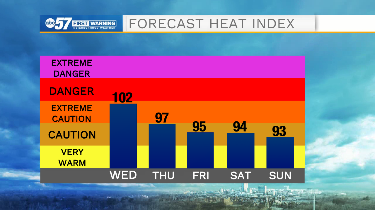
ABC57 First Warning Neighborhood Weather Forecast
Wednesday, August 25th, 2021
The extreme heat continues today. We top out in the low 90s today & Thursday with heat index value near 100F. Storm chances continue today into the weekend as well. Morning showers are moving out right now but another round moves in later this evening. Scattered storms are possible again Thursday and Friday. Rain looks less likely on Saturday but another round will move through on Sunday. The heat continues into the weekend. We finally see relief from a cold front on Monday.
Today: Hot and humid. Scattered thunderstorms. High 93.
Tonight: Mostly cloudy, chance of storms. Low 72.
Thursday: Hot and humid. Isolated PM thunderstorms. High 90.
Friday: Hot and humid. Scattered thunderstorms. High 88.