No sign of winter, heavy rain biggest threat this week
By:
Tom Coomes
Posted: Jan 5, 2020 6:31 PM EDT

-
3:16

Dowagiac residents seek class action over noise from hyperscale...
-
2:03

Families in St. Joseph County finding fun ways to cool off
-
1:00

Fibrosan breaks ground in the Cassopolis area, promising new...
-
6:10

Fulton County man speaks out after being sued by Indiana Attorney...
-
2:51

Local county fair officials discuss new law allowing alcohol...
-
2:44

Benton Harbor Area Schools begin search for new superintendent
-
1:21

How firefighters keep cool in the summer heat
-
1:04

Local Elkhart business hosts Humanitarian Drive for Venezuela
-
3:22

Michigan City officials address privacy concerns as police consider...
-
2:11

Community reviews 62 recommendations by the South Bend Reparatory...
-
4:00

Mishawaka Police Department provides new details on police confrontation...
-
1:35

Vandals hit four mausoleums at Crystal Springs Cemetery

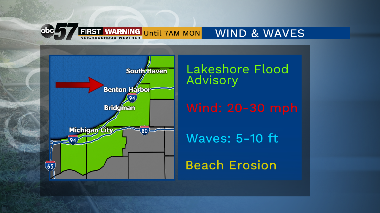
Breezy conditions continue through the evening, waves peak as the wind turns westerly on Lake Michigan. Wind and waves subside Monday.
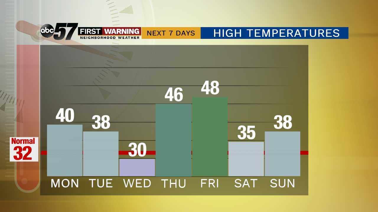
Skies clear and the wind calms to start the week. The first full week of January is far from winter-like. Highs hang close to 40 with little chance of snow. A weak system brushes the area Tuesday with minimum impact. Temperatures spike Thursday and Friday and rain is likely. Minor flooding may be the biggest threat with early estimates of more than two inches possible, widespread rain to end the week.
Tonight: Partly cloudy. Low of 28.
Monday: Mostly sunny. High of 40.
Tuesday: Mostly cloudy High of 38.
Wednesday: Partly cloudy. High of 30
Sign up for the ABC 57 Newsletter