
-
1:16

No shortage of sunshine today
-
1:37

Memorial Day parade forecast
-
4:51

Local band ’The Erly’ stops by ABC57 ahead of June 3 performance
-
1:17

VERY foggy first few hours of the morning
-
1:57

A local taste brings New Carlisle community together on race...
-
0:45

Pancakes help raise funds to support the Alzheimer’s Association
-
1:03

Lighter rain expected into the afternoon
-
1:04

Non-severe storms expected
-
1:16

Showers start this morning
-
1:59

Mac & Cheese festival turns Four Winds Field into a kitchen
-
0:45

Michiana Spring Clay tour encourages people to try and take a...
-
2:56

Fresh Cuts, Fresh Starts: Re-Entry Program Gives Back in Elkhart

Not as cold tonight, temperatures will stay above zero but snow returns to the forecast. Light snow, less than an inch for most the area Thursday night into Friday morning.
The big question will be if we break 20 on Friday, it’s the only day that it could happen in the next week. The warm-up will precede a clipper system that will bring area-wide significant snowfall Friday night and Saturday. A widespread one to three inches is likely Friday night with lake effect adding at least another one to three Saturday, for some. Bitter cold returns for New Year’s with lows falling back below zero early next week.
Tonight: Light snow showers, low of 8.
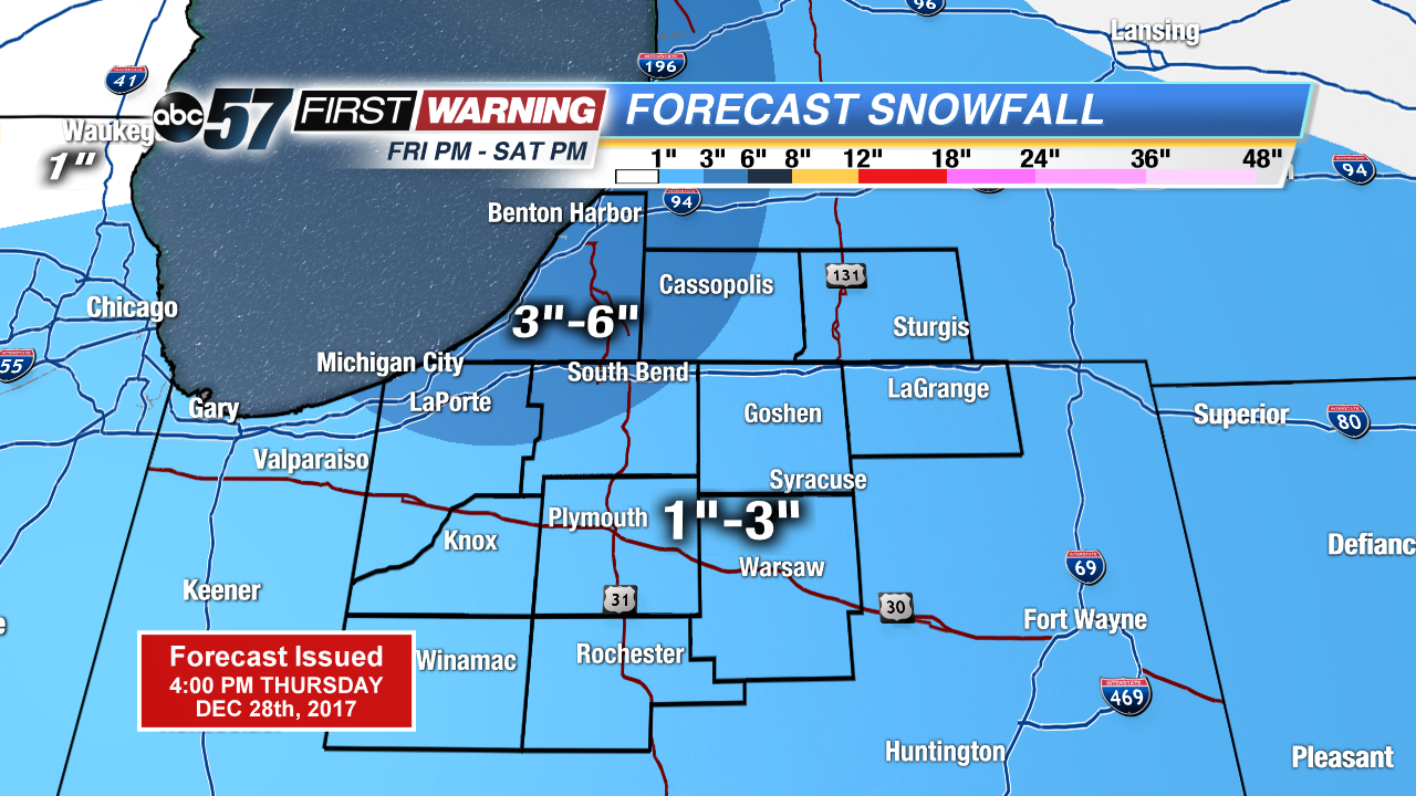
Friday: Mostly cloudy, snow starting by the evening, high of 18.
Saturday: Lake effect snow, high of 14.
Sunday: Mostly cloudy, highs in the low teens.