
-
0:59

Contract negotiations collapse, prompting NIPSCO to lock out...
-
0:58

Indiana Football trophies tour stops by IUSB
-
0:57

How the town of Bourbon shapes up one year after EF-1 tornado
-
0:54

School City of Mishawaka announce Teachers of the Year
-
1:36

Severe threat not over
-
2:19

St. Joseph County officials address fax service hack
-
1:28

Round two around midnight
-
1:53

Local churches gearing up for the easter holiday amid a possible...
-
1:48

Preparations underway as Indiana University football trophies...
-
3:09

Indiana Utility Regulatory Commission collecting consumer data...
-
1:18

St. Joseph County officials host Election 101 Workshop on voting...
-
5:36

Hannah Hidalgo wins Naismith Defensive Player of the Year

The end of November, beginning of December remain quiet. A mix of sun and clouds this week, with temperatures warming into the mid-50s by Thursday. Wednesday is the cloudiest day, with more sunshine leading into the weekend. The weekend will not be mild, temperatures fall into early next week. The only threat of snow right now is lake effect next Monday. At this point we're just looking at the pattern for the possibility of snow, that could easily change.
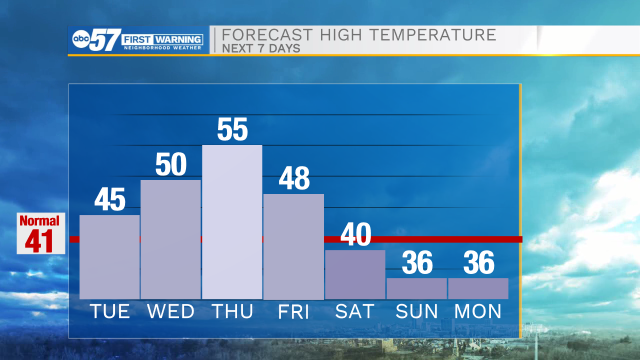
Tonight: Mostly cloudy. Low 32.
Tuesday: Partly cloudy. High 45.
Wednesday: Partly to mostly cloudy. High 50.
Thursday: Partly cloudy. High 55.
Sign up for the ABC 57 Newsletter