One last bitter cold day with lake effect snow
By: Emily Kennedy
Posted: Mar 5, 2019 3:27 AM EDT

-
2:05

JobSpark helps inspire career exploration for middle school students
-
2:01

MPHPL launches new bookmobile to extend library access
-
2:17

Will Pauling shines, Jadarian Price shows versatility at Notre...
-
2:55

Notre Dame’s Pro Day gives 16 seniors one more shot to impress...
-
2:57

South Bend residents voice concerns over proposed pedestrian...
-
3:03

Prices at the pump continue to rise across Michiana
-
1:35

Warming up before storms arrive Thursday
-
2:06

Staying sunny until Thursday
-
0:58

Goshen City Council amends DORA rules amid community concerns
-
1:20

SB Common Council adopts Downtown 2045 Plan
-
2:39

Friends and family celebrate life of Jamecia Moffitt
-
1:15

St. Joseph County Council updates residents on Affordability...

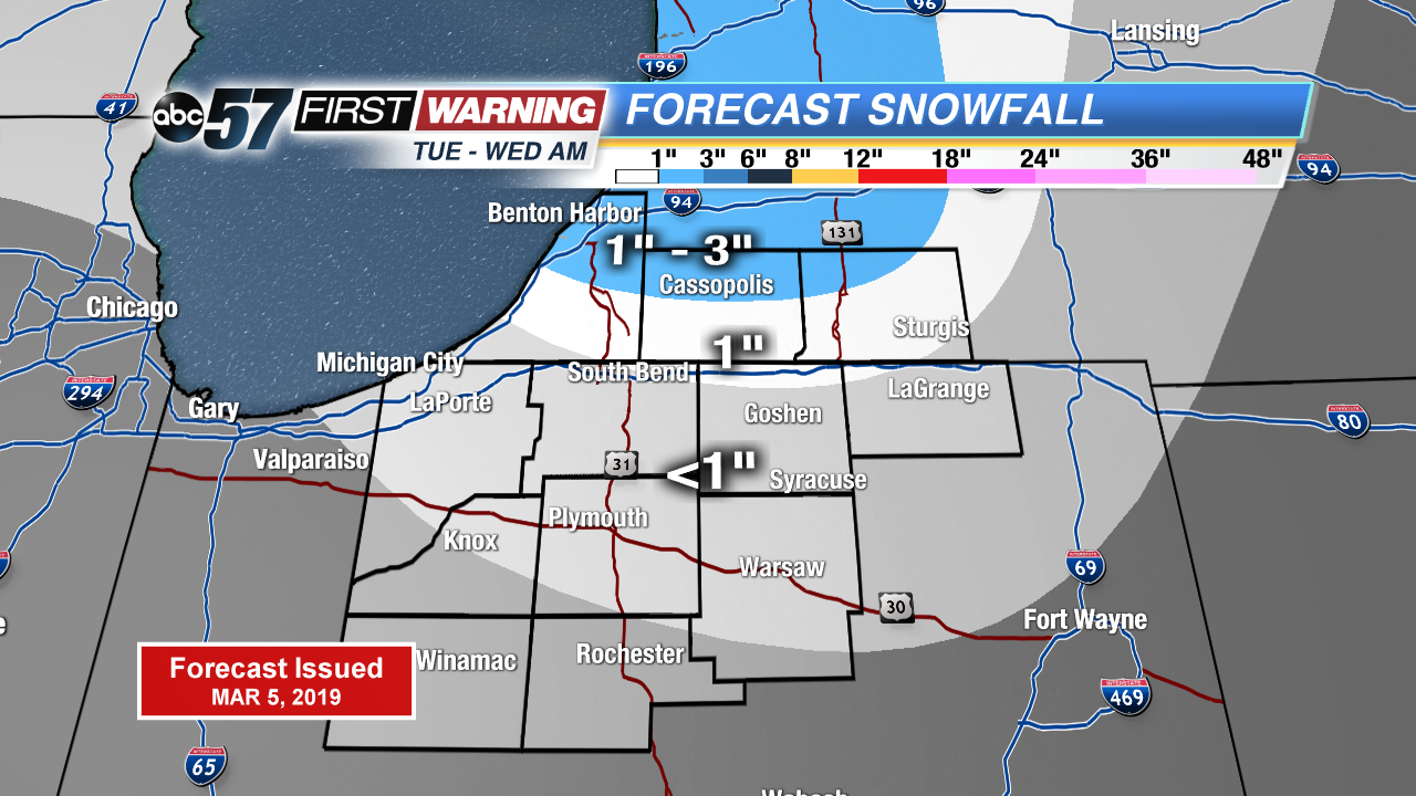
More record cold temperatures possible today with breezy winds making it feel even colder! Lake effect snow shower pick up during the evening through the overnight hours. Lake effect snow tapers off Wednesday morning with sunshine breaking through the clouds. The next chance of snow is Thursday evening into Friday morning. Otherwise temperatures slowly warm up into the weekend. A strong low pressure system brings us mainly rain Saturday night with possible rumbles of thunder.
Today: Mostly cloudy, lake effect snow showers, high of 19. Breezy.
Tonight: Mostly cloudy, lake effect snow showers, low of 10.
Wednesday: Partly to mostly sunny, high of 26.
Thursday: Partly cloudy, chance evening snow, high of 30.
Sign up for the ABC 57 Newsletter