One last warm day before cold front brings chilly weather
By: Emily Kennedy
Posted: Apr 8, 2020 3:15 AM EDT

-
2:06

Staying sunny until Thursday
-
0:58

Goshen City Council amends DORA rules amid community concerns
-
1:20

SB Common Council adopts Downtown 2045 Plan
-
2:39

Friends and family celebrate life of Jamecia Moffitt
-
1:15

St. Joseph County Council updates residents on Affordability...
-
0:51

Locals gather to recognize farmworkers across Northern Indiana
-
2:07

Impact of higher gas prices for delivery drivers
-
3:43

ND Eviction Clinic exposes ’shameful’ living conditions at...
-
3:59

Neighbors share traffic, noise concerns about proposed Capital...
-
1:50

Leaf pick up resumes in South Bend after weather postpones service...
-
1:02

Another rollercoaster ride to end the week
-
3:41

Present Pillars to host “Dad Strong 5K“ to support fathers...

ABC 57 First Warning Neighborhood Weather
Wednesday, April 8th, 2020
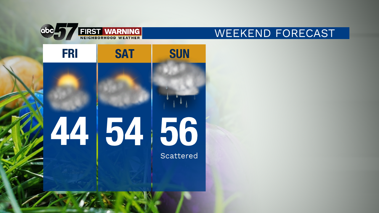
Daytime highs only slightly drop for today, giving us another beautiful day! A strong cold front will move through tonight, bringing rain and thunderstorms starting after 6pm this evening. Much colder drops our daytime highs into the 40s for the remainder of the week. Easter weekend rebounds slightly into the 50s but another system moves through on Easter, bringing more rain.
Today: Partly cloudy, evening rain/storms. High 69.
Tonight: Rain early then partial clearing. Low 38.
Thursday: Partly to mostly cloudy. Breezy. High of 46.
Friday: Chilly, clearing skies. High of 44.
Sign up for the ABC 57 Newsletter