
-
1:05

Freeze warning begins tonight
-
1:15

Gunman identified in mass shooting in Shreveport, Louisiana
-
1:14

After afternoon showers, drier week ahead
-
0:57

Calm and cool now, showers later
-
0:53

Cold out the door
-
2:35

CJ Carr shines as Notre Dame holds annual Jersey Scrimmage ahead...
-
0:50

Boys and Girls Club giveaway sports shoes to kids in need
-
3:20

Michigan City residents raise concern about Google’s Hyperscale...
-
2:32

Residents seek answers in fatal officer-involved shooting
-
0:48

Cool conditions continue this weekend
-
0:37

Two injured in single-vehicle crash, passenger ejected from vehicle
-
0:51

Cooling and drying through morning

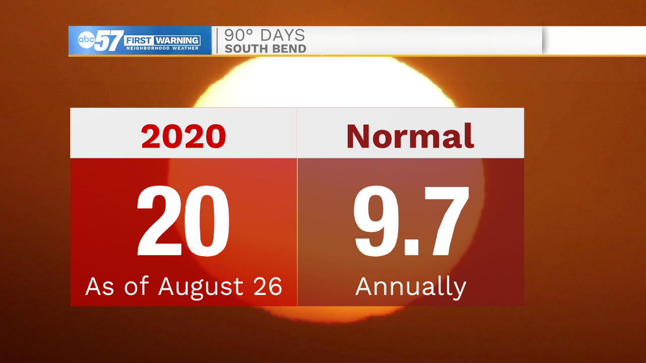
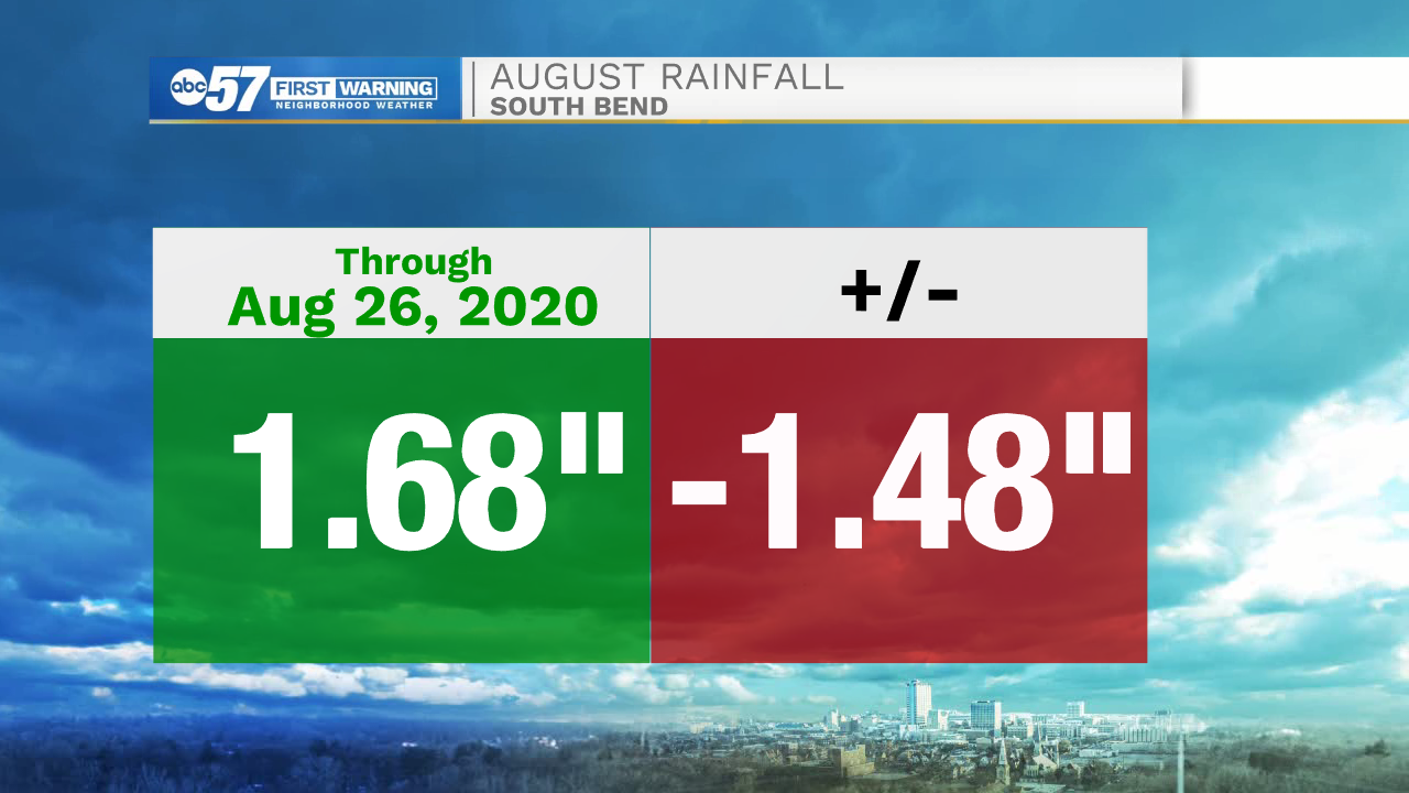
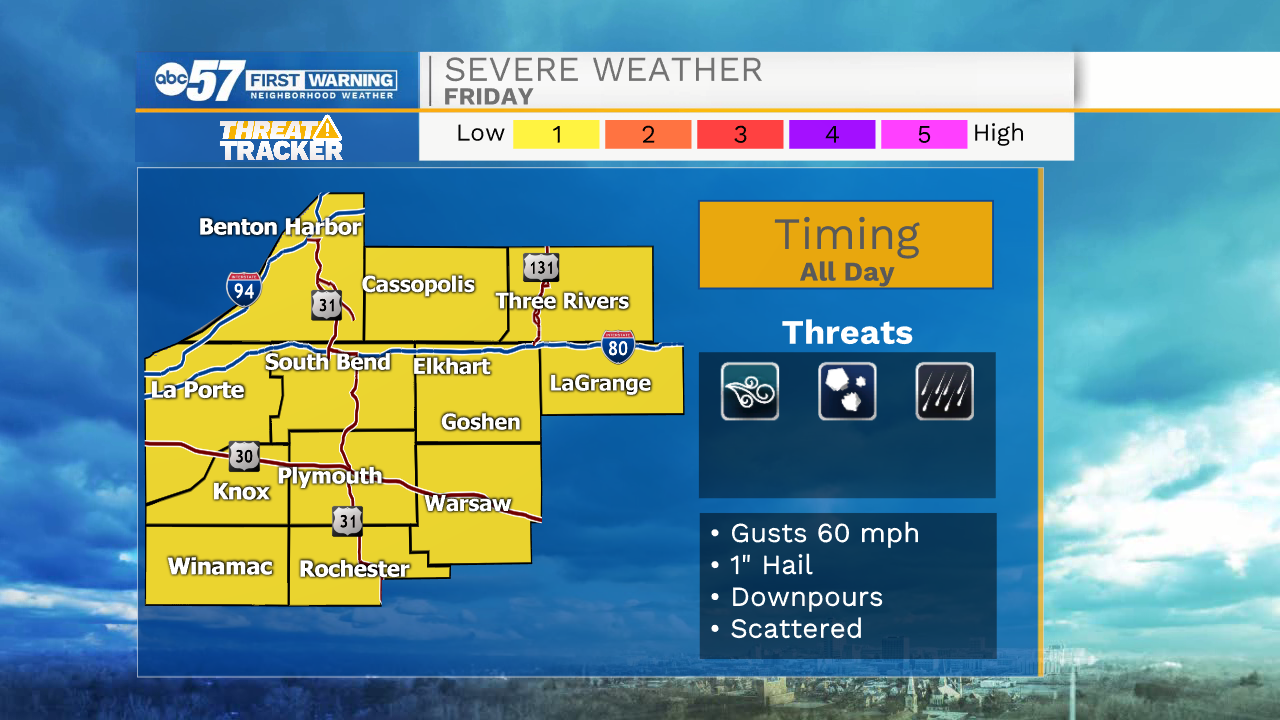
90 degree heat lasts through Thursday. Friday is the day of change with an approaching cold front. That front, along with an added boost from the remnants of Hurricane Laura to the south will cause scattered showers and thunderstorms. The storm threat starts early Friday morning and lasts through the evening. The severe threat is very conditional as how morning storms develop could influence or inhibit afternoon storms. The front clear Friday night and the weekend is mild and dry.
Tonight: Mostly clear. Low 72.
Thursday: Hot and mostly sunny. High 92.
Friday: Scattered showers / storms. High 88.
Saturday: Mostly sunny. High 78.
Sign up for the ABC 57 Newsletter