One more hot day before a beautiful weekend
By: Emily Kennedy
Posted: Jun 5, 2020 2:56 AM EDT

-
2:16

The fierce March weather continues, wind, storms, snow ahead
-
2:32

Nine people charged in alleged murder at Miami Correctional Facility
-
2:31

National Weather Service confirms tornadoes
-
2:04

Cold out the door, Fair by afternoon
-
0:20

School City of Mishawaka approves Growing Together Preschool,...
-
2:15

“Hoosier Hospitality, Hoosier Lanes” local business in Wheatfield...
-
2:34

Local student earns spot at the Scripps Howard National Spelling...
-
2:38

NWS confirms EF-2 tornado hits Starke County Tuesday night
-
0:59

Edwardsburg tornado cleanup continues after second round storm
-
2:28

Once in “tornado emergency,“ Knox residents reflect on twister’s...
-
3:11

SJC police officer talks flooding danger on roads
-
2:18

People in Starke County prepare to fix damage after Tuesday night’s...

Friday, June 5th, 2020
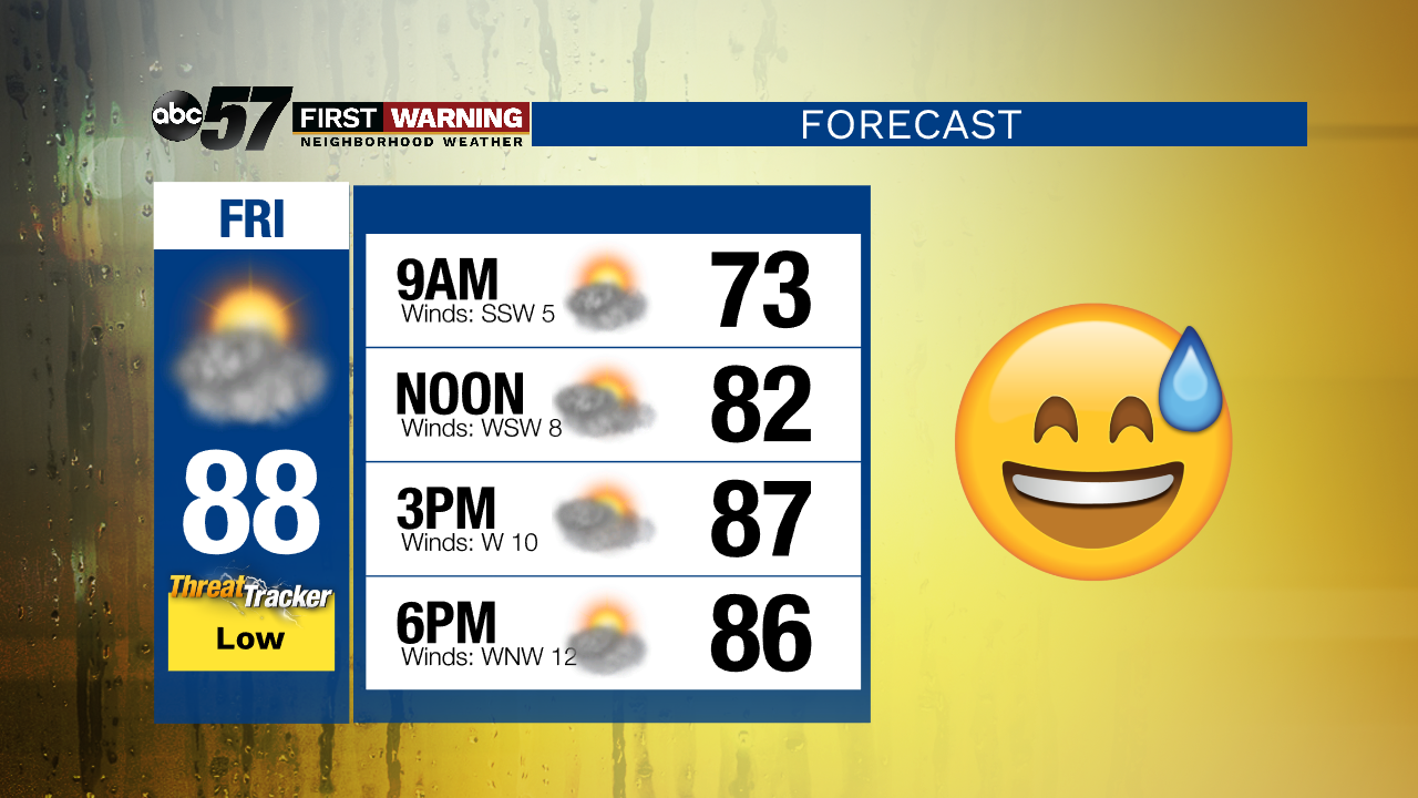
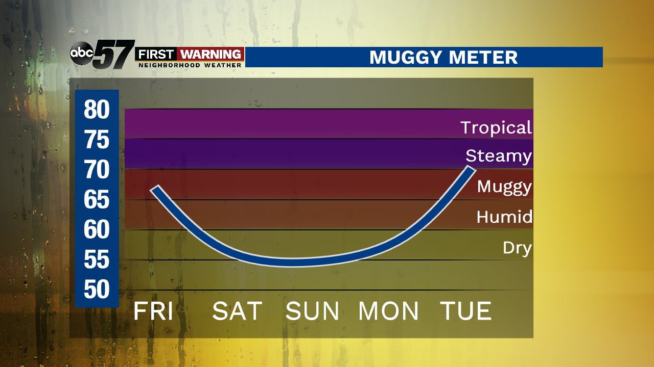
A mix of sun and clouds today with a stray shower or storm possible. It's hot and muggy as daytime highs top out in the upper 80s. A weak cold front brings relief from the heat and humidity this weekend. Temperatures cool into the upper 70s for Saturday and Sunday. It's back into the 80s Monday with sunshine. We finally get some much needed rain starting late Tuesday evening into Wednesday.
Today: Mix of sun and clouds, isolated storm possible. High 88.
Tonight: Partly cloudy. Low 60.
Saturday: Sunshine. High 77.
Sunday: Sunshine. High 78.
Sign up for the ABC 57 Newsletter