
-
1:02

Sunny and pleasant Tuesday morning
-
1:40

Elkhart holds annual Memorial Day parade
-
3:37

Law enforcement, veterans and more participate in Back the Blue...
-
3:47

Families honor lost loved ones as lifeguards return to South...
-
1:16

No shortage of sunshine today
-
1:37

Memorial Day parade forecast
-
4:51

Local band ’The Erly’ stops by ABC57 ahead of June 3 performance
-
1:17

VERY foggy first few hours of the morning
-
1:57

A local taste brings New Carlisle community together on race...
-
0:45

Pancakes help raise funds to support the Alzheimer’s Association
-
1:03

Lighter rain expected into the afternoon
-
1:04

Non-severe storms expected

Wednesday is the last mild day before the humidity surges and we begin a summertime stormy pattern. Thursday through Saturday highs warm into the 80s, the mugginess will fuel the cycle of scattered showers and thunderstorms, mostly in the afternoon and evening. Heavy downpours and strong storms are possible but there is no clear timing on a specific event at this time, just the possibility.
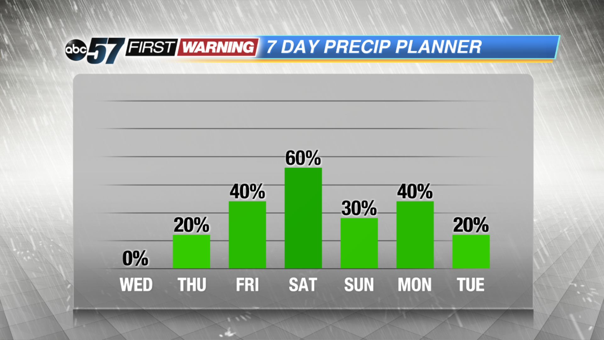
Tonight: Mostly clear, low of 48.
Wednesday: Mostly sunny, high of 76.
Thursday: Partly to mostly cloudy, chance of showers late, highs of 82.
Friday: Scattered showers and storms, highs in the mid-80s.
Sign up for the ABC 57 Newsletter