Most of Sunday is dry again, but some showers will move through during the second half and tail end of the day. As temps drop overnight, some rain may change over to snow but no accumulation is expected. Some very light precip (drizzle/flurries) could hang around through Monday, but most will just see clouds.
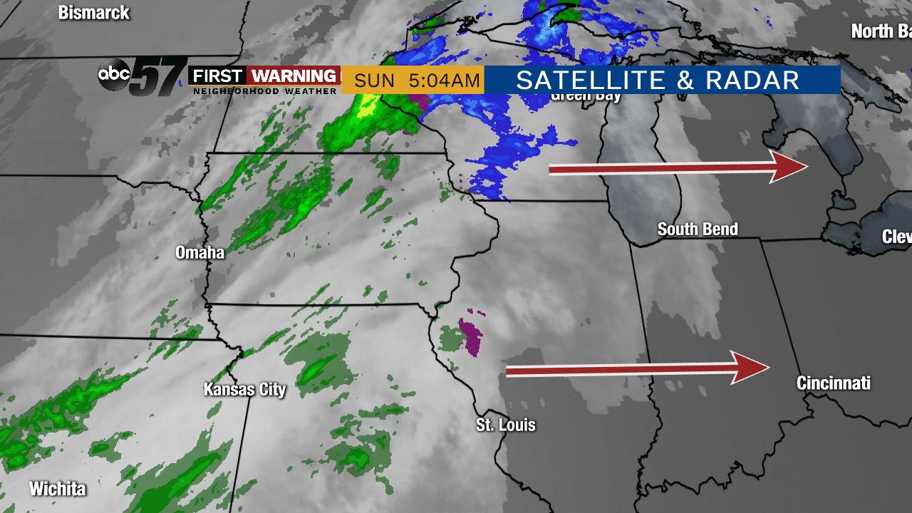 Radar image around 5 AM Sunday morning. Light rain will slowly approach Michiana and arrive late today.
Throughout the new work week, we're really not expecting much in the way of additional rain or snow chances. The next best round of weather comes Thursday. As of now, a stronger low pressure system looks to push into the Great Lakes region by late Wednesday night and Thursday, throwing widespread rain and wind our way. At the same time, high temperatures will continue to soar into the low 50s for the first time in 2 weeks!
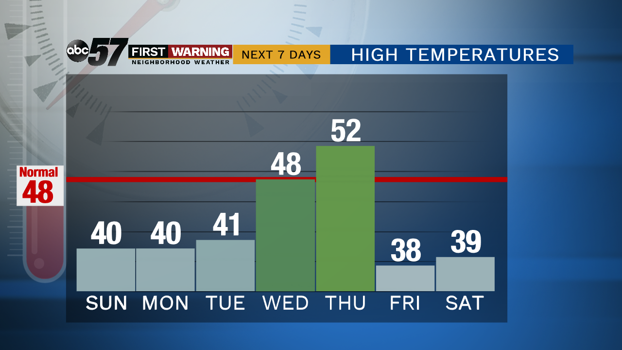 Highs continue to stay on the cool side. But, Wednesday and Thursday will break the cold streak!
And speaking of high temperatures, we'll continue to slowly warm up before that new rain chance Thursday. We're expecting TWO days of above normal warmth before the cold front knocks us down into the new weekend.
