
-
1:30

Country music star Jake Owen to play at Blue Gate Performing...
-
1:51

Warm and sunny stretch with a few showers possible this weekend
-
0:30

Prayer vigil held for domestic violence victim in South Bend
-
1:10

Bristol Town Council votes in favor of annexation of 500 acres...
-
0:52

Official ribbon cutting for The Delta neighborhood in Elkhart
-
1:08

Traveling or booking a trip soon? Here’s what to know
-
0:27

Elkhart Police Department investigating a hit and run on Cassopolis...
-
2:40

Recovery efforts continue after EF-1 tornado devastated Edwardsburg
-
1:22

The March rollercoaster continues
-
0:55

Mishawaka High School Theatre presents ’Chicago! Teen’
-
2:25

Local chef showcasing her food at Pacers game
-
3:46

Local farmers concerned war with Iran will impact fertilizer

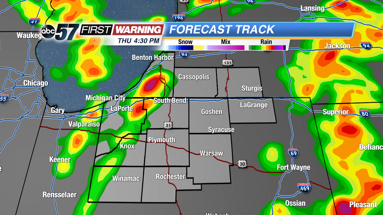
Afternoon Update: Windy this afternoon, gusts will peak in the 45 mph range. The window for thunderstorm is through 5 PM, storms will be scattered and the severe risk is isolated, however in an already windy environment damaging wind gusts +50 mph are possible as well as tornadoes.
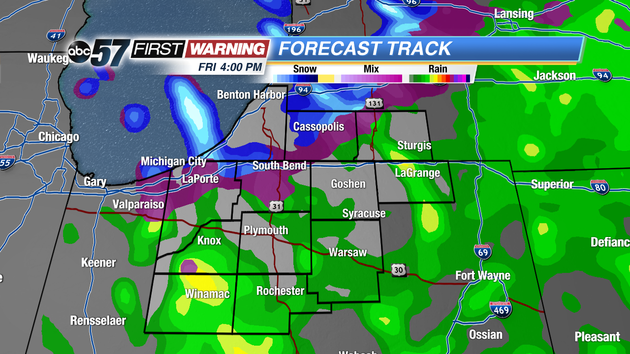
The brief warm spell is over. Temperatures fall from the 40s on Friday and light rain mixes with snow showers Friday afternoon. The weekend is colder and calmer, some sunshine and highs in the 30s and 40s. Temperatures rise gradually through next week, turning more spring-like by next weekend.
Tonight: Breezy, falling temperatures into the lower 40s.
Friday: Mostly cloudy and breezy, chance of rain/snow as temperatures fall from 42.
Saturday: Mostly cloudy, high of 36.
Sunday: Partly cloudy, highs in the low 40s.