Periods of heavy lake effect snow
By: Emily Kennedy
Posted: Jan 4, 2018 3:07 AM EDT
-
3:13
Local players react to $3 million investment in Byer Softball...
-
0:32
Layoffs at Whirlpool could affect workers in Benton Harbor
-
1:03
Annual District Sisterhood Conference at Ivy Tech empowers students
-
1:49
Back home in downtown South Bend, YMCA to open new location
-
2:16
This week’s ABC57 Cub Reporter is Nicholas Zentz
-
3:05
Amazon Web Services invests $11 billion to build data center...
-
4:05
Riley High School student center stage at the NFL Draft
-
1:35
Rain, wind, and milder temperatures forecast this weekend
-
2:49
Joe Alt expected to be drafted in the first round of NFL Draft
-
2:11
Students gearing up for local careers in Manufacturing
-
2:13
Sunny today, but expect a wetter and warmer weekend
-
0:54
Goodwill ’Little Black Dress’ event raises funds for community...
Lake effect snow showers continue through today, creating for slick roads and low visibility at times on the roadways. Give yourself at least 10-15 extra
minutes for your morning commute. The heaviest snow is expected for Berrien and Cass Co. where some could see 12-18” of snow by Friday night with localized higher amount possible. The clouds from the lake effect will keep us from getting too cold, but daytime highs will only be in the low to middle teens.A couple flurries are possible Saturday morning but most of the day is dry with partly cloudy skies. It’ll be a great day to run any errands or clean up the snow because a wintry system moves in
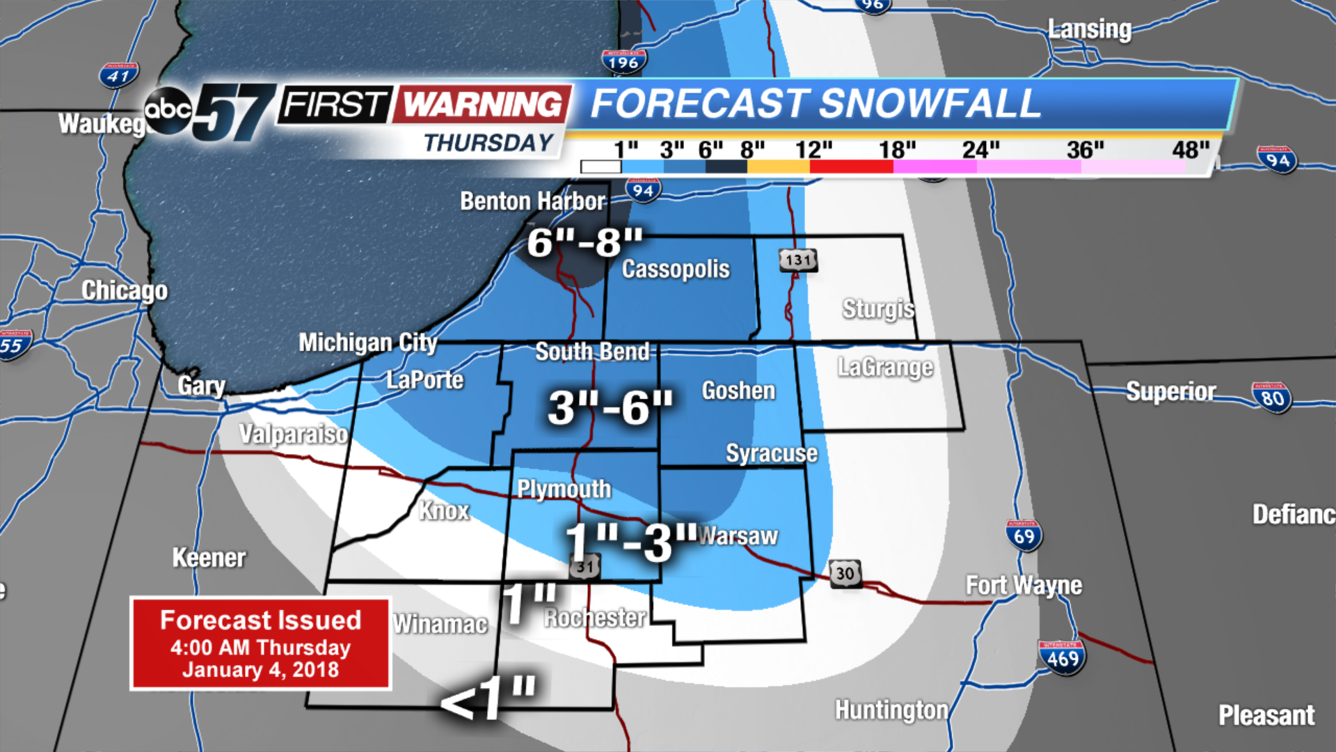
Sunday afternoon. This system looks to last through at least midday Monday. Temperatures do warm up, making it into the low 30s by the very beginning of next week.Today: Lake effect snow showers, high of 14, falling PM temperatures.
Tonight: Lake effect snow showers, low of 4.
Friday: Lake effect snow showers, high of 10.
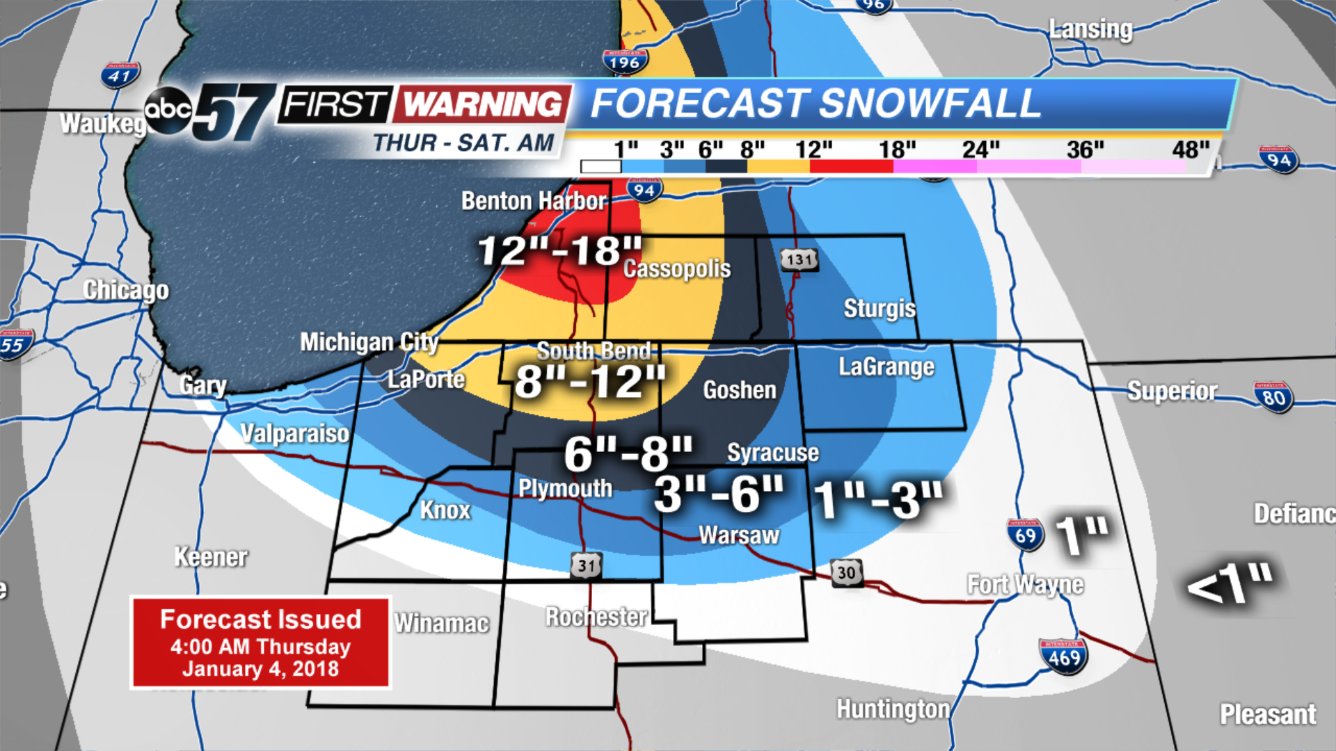
Saturday: Partly cloudy, high of 15.
Sign up for the ABC 57Newsletter