Periods of rain to a wintry mix to snow lasts until Sunday
By: Emily Kennedy
Posted: Jan 24, 2020 3:19 AM EDT

-
2:23

La Porte community rallies for Sammy Strong Benefit, raising...
-
1:57

The Potawatomi Zoo opens its gates to Zoo Nights Live
-
2:50

Carson Kvapil wins his first O’Reilly Auto Parts Series win...
-
1:10

William Tuffs honored as the only Indiana man who took part of...
-
0:50

Beacon Health held a Health and Wellness fair for the community
-
1:03

Warm conditions start overnight
-
1:02

Another pleasant day
-
0:42

Still cooler out the door
-
2:00

New Carlisle celebrates annual Hometown Days
-
1:40

Ross Chastain leads NASCAR O’Reilly Auto Parts Series practice...
-
2:27

Backpacks for Berrien hosts their Stuff-a-Bus event, ultimate...
-
2:59

Ludacris Opens Elkhart County 4-H Fair Concert Series Amid Ticket...

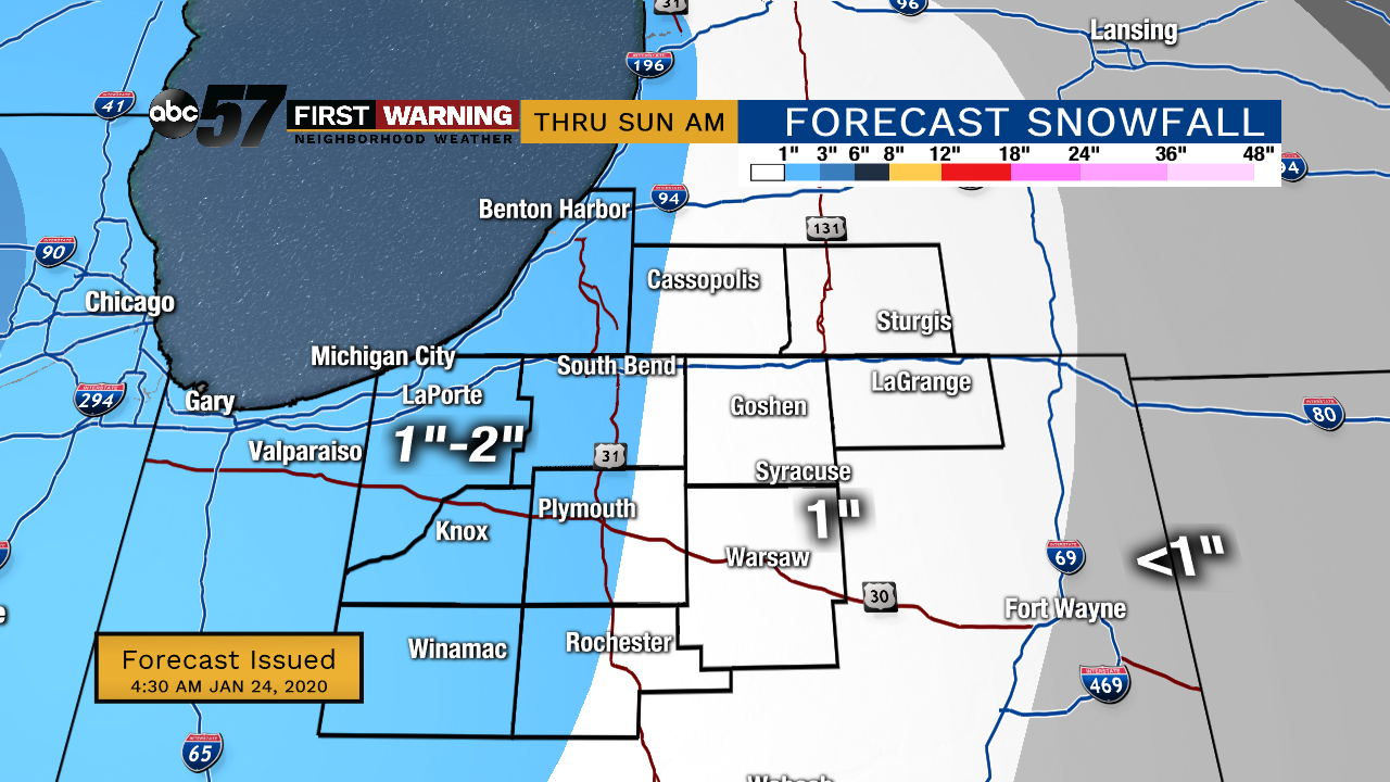
Friday, January 24th, 2020
Mainly rain for today but snow will mix tonight. Due to the melting snow, fog is possible. The rain/snow mix then lasts into Saturday turning to just light snow Saturday night into early Sunday morning. Little snow accumulation is expected. Temperatures remain above normal this weekend and through next week as well.
Today: Rain likely. High 38.
Tonight: Scattered light rain/mix possible. Low of 32.
Saturday: Mix/snow likely. High 36.
Sunday: A few flurries possible in the morning, then cloudy. High 35.
Sign up for the ABC 57 Newsletter