
-
2:10

Cool, but calm, today
-
1:23

City of South Bend presents an ’Age-Friendly Plan’ to better...
-
0:54

South Bend Venues Parks and Arts hosts ’Adult Recess’
-
2:27

Why Aneyas Williams turned down the transfer portal and stayed...
-
2:21

Bourbon community rallies around Triton boys’ basketball team...
-
5:02

Dave Matthews shares details about LLC bankruptcy filings
-
1:00

Warming up this weekend before more storms next week
-
1:46

A chilly and calm start to the weekend
-
1:00

NIPSCO workers rally in South Bend for new contract
-
1:53

Severe weather threat is over, MUCH colder Friday
-
3:43

South Bend Mayor James Mueller delivers 2026 State of the City...
-
0:52

Family and friends of Adrian Cruz voice frustration in sentencing...

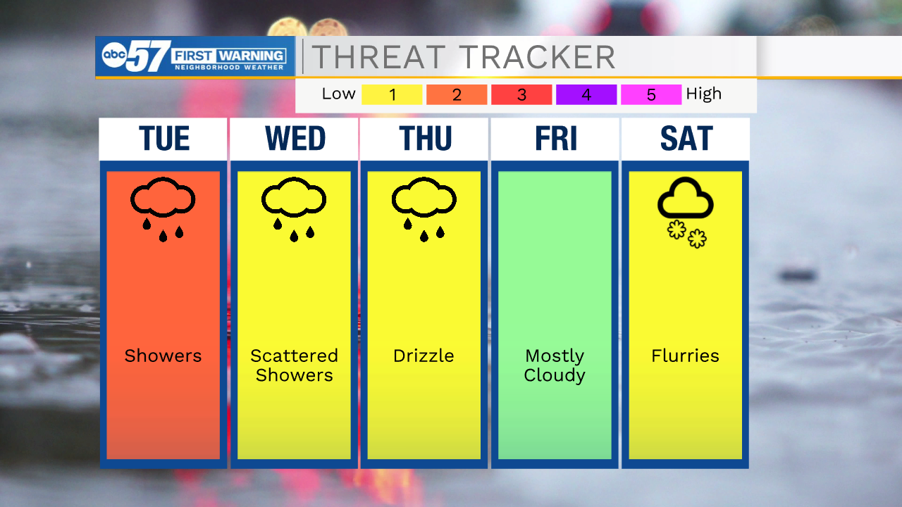
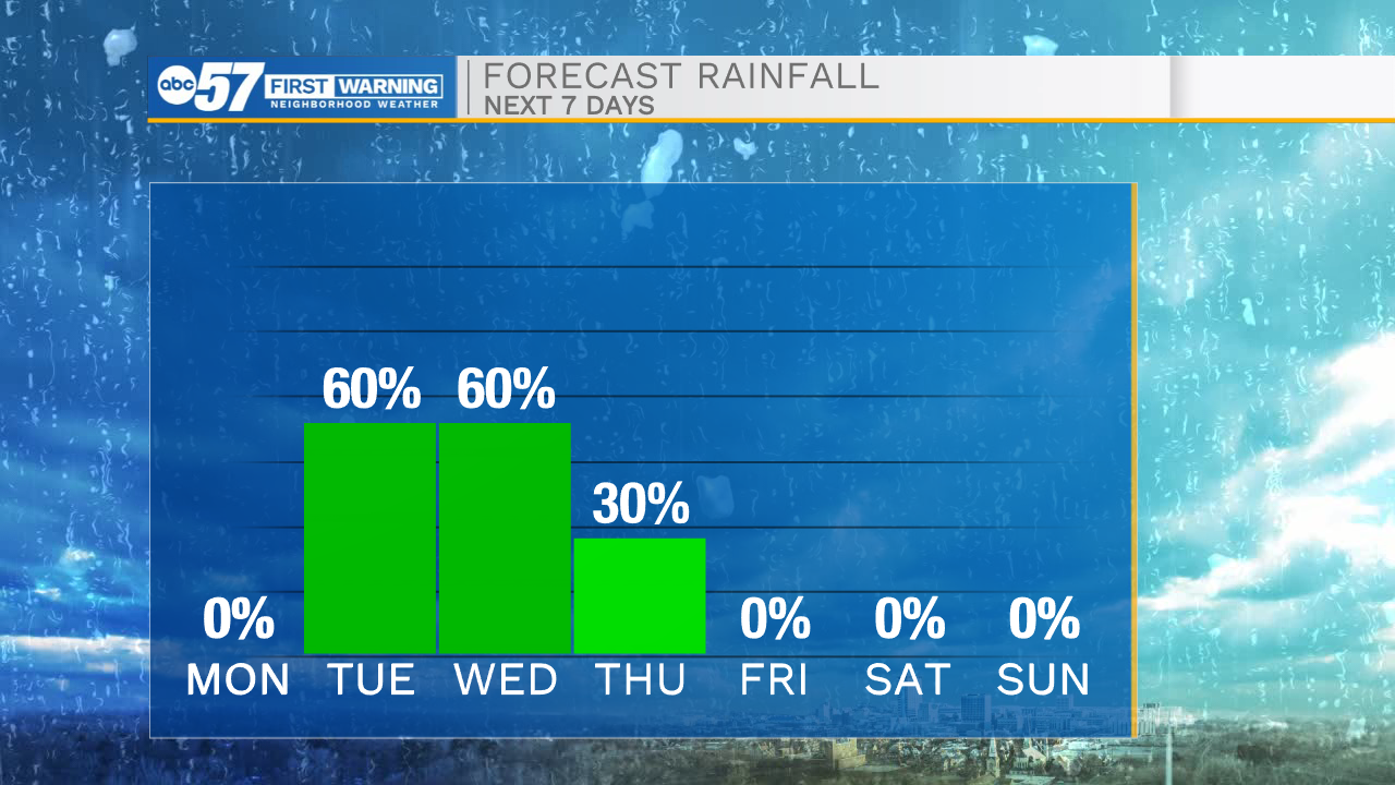
The weather is wet the rest of the week, Tuesday brings a few rounds of rain with mornings showers and late afternoon rain. Tuesday night is likely the wettest period, with up to an inch of rain possible. Thunderstorms are possible Wednesday afternoon, severe weather is unlikely, but downpours could bring localized heavy rain. The rest of the week is much cooler, with light rain or drizzle. Saturday is the chilliest day, with possible snow flurries.
Tonight: Cloudy. Low 48.
Tuesday: Showers. High 55.
Wednesday: Showers/ PM T-storms. High 66.
Thursday: Drizzle. High 46.
Sign up for the ABC 57 Newsletter