Possible heavy rain and storms late Tuesday
Posted: Oct 29, 2018 11:52 AM EDT
For the first time since the beginning of October, parts of Michiana could hear a few rumbles of thunder come Tuesday evening. Even more, there's a risk for moderate to potentially heavy rain as a strong fall cold front moves through the region. Fortunately, severe weather is not anticipated at this time.
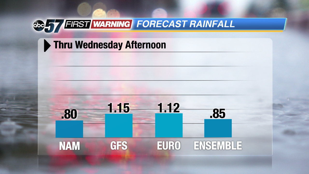
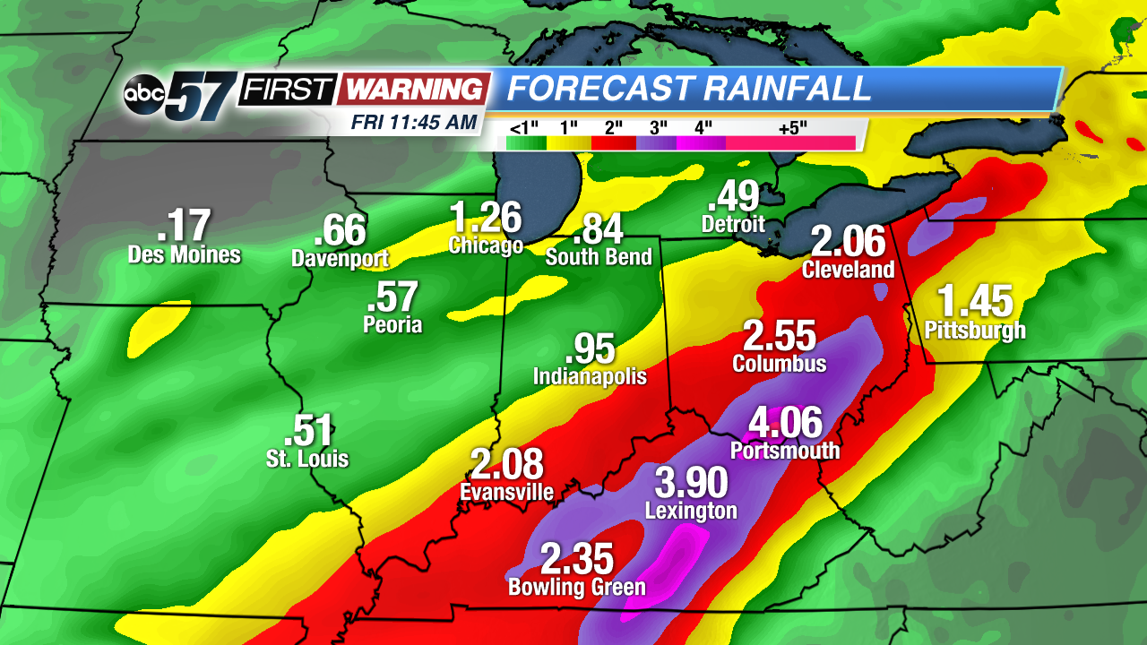
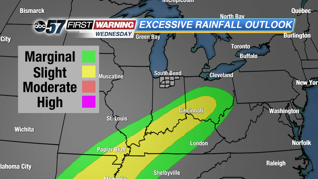
Between 8 PM Tuesday evening and 12 PM Wednesday, South Bend and Michiana will likely have seen about 1" of rainfall. Nearly every forecast model shows totals on either side of the one-inch mark. It will fall in roughly a 12-hour period, which could lead to some ponding on area roadways. However, flooding is not expected due to the lack of heavy rain this month. The front will combine with a separate system from the South and bring even heavier rain to Kentucky, southern Indiana and Ohio come Wednesday and Thursday.
Rainfall totals of 2-5" are likely in those states by Thursday night. As a result, flooding will be a concern there. Thankfully we will not see any significant rainfall Wednesday or Thursday as that system stays just to our south and east. In short, a good soaking rain (some of which could be heavy) is almost a certainty Tuesday night, but flooding is not likely.
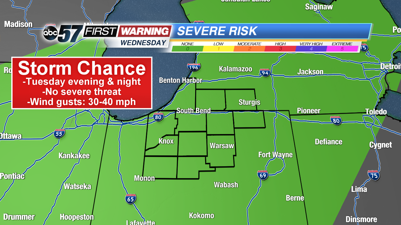
Alongside the chance for heavier rain is the risk for a few rumbles of thunder. There will be some elevated instability, or "storm energy," in place come Tuesday evening. This will combine with the cold front and high levels of moisture in the atmosphere to support a slight chance of thunderstorms. Strong to severe storms are not in the cards, but this would be the first time we've heard thunder in nearly three weeks! Overall, it has been a relatively quiet month regarding thunderstorms. The main concern with any of the heavier showers or storms would be wind gusts peaking at 30-40 mph for a brief time Tuesday evening.


