Quick shot of arctic air to provide one of the coldest stretches of winter
Posted: Feb 11, 2020 9:28 AM EDT
Ready or not we've got one of the coldest blasts of air all season on the way to end the week.
Not only will we see accumulating snow Wednesday evening and Thursday, but an arctic front will push through the region as well.
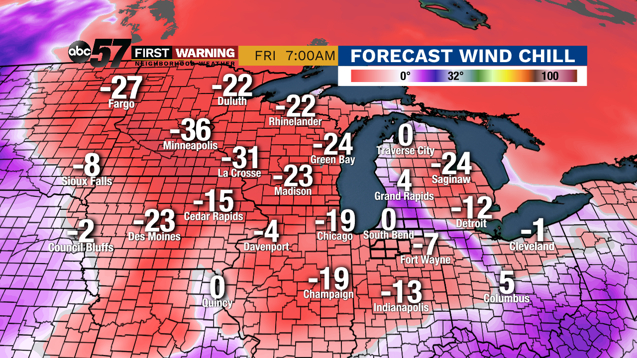 Potential wind chills Friday morning.
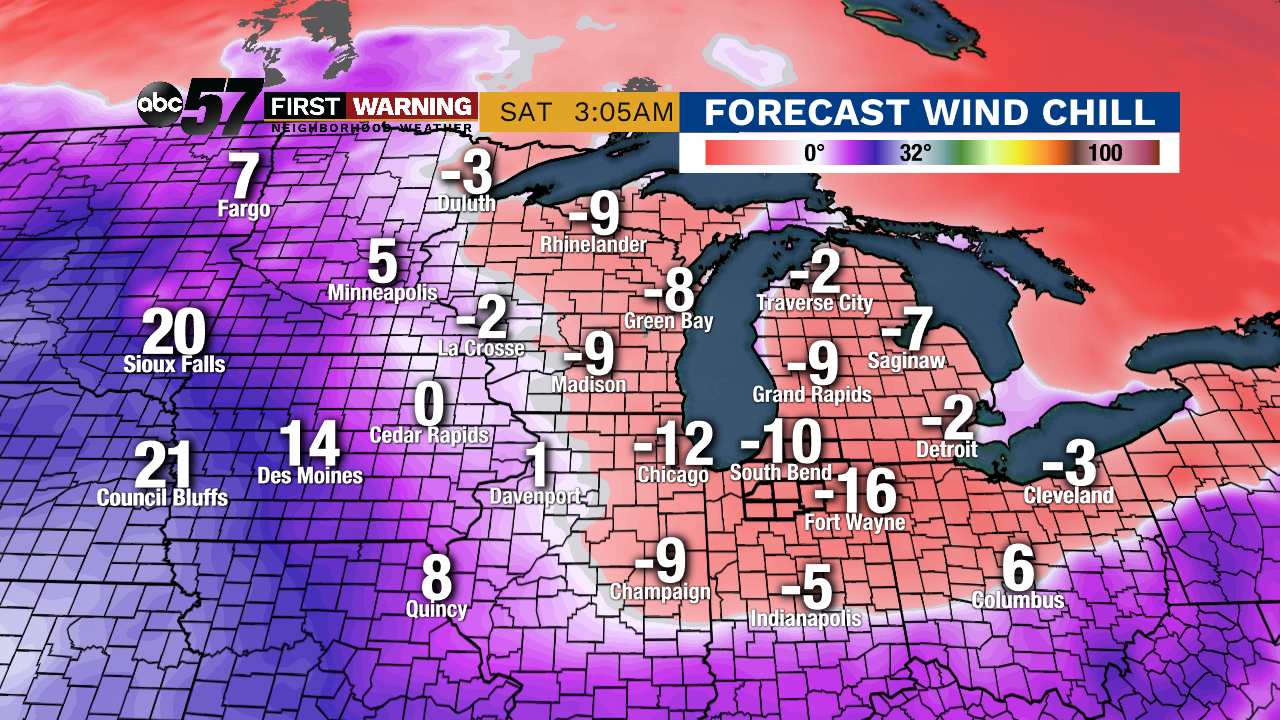 Potential wind chills early Saturday morning.
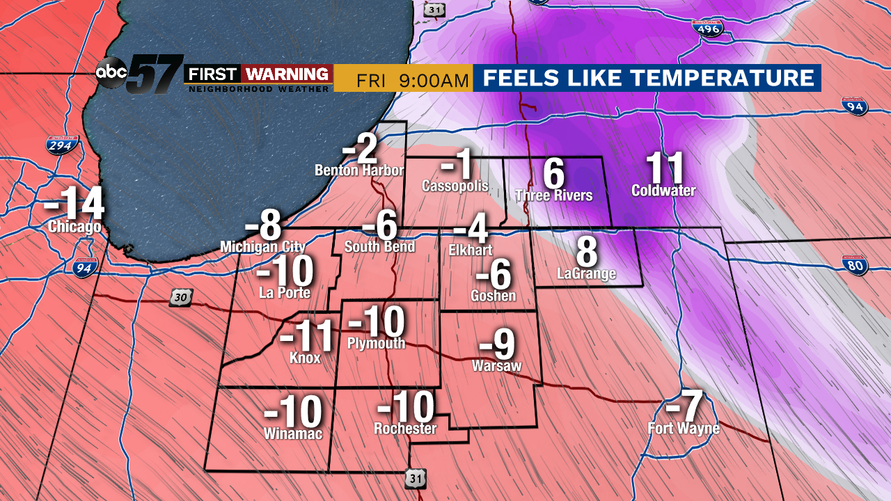
For Michiana, it won't be quite that bad.
 Potential wind chills Friday morning.
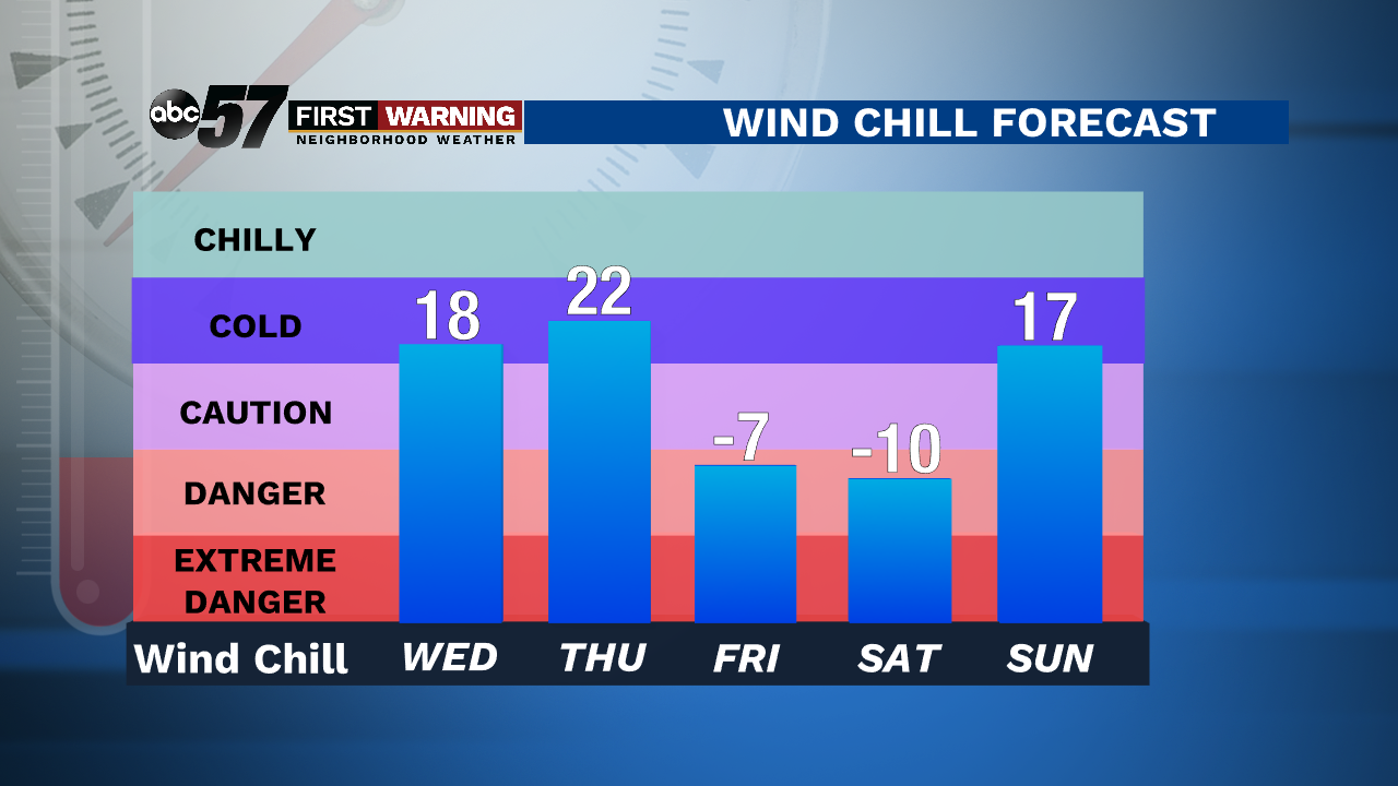
That's when our highest chance of seeing subzero wind chills exists.
 Potential wind chills Saturday morning.
Friday in its entirety will be bitterly cold, but wind chills should rise above zero during the daytime hours before falling back below zero Friday evening and night.
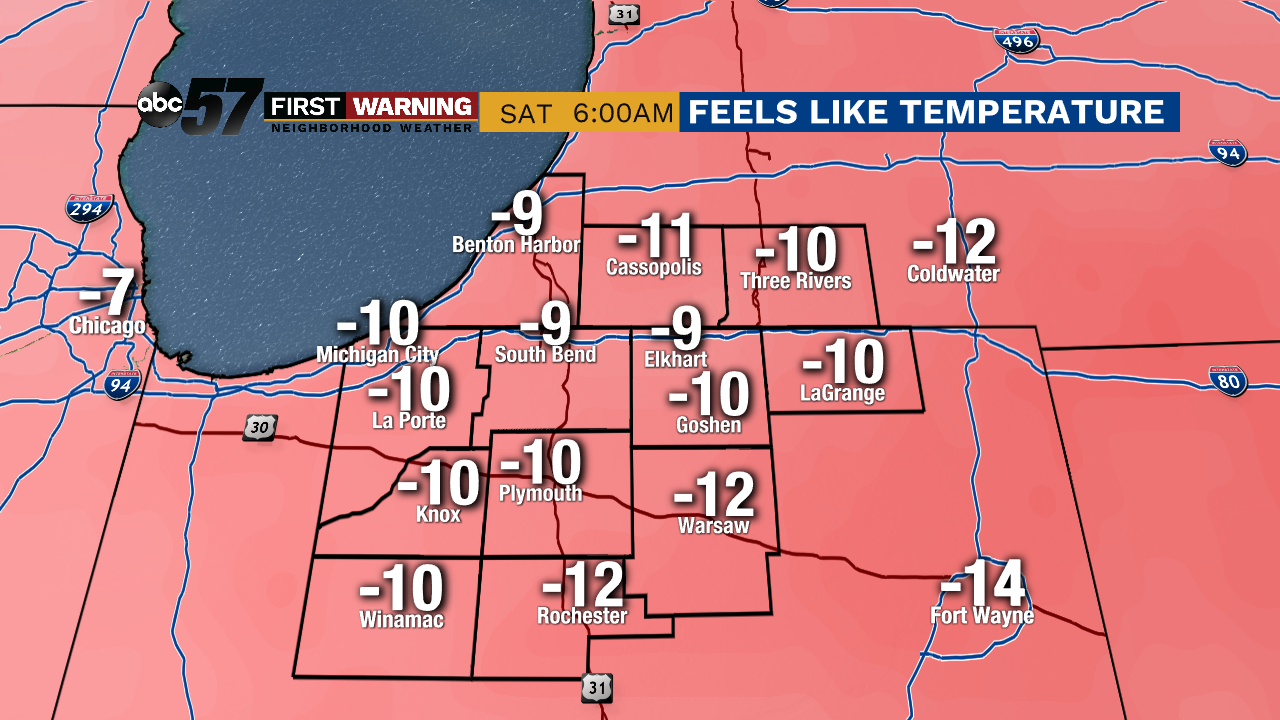
 Morning wind chill forecast for South Bend and surrounding areas.
Regardless it's set to be one of the coldest 48-hour periods all winter. And when combined with the several inches of snow we are expecting, the cold will create hazardous conditions late this week into the weekend.
