


It’s a quiet but cool day Thursday, but snow is on the way for tonight.
Skies are mostly cloudy with temperatures climbing from the mid 20s this morning to upper 30s by afternoon. Use the afternoon to run some errands ahead of snow.
Snow likely starts late this evening and continues overnight tonight. There is likely some accumulating snow by the Friday morning commute. Roads could be messy for anyone driving overnight or early Friday.
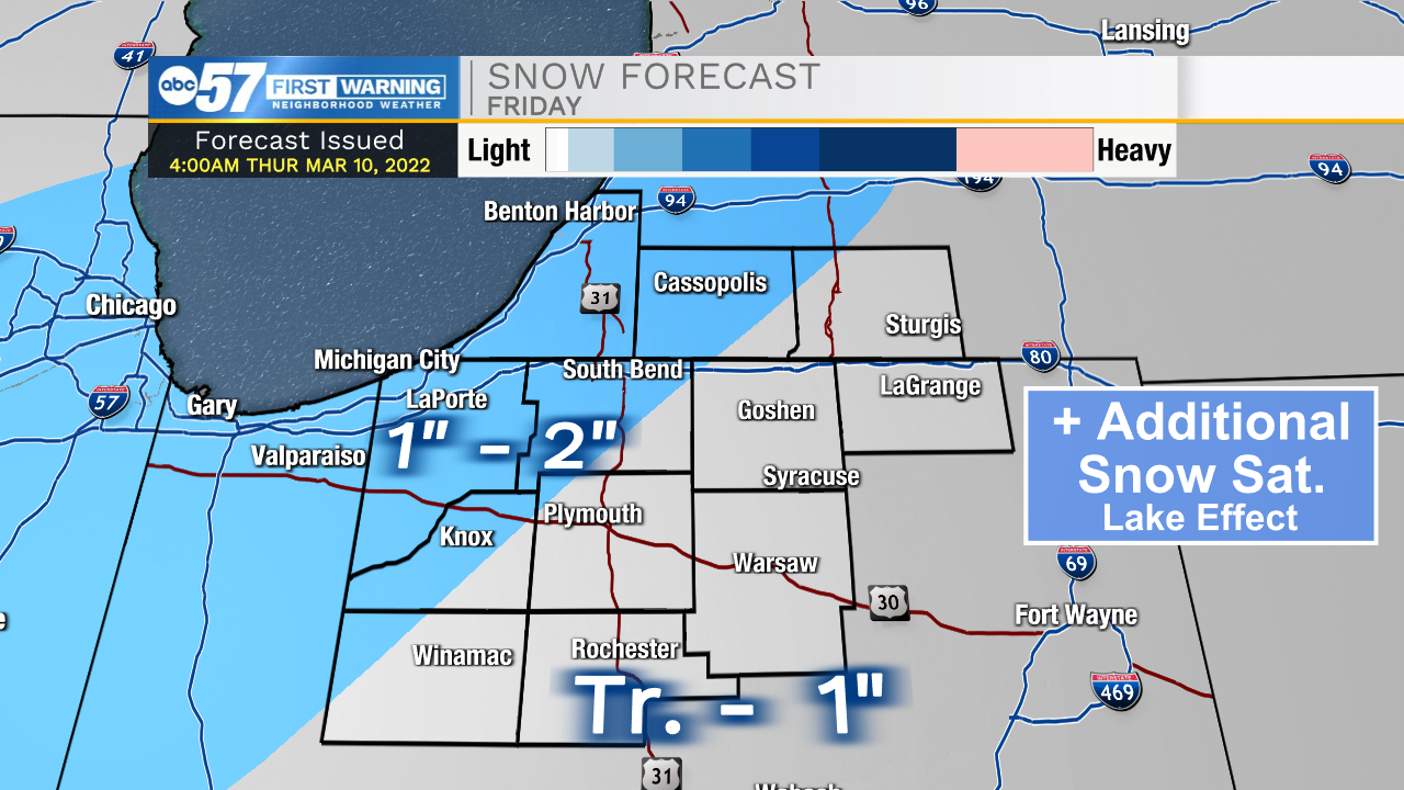
Snow showers, possibly a wintry mix, continues into Friday afternoon.
Temperatures take a nose dive Friday and Saturday, with wind chills Saturday morning around zero.
Saturday is windy with lake effect snow in the morning, which could bring some additional accumulation to the snow from Friday.
By Sunday, temperatures begin to improve. It’s still windy Sunday but at least it should stay dry with some peeks of sun.
Temperatures climb into the 50s most of next week.
Reminder: Daylight Saving Time begins at 2:00 a.m. on Sunday, March 13. We spring forward one hour.
Today: Mostly cloudy. High 38.
Tonight: Snow showers. Low 24.
Friday: Snow, then rain/snow by afternoon. Becoming windy. High 36.
Saturday: Cold, windy, lake effect snow showers. High 26.
Sunday: Partly cloudy, windy. High 48.