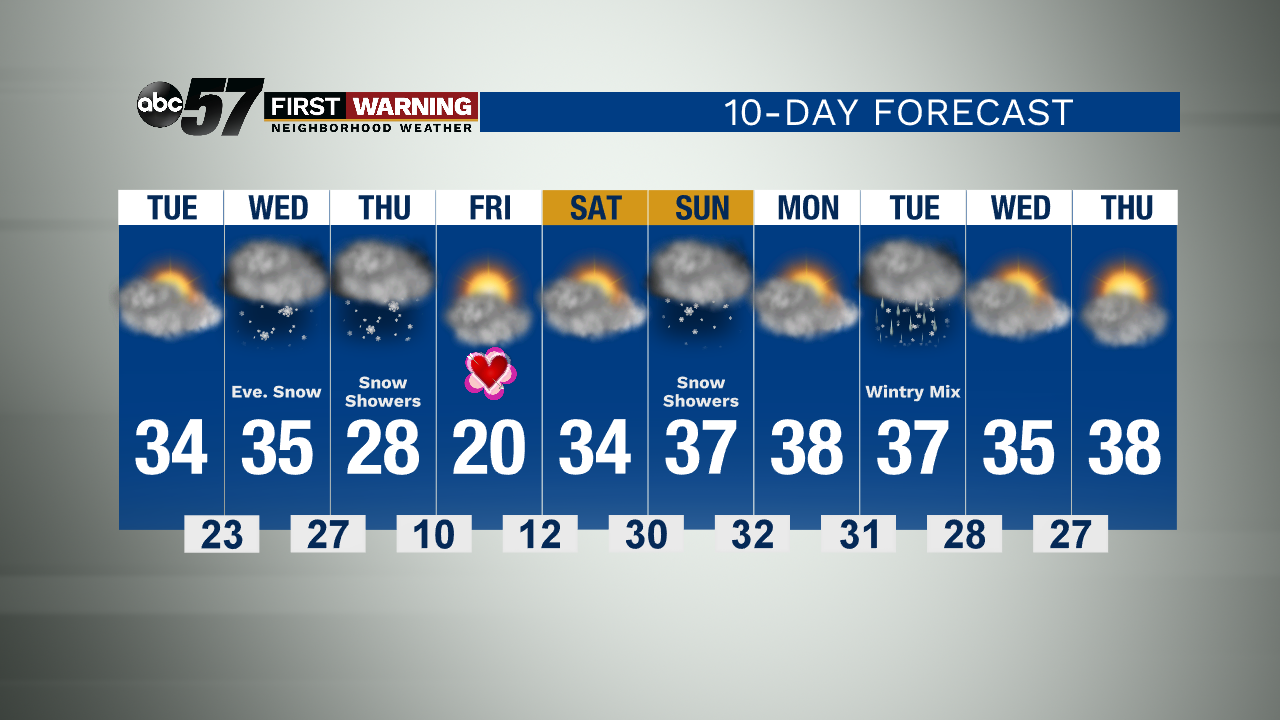
Tuesday and Wednesday will be similar to tonight—quiet and dry with seasonable temperatures. The next chance for snow is Wednesday evening. It will be another wet snow, and will last overnight into Thursday morning. A few lake effect snow showers are possible later in the day Thursday.
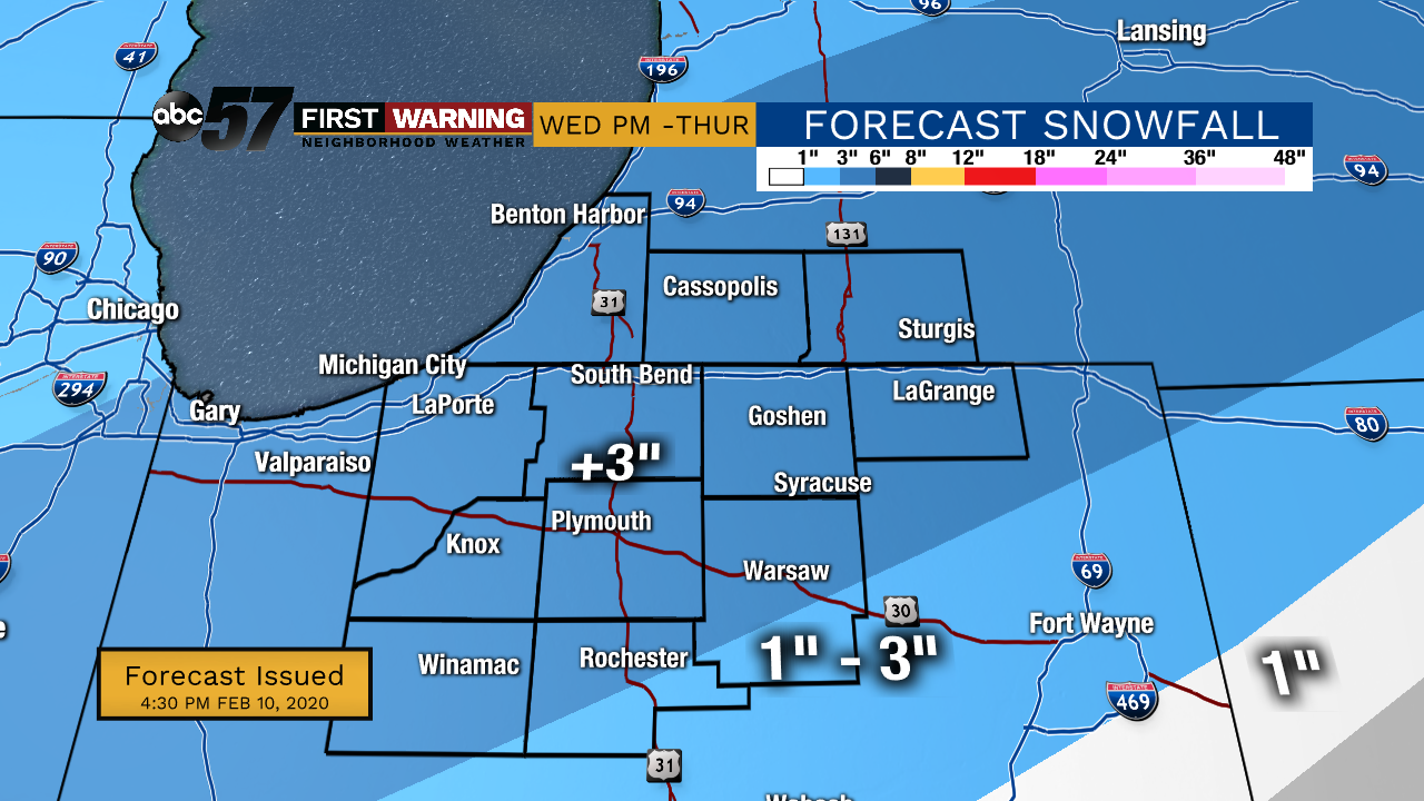
Right now, most of the viewing area can expect around 1-3 inches of snow. There is another band of snow just to our south, where 3-4 inches are possible. This band could move to the north, and parts of the viewing area could see this 3-4 inches range instead.
Midday Thursday, temperatures drop dramatically and by Friday morning, temperatures will be around 10 degrees.
Tonight: Mostly cloudy. Low 26.
Tuesday: Mostly to partly cloudy. High 34.
Wednesday: Increasing cloud cover. Afternoon wintry mix, then evening snow. High 35.
Thursday: Cloudy and a few snow showers. Temperatures drop throughout day. High 28.