


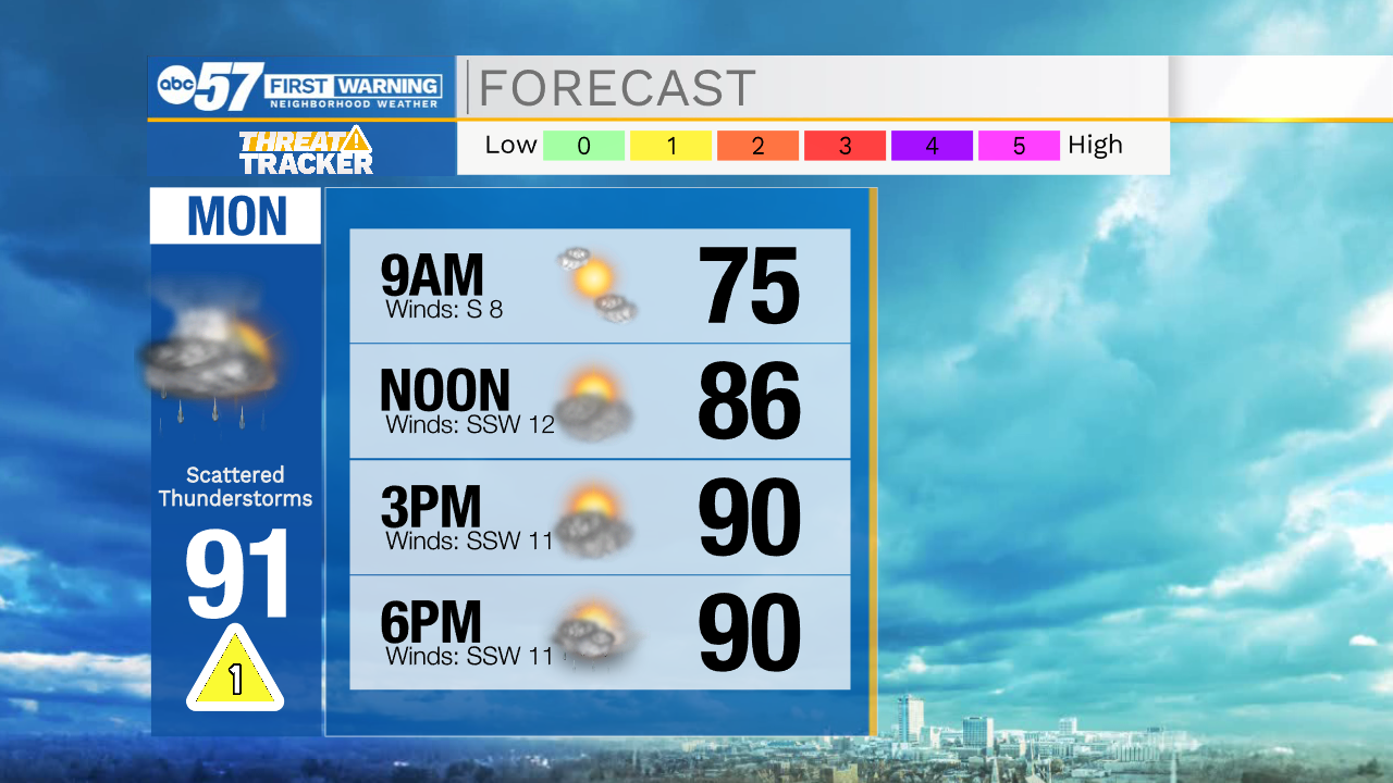
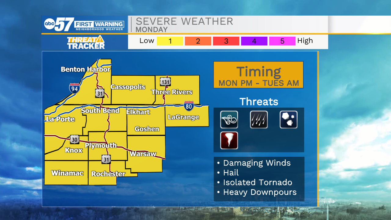
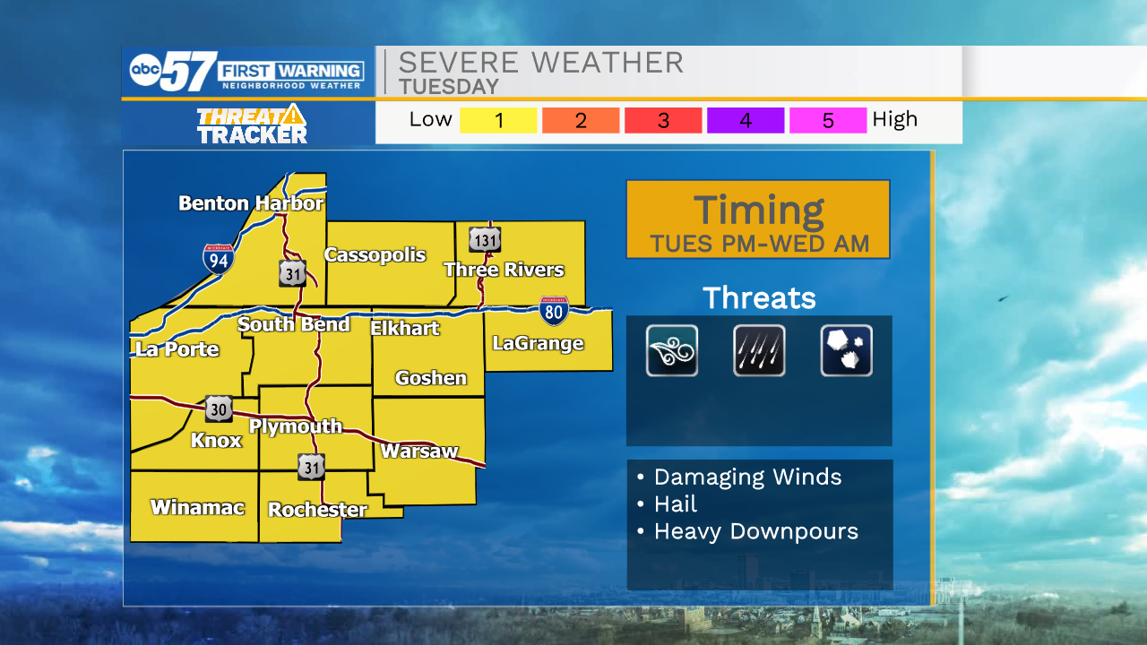
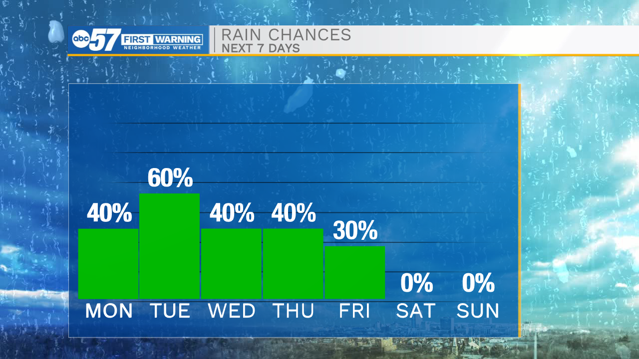
The clear and quiet weather will stick around through tonight and the first half of tomorrow. Temperatures tomorrow morning will drop into the mid 60s with highs tomorrow afternoon topping out in the lower 90s. Cloud cover will slowly increase throughout the day, then rain and storm chances arrive tomorrow evening. A few storms that do develop could be on the strong to low end severe side. Once showers and storms arrive, they will stick around for awhile. Expect off and on showers and storms Tuesday, Wednesday, Thursday, and Friday. We will have to watch for a higher flooding potential as we get later through the week. High temperatures throughout the week will hold in the 90s through Tuesday, then drop back into the 80s to round out next week.
Tonight: Mostly clear. Low 65.
Tomorrow: Mostly sunny/PM showers/storms. High 91.
Tuesday: Showers/storms. High 90.
Wednesday: Scattered showers. High 87.