-
1:23

City of South Bend presents an ’Age-Friendly Plan’ to better...
-
0:54

South Bend Venues Parks and Arts hosts ’Adult Recess’
-
2:27

Why Aneyas Williams turned down the transfer portal and stayed...
-
2:21

Bourbon community rallies around Triton boys’ basketball team...
-
5:02

Dave Matthews shares details about LLC bankruptcy filings
-
1:00

Warming up this weekend before more storms next week
-
1:46

A chilly and calm start to the weekend
-
1:00

NIPSCO workers rally in South Bend for new contract
-
1:53

Severe weather threat is over, MUCH colder Friday
-
3:43

South Bend Mayor James Mueller delivers 2026 State of the City...
-
0:52

Family and friends of Adrian Cruz voice frustration in sentencing...
-
2:13

Potawatomi Zoo prepares for opening day with new attractions

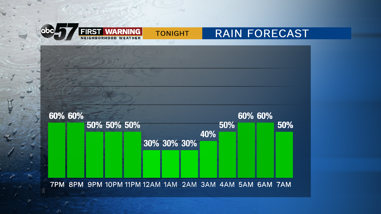
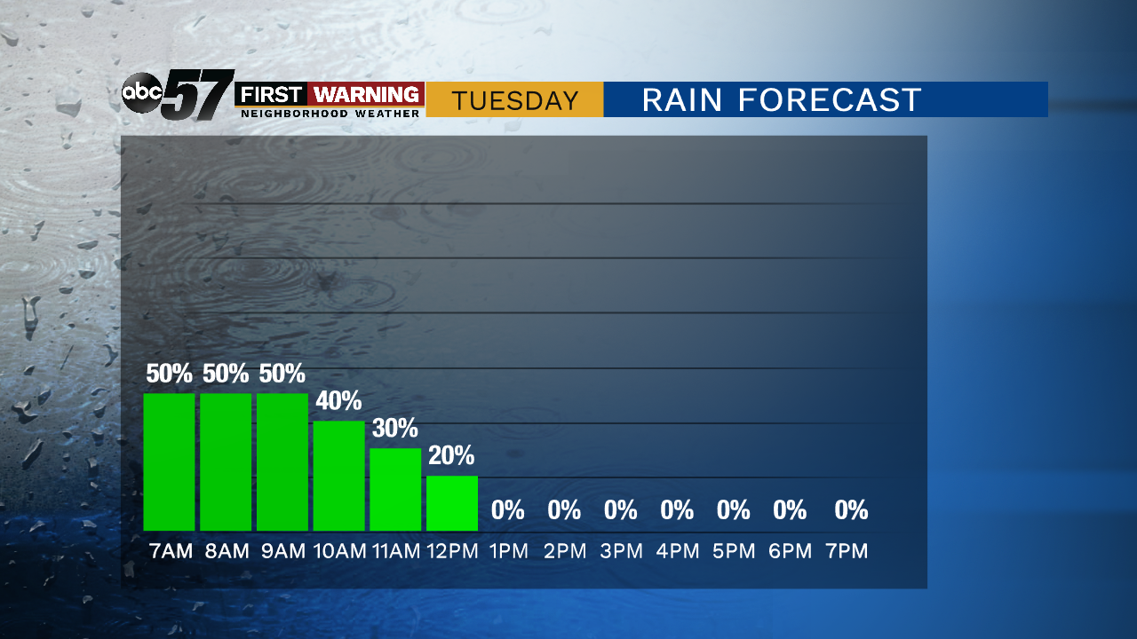
Scattered showers with thunder possible continues Monday night into Tuesday morning before clearing. Total rainfall up to one inch is possible with downpours. The severe threat is low but a few wind gusts are also possible.
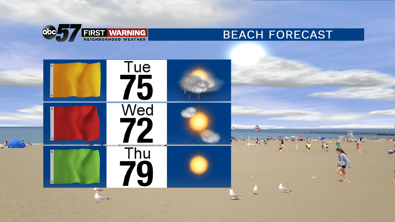
A few rain showers linger through early Tuesday before gradual clearing in the afternoon. The rest of the week is mostly mild and fair, sunny and highs in the 70s. A weak wave could bring a chance of rain to start the Labor Day Weekend, Friday night. The rest of the holiday weekend looks fair with highs warming towards 80 by Monday.
Tonight: Cloudy with on-and-off showers and storms, low of 66.
Tuesday: Mostly cloudy with AM showers, then clearing, high of 78.
Wednesday: Mostly sunny and breezy, high of 76.
Thursday: Mostly sunny, high of 78.