


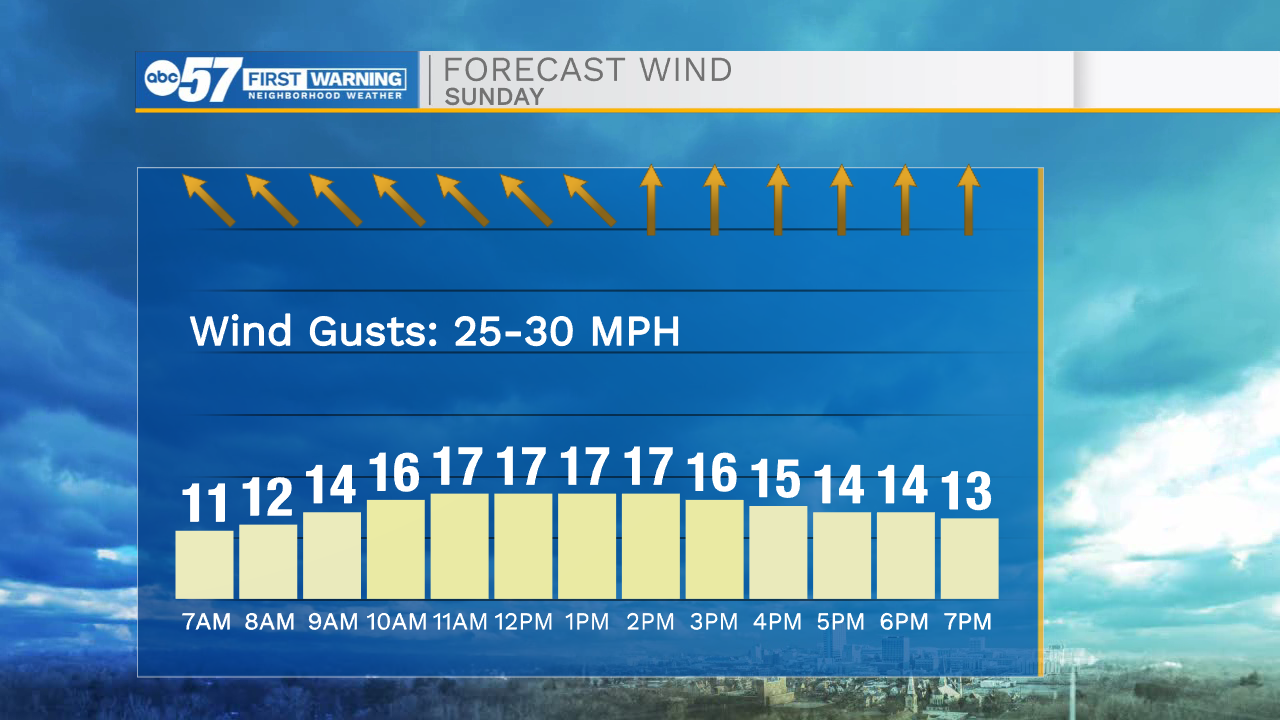
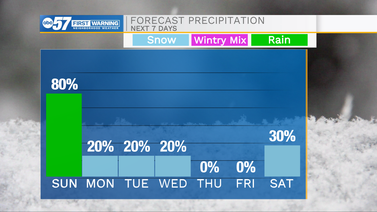
Temperatures tonight will fall into the lower 30s, so bundle up tomorrow morning. We will stay dry throughout Michiana during the morning hours, but then rain arrives after lunchtime. Rain will impact all portions of Michiana at some time during tomorrow afternoon, evening, and overnight. It won’t be a wash out, but a few moderate to heavy downpours are possible. Sunday night into Monday temperatures will fall to freezing, changing some of the isolated rain over to snow. Little to no impacts are expected on the roadways. Monday and Tuesday a few flurries are possible. Along with the cold and snow chance, temperatures and feel like temperatures will plummet. Lows Monday and Tuesday morning will drop into the low to mid 20s with feel like temperatures well into the teens. Winds speeds Monday will reach into the 20s with gusts possible in the 40s. Strong winds will begin to subside into Tuesday.
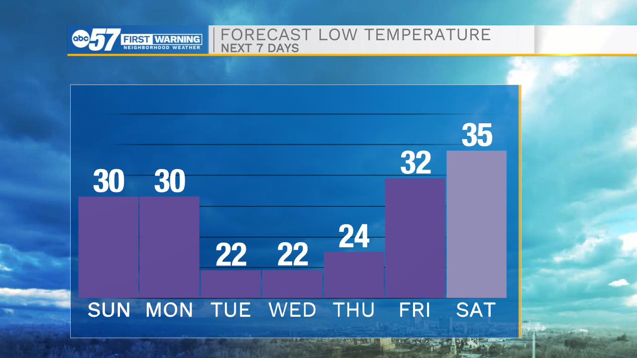
Tonight: Partly to mostly cloudy. Low 30.
Tomorrow: Scattered showers. High 50.
Monday: AM Snow flurries/windy. High 35.
Tuesday: Snow flurries/PM snow showers. High 30.