
-
1:51

Warm and sunny stretch with a few showers possible this weekend
-
0:30

Prayer vigil held for domestic violence victim in South Bend
-
1:10

Bristol Town Council votes in favor of annexation of 500 acres...
-
0:52

Official ribbon cutting for The Delta neighborhood in Elkhart
-
1:08

Traveling or booking a trip soon? Here’s what to know
-
0:27

Elkhart Police Department investigating a hit and run on Cassopolis...
-
2:40

Recovery efforts continue after EF-1 tornado devastated Edwardsburg
-
1:22

The March rollercoaster continues
-
0:55

Mishawaka High School Theatre presents ’Chicago! Teen’
-
2:25

Local chef showcasing her food at Pacers game
-
3:46

Local farmers concerned war with Iran will impact fertilizer
-
2:56

The partial government shutdown is impacting travel across the...

Showers work their way in late this morning into the afternoon. A couple rumbles of thunder are possible with breezy conditions. After the cold front passes through, temperatures fall into the 50s tomorrow with a chance of lake effect rain. The sunshine is back Wednesday but it’s short-lived as another cold front swings through Thursday, bringing another chance of rain after midday. As we wrap up the work week and head into the weekend, it looks to stay nice and dry. Temperatures overall remain cool. Most daytime highs remain in the 50s.
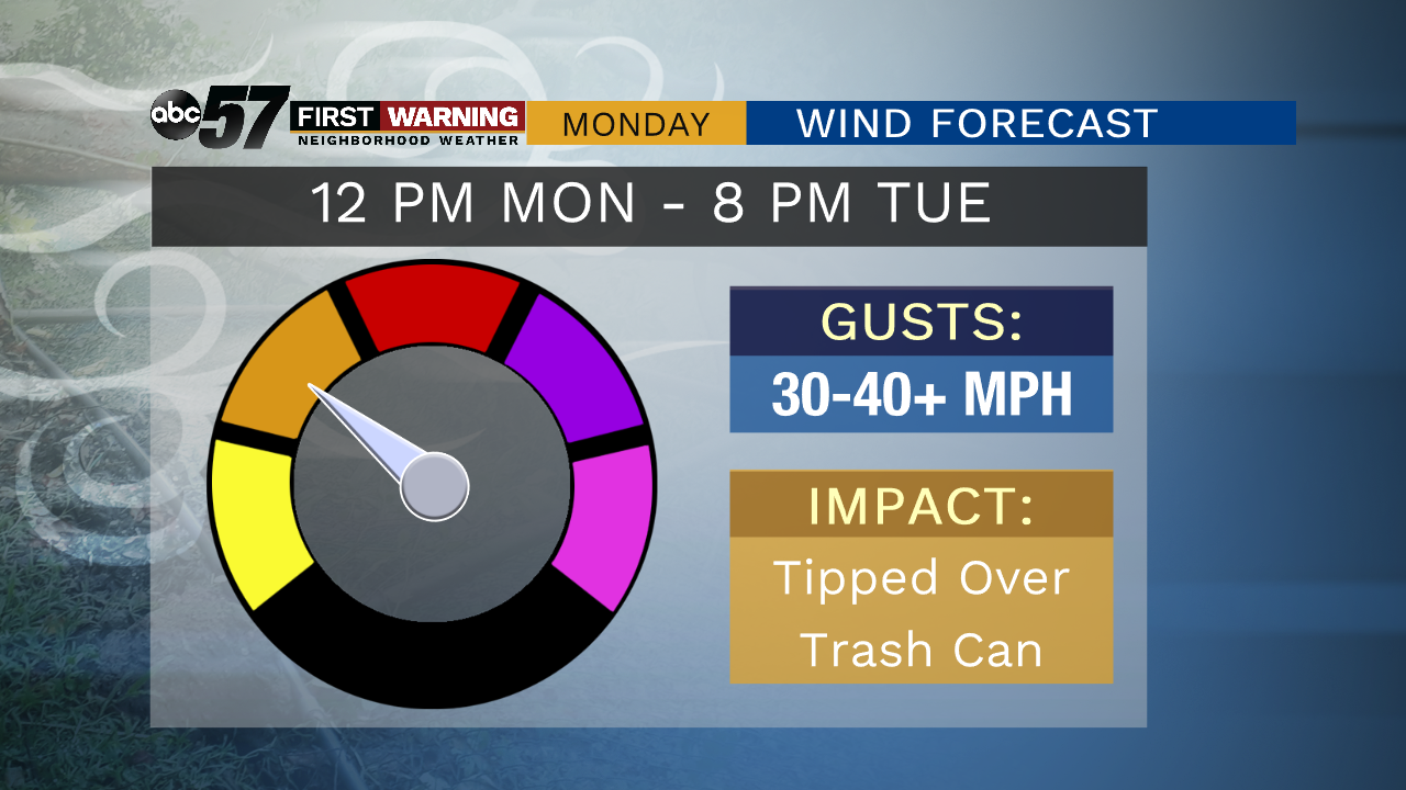
Today: Windy with rain and perhaps a few thunderstorms. High of 65.
Tonight: Few clouds, chance of rain. Low of 46.
Tuesday: Windy and mostly cloudy. Lake effect showers possible. High of 54.
Wednesday: Mix of sun and clouds. High of 58.