


Steady rain overnight into Tuesday morning. Much of the rain is done before the morning commute to work or school.
Overnight showers taper off Tuesday morning with gradual clearing into the afternoon. Temperatures will be colder as temps struggle to reach the mid-40s. The rest of the week the region is brushed by a few systems. The next one is Wednesday morning and rather weak, only bringing a slight chance of rain. Thursday evening’s is bit stronger with more widespread rain. The weekend right now is a toss-up as Michiana lies on edge of clearing skies to the north and clouds and rain to the south, right now cooler, drier weather looks to prevail.
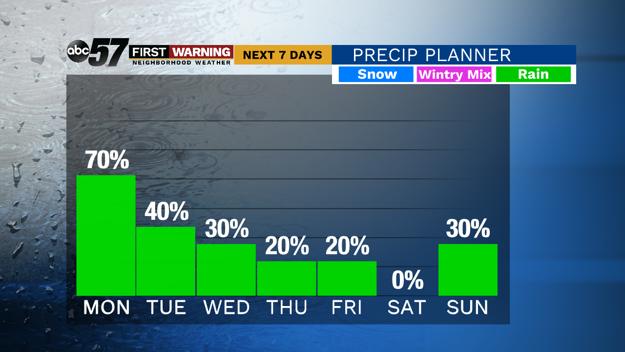
Tonight: Rain showers. Low 38.
Tuesday: Rain ending early, mostly to partly cloudy. High 44.
Wednesday: Mostly cloudy, chance of isolated showers. High 50.
Thursday: Rain likely by late afternoon, a bit breezy. High of 58.