-
3:03

Prices at the pump continue to rise across Michiana
-
1:35

Warming up before storms arrive Thursday
-
2:06

Staying sunny until Thursday
-
0:58

Goshen City Council amends DORA rules amid community concerns
-
1:20

SB Common Council adopts Downtown 2045 Plan
-
2:39

Friends and family celebrate life of Jamecia Moffitt
-
1:15

St. Joseph County Council updates residents on Affordability...
-
0:51

Locals gather to recognize farmworkers across Northern Indiana
-
2:07

Impact of higher gas prices for delivery drivers
-
3:43

ND Eviction Clinic exposes ’shameful’ living conditions at...
-
3:59

Neighbors share traffic, noise concerns about proposed Capital...
-
1:50

Leaf pick up resumes in South Bend after weather postpones service...

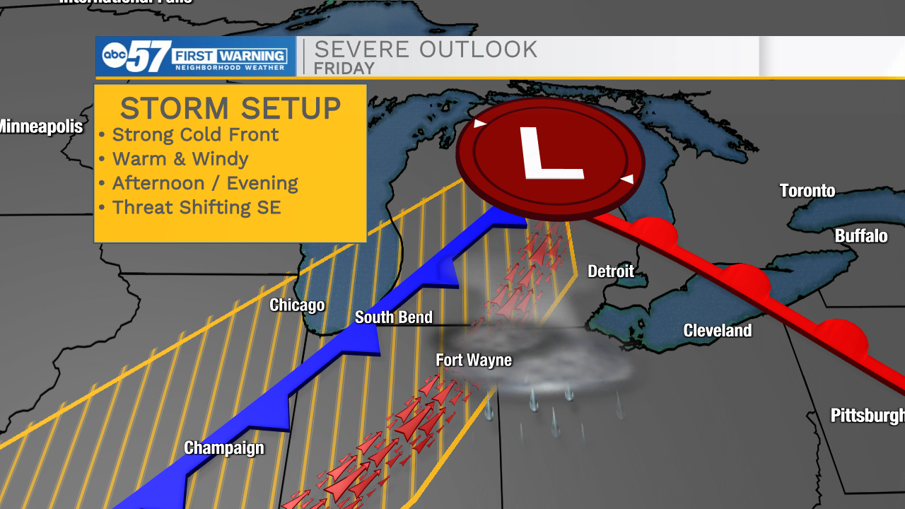
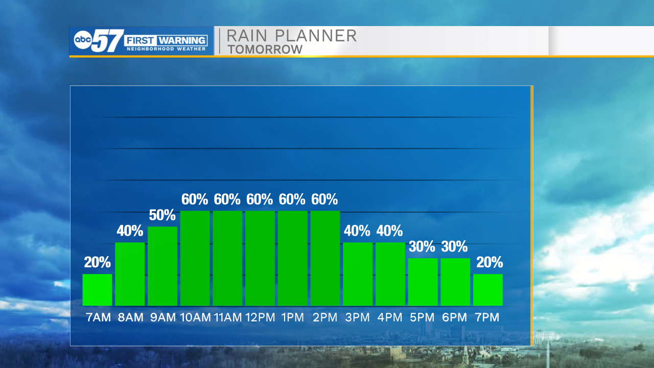
The first change in the forecast is the timing of rain Wednesday, showers are trending earlier, midday to mid-afternoon light rain is likely. The rain tapers-off by the late afternoon. Temperatures warm into the 80s Thursday and Friday along with some humidity. A cold front closes on the area Friday afternoon / evening. The second change in the forecast is the front may reach Michiana as storm begin to pop in the late afternoon. This could change the severe outlook, increasing the storm threat from South Bend to Fort Wayne. Focus will remain on Friday. But the Tuesday update is the storm threat looks lower, than Monday.
Tonight: Mostly cloudy. Rain showers late. Low 52.
Wednesday: Rain showers. High 68.
Thursday: Partly cloudy. High 82.
Friday: Breezy, PM T-Storms. High 85