Rainy with thunderstorms possible; BIG temperature drop tonight

-
2:23

La Porte community rallies for Sammy Strong Benefit, raising...
-
1:57

The Potawatomi Zoo opens its gates to Zoo Nights Live
-
2:50

Carson Kvapil wins his first O’Reilly Auto Parts Series win...
-
1:10

William Tuffs honored as the only Indiana man who took part of...
-
0:50

Beacon Health held a Health and Wellness fair for the community
-
1:03

Warm conditions start overnight
-
1:02

Another pleasant day
-
0:42

Still cooler out the door
-
2:00

New Carlisle celebrates annual Hometown Days
-
1:40

Ross Chastain leads NASCAR O’Reilly Auto Parts Series practice...
-
2:27

Backpacks for Berrien hosts their Stuff-a-Bus event, ultimate...
-
2:59

Ludacris Opens Elkhart County 4-H Fair Concert Series Amid Ticket...

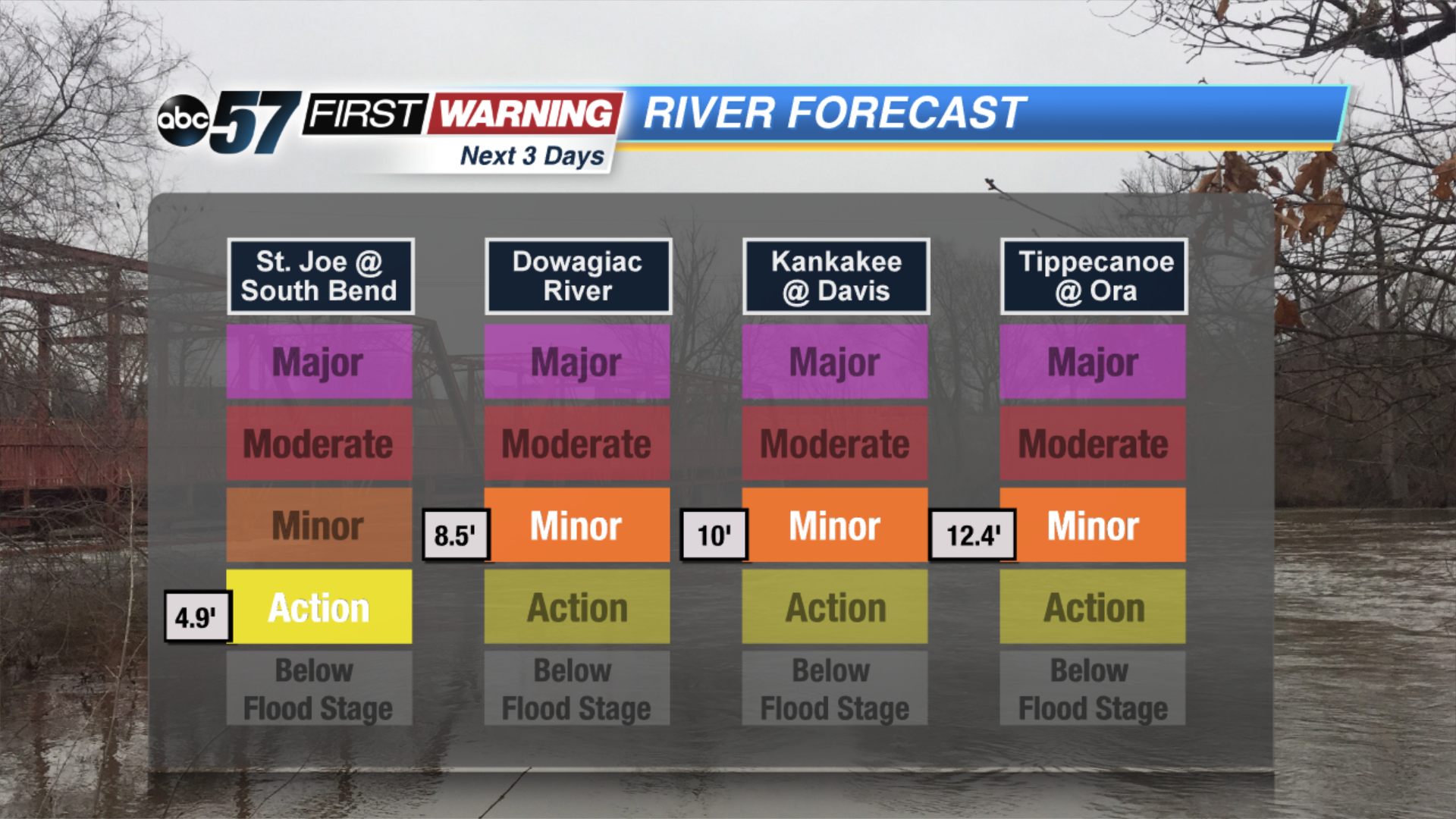
Scattered showers spread across our area today with pockets of heavy rain possible. It could lead to minor flooding along rivers and in low-lying. A couple of thunderstorms could be embedded in the showers with gusty winds possible. Cold air wraps in behind this system, drastically dropping our temperatures into the teens by tomorrow.
Friday is windy and cold with a few lake effect snow showers possible mainly in our Michigan counties. Skies are bright with a slight improvement in temperatures Saturday. Clouds move back in Sunday with a chance of snow showers in the evening with another messy system Tuesday.
Today: Rainy, thunderstorm possible, high of 54.
Tonight: Chance of snow north, low of 16.
Friday: Cold, temperatures falling the upper teens, chance of snow showers north.
Saturday: Cold and sunny, high of 24.