
-
1:08

Storms start this afternoon
-
0:56

Calm morning, storms tonight
-
2:43

South Bend residents see future plans for former Drewry’s Brewery
-
2:45

Damage assessment continues in Elkhart County following EF-2...
-
0:44

Indiana and Illinois set record for tornadoes
-
1:27

Community Build underway at Kathryn Park
-
2:34

Day two of searching for a missing child continues
-
3:47

The Elkhart community is searching for answers after a 2-year-old...
-
1:04

Overall pleasant for Michiana
-
1:52

South Bend Common Council issues an official apology to residents...
-
0:54

Slightly cool out the door
-
1:54

Suspect identified, charged in fatal hit-and-run of Timothy Johnson

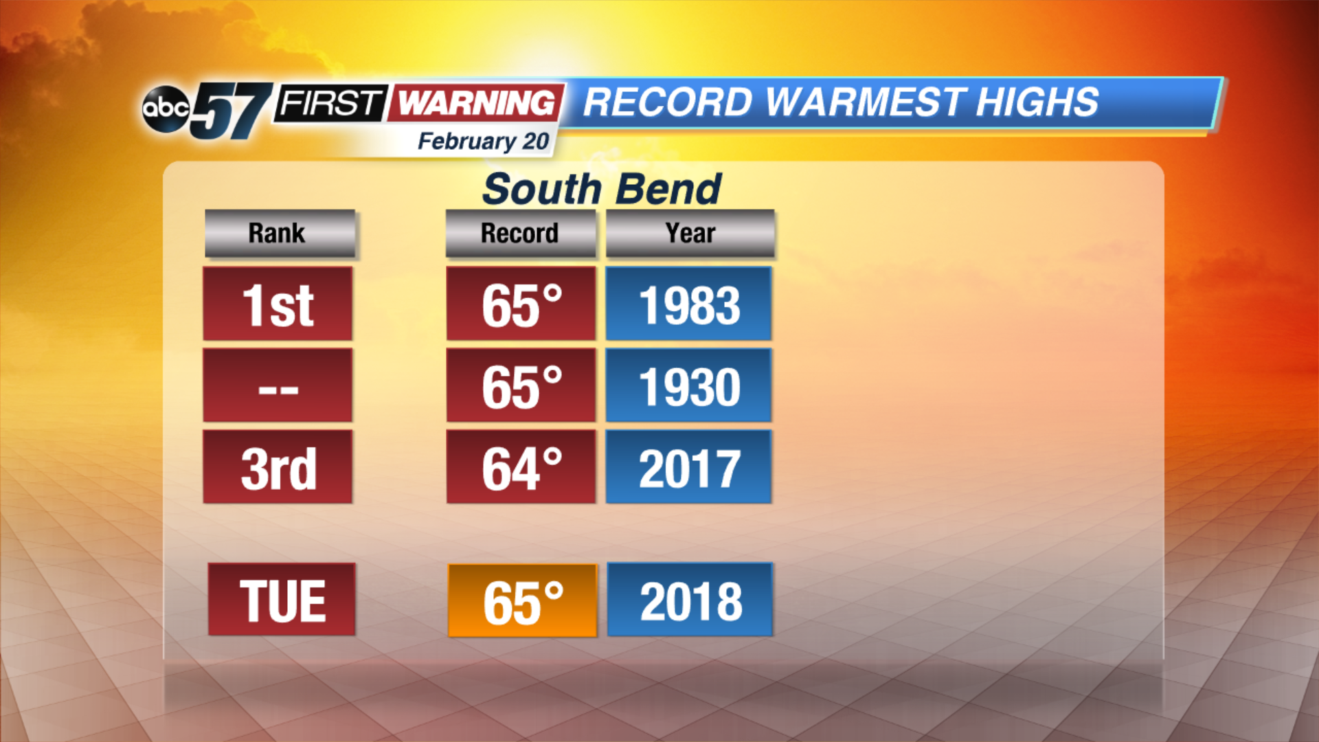
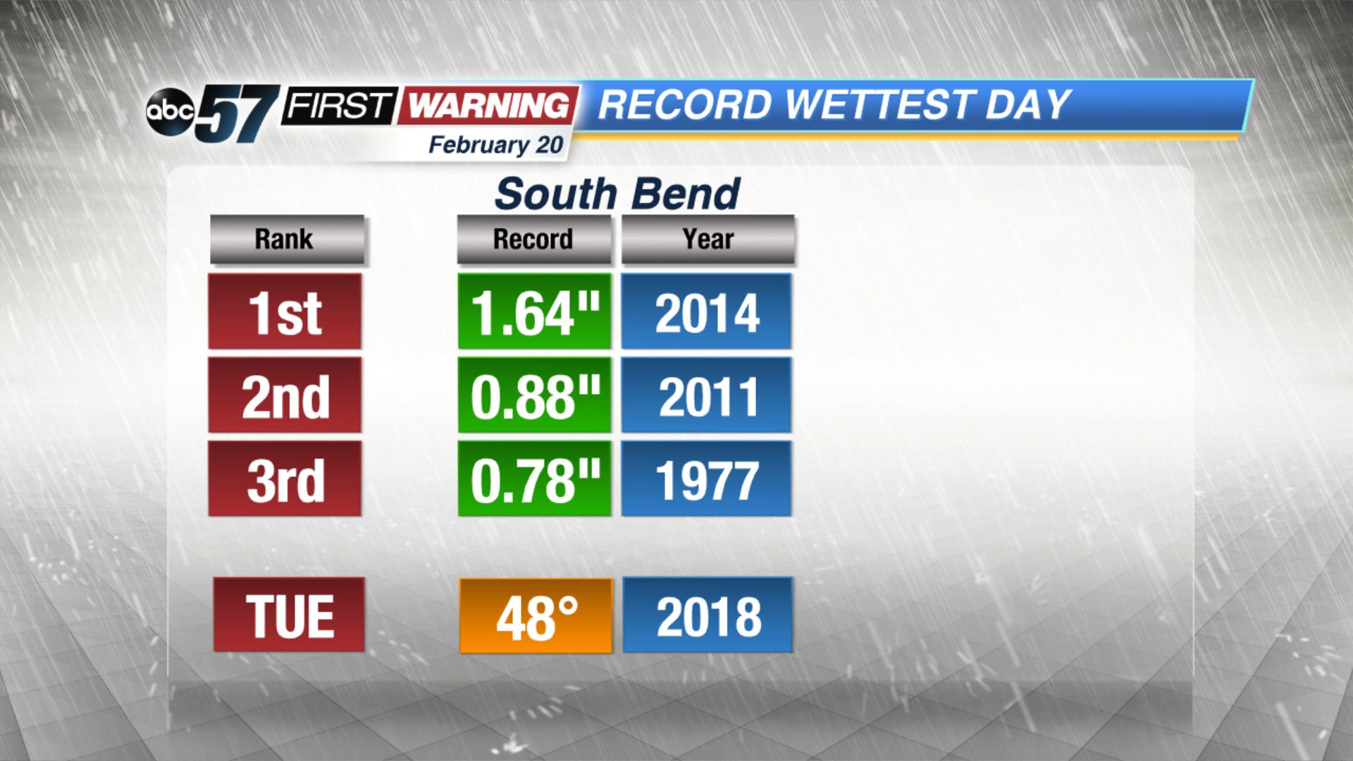
Soggy weather stays in the forecast through Wednesday, steady and sometimes heavy rain through Tuesday night. Minor flooding and standing water is the greatest concern through midweek but rising rivers may lead to additional flooding by the end of the week. High temperatures spike near record highs Tuesday in the mid-60s, before dropping again Wednesday and settle into 40s for the foreseeable future.
Tonight: Rainy and breezy, temperatures climb from the mid-50s overnight.
Tuesday: Rainy, heavy at times, rumbles of thunder possible, high of 65.
Wednesday: AM wintry mix, temperatures fall from the mid-30s.
Thursday: Partly cloudy, highs in the low 40s.
Sign up for the ABC 57 Newsletter