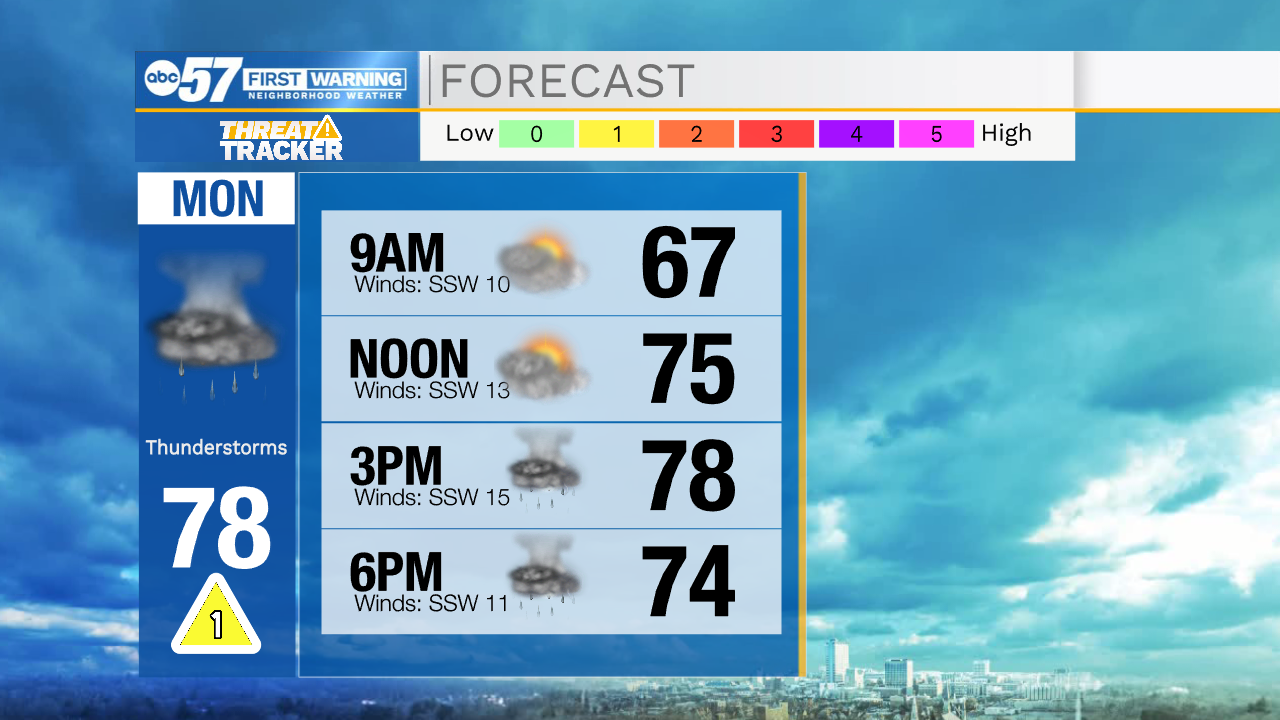
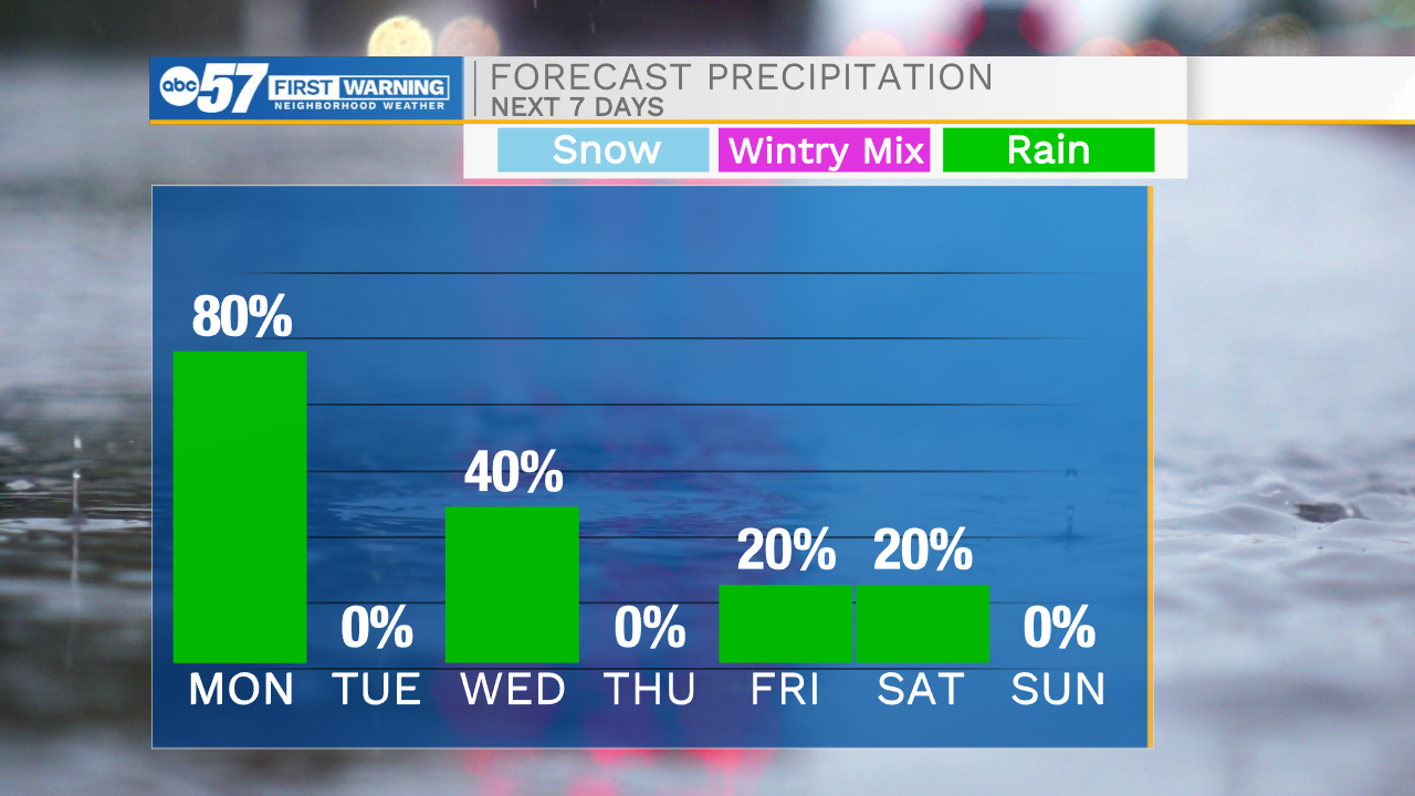
Scattered showers and storms return to the forecast Monday


This evening a few isolated showers are possible, but most will stay dry. Temperatures tonight will only drop into the lower 60s making it a very mild start to the work week. Tomorrow afternoon expect cloudy conditions with highs in the upper 70s. Rain showers and thunderstorms return to the forecast for tomorrow afternoon and evening. A few of the storms that do develop could contain some gusty winds. Tomorrow evening and overnight we will all be dealing with the scatted rain until it finally moves out during the early morning Tuesday. Tuesday afternoon a little sunshine will return with high temperatures in the lower 70s. Another round of showers and storms are possible Wednesday evening. After those clear we look to stay mostly dry heading into next weekend, although low rain chances will remain in the forecast. High temperatures throughout next week and next weekend will hold in the low to mid 70s.
Tonight: Mostly cloudy. Low 62.
Tomorrow: Scattered showers/storms. High 78.
Tuesday: Partly cloudy. High 72.
Wednesday: PM Showers/storms. High 74.