Scattered showers and storms today and Tuesday

-
1:46

A chilly and calm start to the weekend
-
1:00

NIPSCO workers rally in South Bend for new contract
-
1:53

Severe weather threat is over, MUCH colder Friday
-
3:43

South Bend Mayor James Mueller delivers 2026 State of the City...
-
0:52

Family and friends of Adrian Cruz voice frustration in sentencing...
-
2:13

Potawatomi Zoo prepares for opening day with new attractions
-
2:54

Local expert weighs in on landmark social media trials
-
1:33

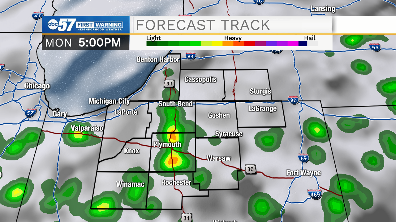
Round one of storms moving east, Round two arriving soon
-
2:38

Bourbon residents recall tornado as severe weather strikes again
-
1:34

Tornado threat decreasing, but severe weather still expected...
-
1:42

Damaging winds and hail move in this evening
-
2:51

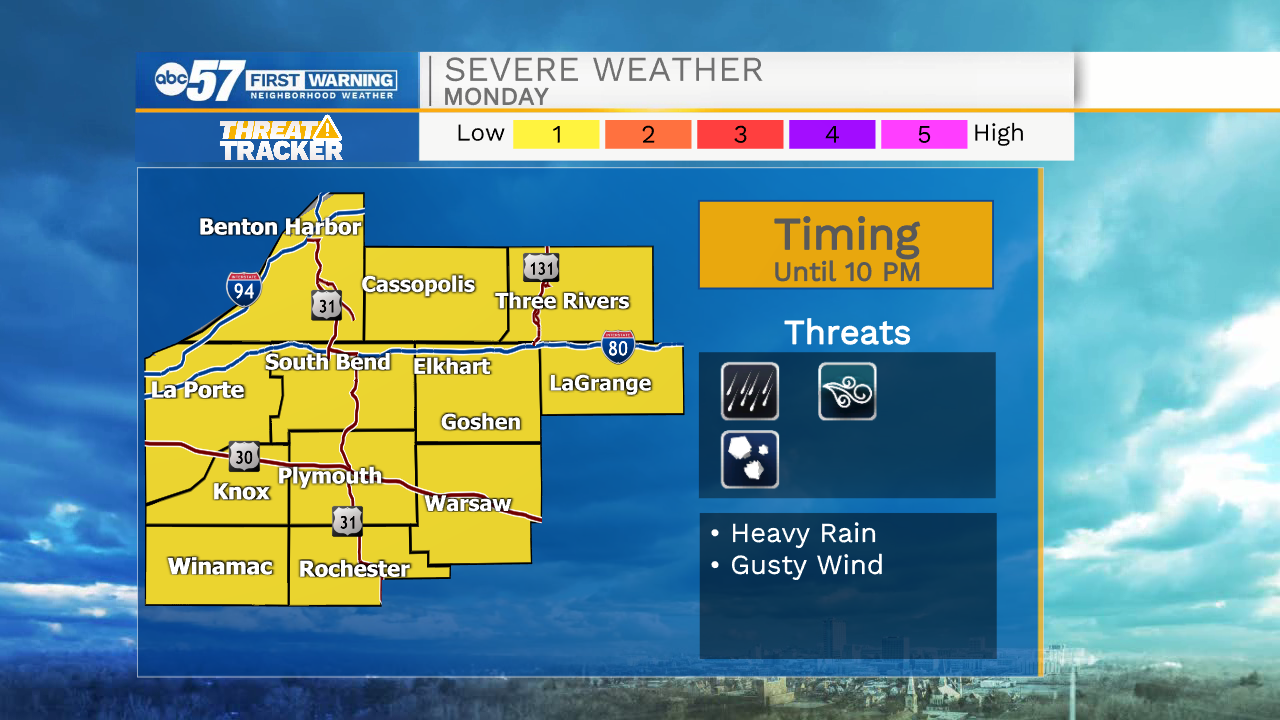
Severe weather expected in Michiana later today

ABC57 First Warning Neighborhood Weather Forecast
Monday, July 12th, 2021
Areas of fog and mist are possible during your morning commute. Today in general is cloudier with scattered showers and storms moving in late this afternoon. There is a chance storms could be strong with gusty wind and heavy rain. An isolated severe storm cannot be ruled out.
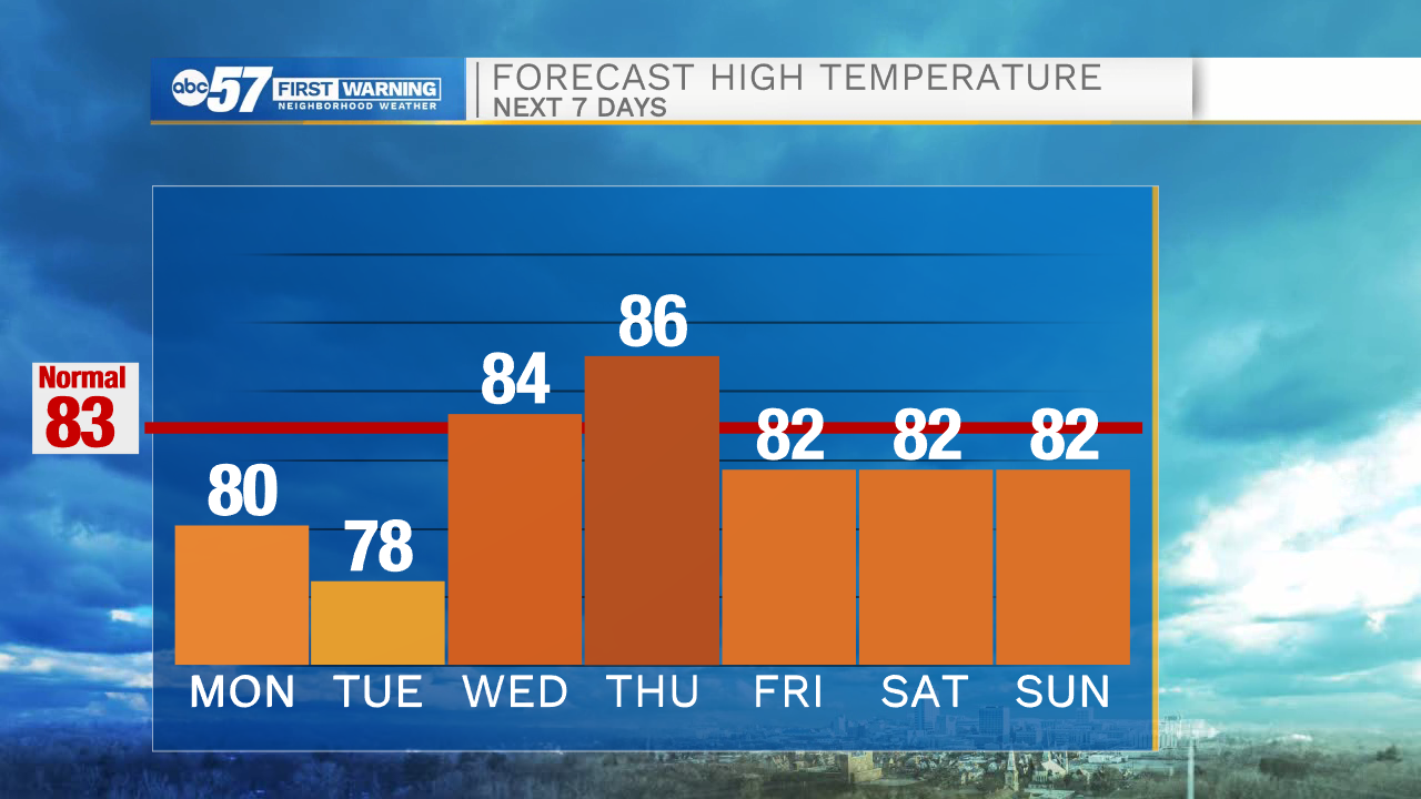
Scattered thunderstorms last on and off through Tuesday. It's much nicer on Wednesday with some sunshine before the next round of wet weather gets started on Thursday. Friday looks damp as well but thankfully it dries out in time for the weekend.
Today: Afternoon/evening storms. High 80.
Tonight: Scattered thunderstorms. Low 68.
Tuesday: Scattered showers and storms. High 78.
Wednesday: Partly cloudy. High 84.