


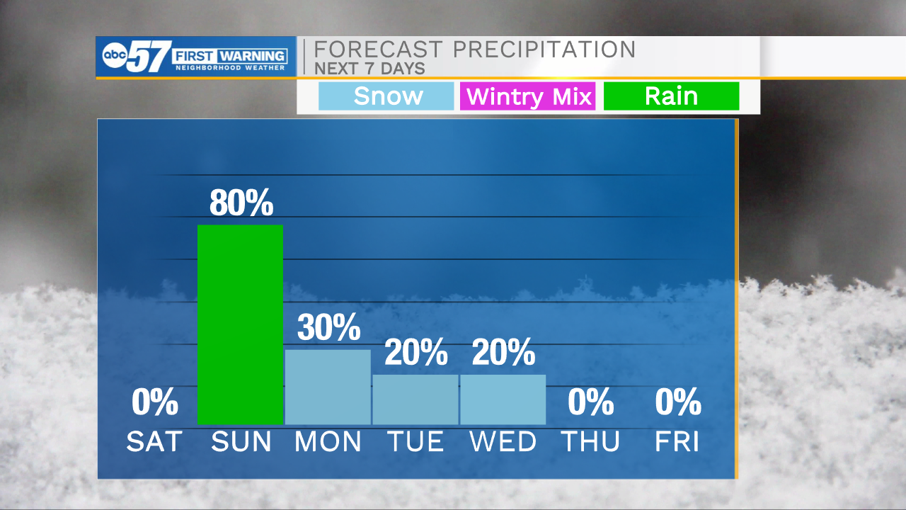
It’s a cold start to your weekend with lows dropping into the 20s. You will need to leave yourself an extra 10-15 minutes to defrost your vehicle this morning before you hit the roadways. This afternoon will be mostly sunny with highs in the lower 40s. Make sure to get outside to enjoy the beautiful weather because rain chances return tomorrow. Scattered showers are expected from late morning through the afternoon and evening. Some of this rain will turn to snow flurries Monday morning. Overall impacts appear low now, but we will continue to monitor this system as it moves closer to Michiana. Low wintry precip chances remain in the forecast for next Tuesday and Wednesday as well. Next week low temperatures will begin to drop into the 20s with highs in the low to mid 30s.
Today: Mostly sunny. High 42.
Tonight: Partly cloudy. Low 30.
Tomorrow: Scattered showers. High 50.
Monday: AM snow flurries. High 35.